Garden No.
GA5246
Significance
Site of historic interest only
Landscape Elements
Buildings/Artefacts, Landscape Park, Plant Collection
Townland
Belleville Demesne
Present on Ordnance Survey
First Edition: Yes, sheet 106
Second Edition: Yes, area reduced
Revised Edition: Yes, area reduced
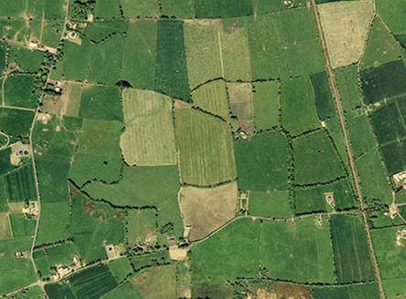
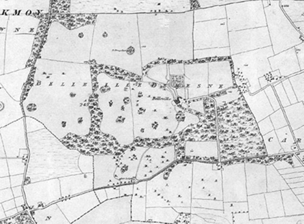
Belleville, c.1830, formed a fine medium-sized demesne, with its house, now in ruins, facing west, overlooking a well-planted parkland to the south. The house was approached from the south-west through a splayed entrance, passing through an area of woodland and taking in the views en route; today none of these features remain. To the north-east of the house, there are some remains of a farmyard, pre-1894. The walled garden, pre-1840, was located to the north and featured a possible gardener's house to the south, the ruins of which are still standing and known as the 'Apple House'. In the 1850s the Athenry-Tuam railway line was built to the east of the demesne.
Principal Building |
1:Five-bay two-storey over basement house with three-storey turrets to either end, pre-1840, facing south-west, in ruins by 1995, now only the south turret remains. |
Outbuilding |
5:Farmyard, pre-1894, to immediate north-east of house, in ruins today. |
Productive Garden |
6:Walled garden, pre-1840, to north of house, now gone. |
Parkland |
Fine parkland, pre-1840, to south of house with woodland, individual trees, clumps and a serpentine access; cleared by 1995. |
Woodland |
Generous areas of woodland, pre-1840, to throughout the demesne; cleared by 1995 with only outlines remaining to west and east. |
Avenue, Drive or Walk |
Main access, pre-1840, led from south-west through parkland and woodland to south-west of house with spur to north for the farmyard; gone by 1995. |
4:Service access, pre-1840, led from south-east along a walled and tree-lined road to entrance to farmyard; intact. |
|
Gate Lodge or Gateway |
2:Main entrance, pre-1840, to south-west, with gate lodge, comprising splayed walls; gates now gone, gate lodge modified and in use as dwelling. |
3:Service entrance, pre-1840, to south-east, comprising modern agricultural gate and rubble walls. |
|
Boundary or Boundary Wall |
Dry-stone field walls. |
Other |
7:Remains of possible gardener's house, pre-1840, now known as the 'Apple House' to south of former walled garden, now in ruins. |
Overview | |
---|---|
Site Footprint Visible | No |
Boundary Defined | No |
Significant Development | No |
Architectural Features | |
---|---|
Principal Building | No |
Garden Building | No |
Buildings of Indeterminate Purpose | No |
Gateways and Gatehouses | No |
Avenues, Drives and Walks | |
---|---|
Avenue | Yes |
Drive or Walk | No |
Garden Features | |
---|---|
Ornamental Garden | No |
Walled Garden | No |
Orchard | No |
Parkland | No |
Woodland | No |
Natural Water Feature | No |
Artifical Water Features | No |
Allée | No |
Vista | No |
Other | No |