
Survey Data
Garden No.
GA5236
Landscape Elements
Landscape Park, Plant Collection
Townland
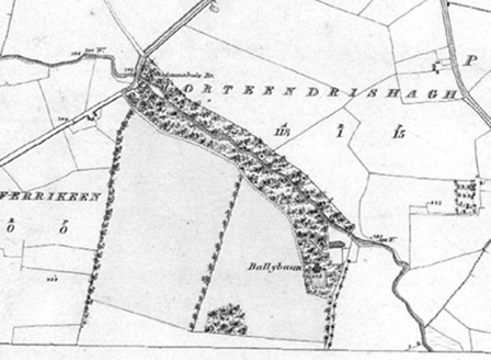
Ballybaun
Present on Ordnance Survey
First Edition: Yes, sheet 106
Second Edition: Yes, area reduced
Revised Edition: Yes, area reduced
Garden No.
GA5236
Landscape Elements
Landscape Park, Plant Collection
Townland
Ballybaun
Present on Ordnance Survey
First Edition: Yes, sheet 106
Second Edition: Yes, area reduced
Revised Edition: Yes, area reduced
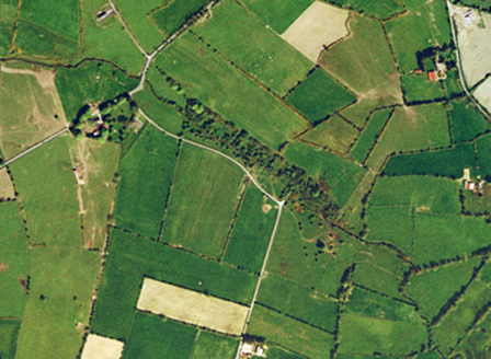
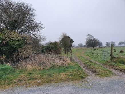
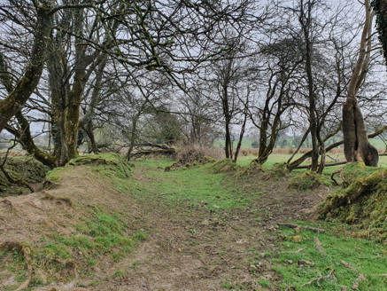
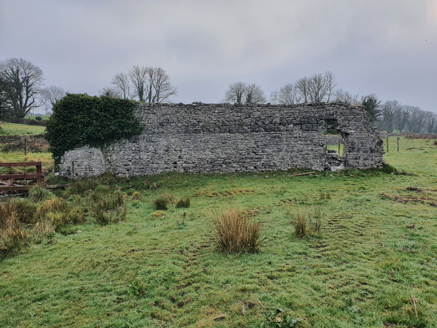
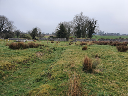
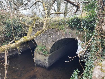
Ballybaun, owned by the French family, was a small country house built on high ground overlooking a tributary of the River Abbert to the north, with enclosed gardens to the south and surrounded by a wooded area, now largely gone. The drive to the house, meandered along woodland by the river from the west, and would have formed an attractive approach. A large outbuilding and yard, pre-1840, close to the river to the north-east was accessed from the west and from the north-east via a bridge which is intact, only foundations remain of this building, along with a single storey of another building, pre-1894, built on the banks of the river to the north-east, the function of these buildings is unclear.
| Principal Building |
House, pre-1840, on a T-plan, set on high ground, overlooking a tributary of the River Abbert, approached from the north-west, gone by 1995 but outline visible in aerial shots. |
| Ornamental Garden Building |
Small enclosed garden, pre-1840, to south of site of house, with sundial, now gone. |
| Outbuilding |
3:Large outbuilding, pre-1840, between house and river, only foundations still visible. |
|
7:Outbuilding, pre-1894, to north on banks of river, single storey remains, function unclear. |
|
| Productive Garden |
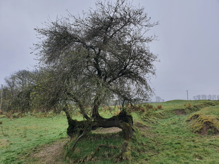
4:Some fruit trees remain to north of the site of the house. |
| Woodland |
Woodland, pre-1840, between the avenue and the river and around the house, now gone bar few specimen trees. |
| Water |
Tributary of River Abbert forms boundary to north. |
| Avenue, Drive or Walk |
2:Main access, pre-1840, from north-west with spur through woodland adjoining river, now part of a local road. |
|
6:Service access, pre-1840, to east side of farmyard and house, no longer in use but track visible. |
|
|
Access from north-east, pre-1894, across river, gone by 1995. |
|
| Gate Lodge or Gateway |
1:Original entrance, pre-1840, to north-west, now part of another property. |
| Boundary or Boundary Wall |
Bounded by a tributary of the River Abbert and farmland. |
| Other |
5:Bridge, pre-1840, across tributary river was part of access to farmyard and house from north-east, intact but access is now gone. |
| Overview | |
|---|---|
| Site Footprint Visible | No |
| Boundary Defined | No |
| Significant Development | No |
| Architectural Features | |
|---|---|
| Principal Building | No |
| Garden Building | No |
| Buildings of Indeterminate Purpose | No |
| Gateways and Gatehouses | No |
| Avenues, Drives and Walks | |
|---|---|
| Avenue | No |
| Drive or Walk | No |
| Garden Features | |
|---|---|
| Ornamental Garden | No |
| Walled Garden | No |
| Orchard | No |
| Parkland | No |
| Woodland | No |
| Natural Water Feature | No |
| Artifical Water Features | No |
| Allée | No |
| Vista | No |
| Other | No |