


Survey Data
Reg No
60260118
Rating
Regional
Categories of Special Interest
Architectural, Scientific, Technical
Original Use
Bridge
In Use As
Bridge
Date
1825 - 1830
Coordinates
325446, 222951
Date Recorded
05/03/2013
Date Updated
--/--/--
Description
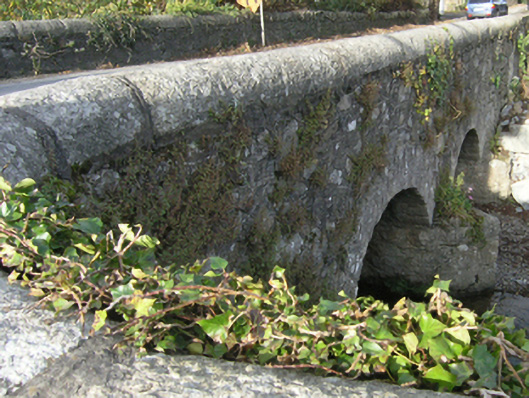
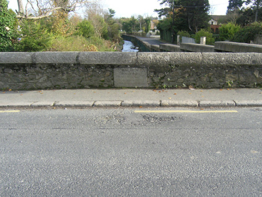
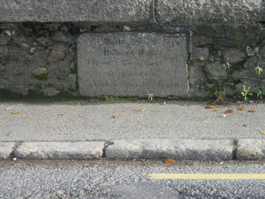
Three-arch road bridge over river, dated 1829. Part creeper- or ivy-covered walls centred on triangular cutwaters to piers having pyramidal capping with cut-granite rounded coping to parapets centred on benchmark-inscribed cut-granite date stone ("1829"). Series of three segmental arches with lichen-spotted granite ashlar voussoirs. Sited spanning Loughlinstown River with gravel-covered banks to river.
Appraisal
A bridge representing an integral component of the early nineteenth-century civil engineering heritage of south County Dublin with the architectural value of the composition suggested not only by the silver-grey granite dressings demonstrating good quality workmanship, but also by the elegant "sweep" of the arches making a pleasing visual statement at a crossing over the stream-like Loughlinstown River: meanwhile, a benchmark remains of additional interest for the connections with cartography and the preparation of maps by the Ordnance Survey (established 1824).