


Survey Data
Reg No
50100259
Rating
National
Categories of Special Interest
Architectural, Artistic, Historical, Social
Original Use
Park
In Use As
Park
Date
1660 - 1880
Coordinates
316011, 233377
Date Recorded
24/08/2016
Date Updated
--/--/--
Description
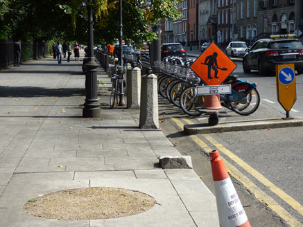
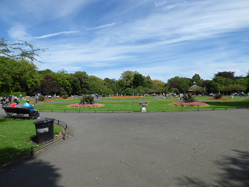
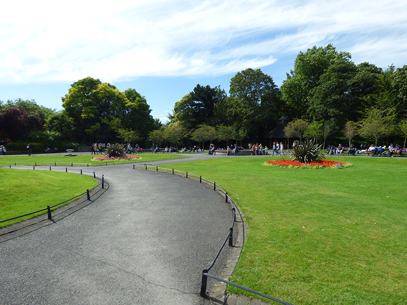
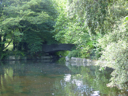
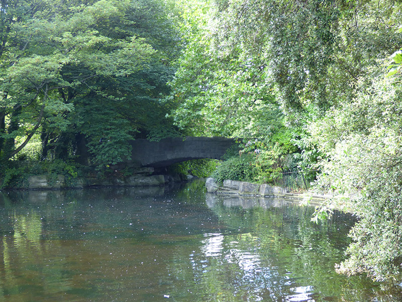
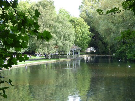
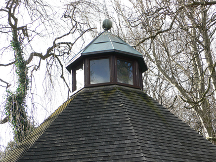
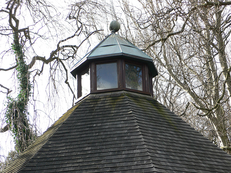
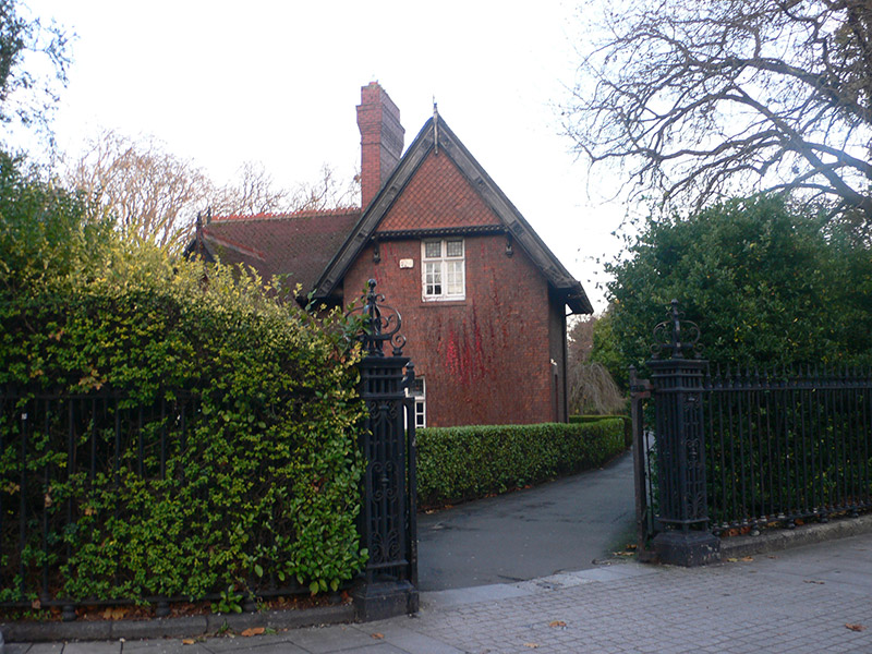
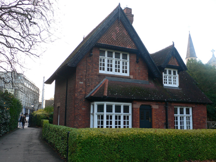
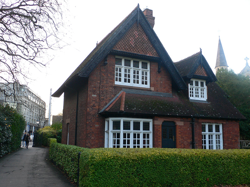
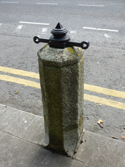
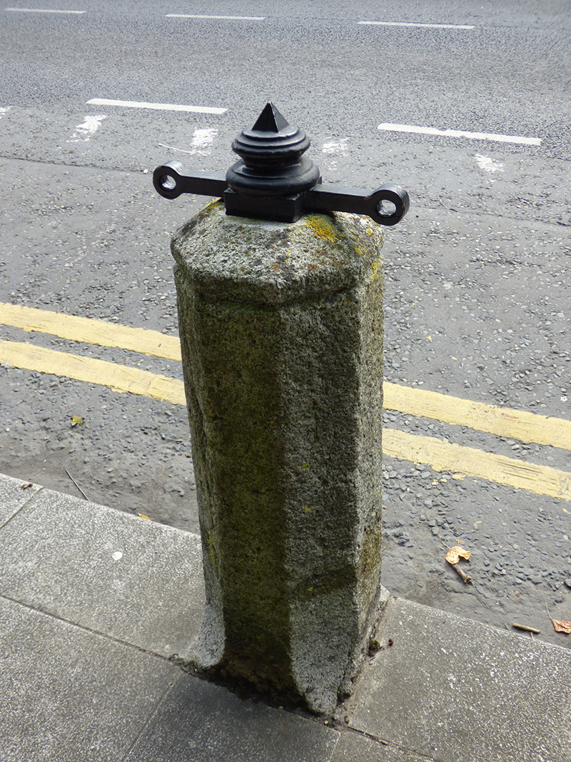
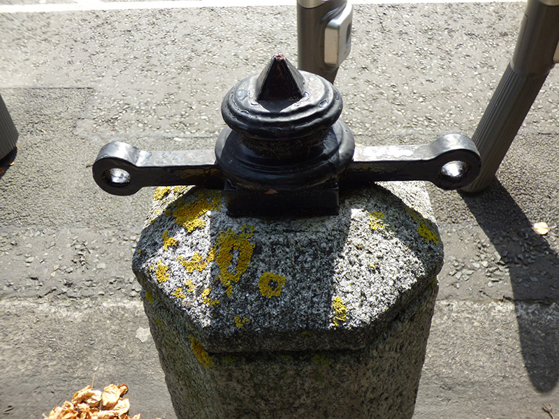
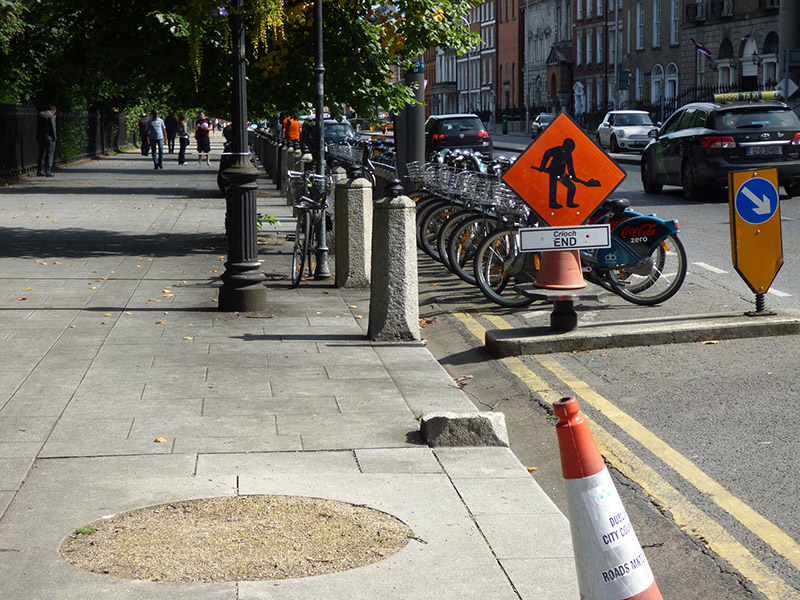
Rectangular-plan urban park, established c. 1664, laid out anew 1814-18 and re-landscaped as public park c. 1877. Principal entrance gates at corners, with secondary entrances along middle of sides. Central formal parterre comprising concentric grass lawns and planting beds, axial tarmacadam paths, terminated to east and west by matching ornamental fountains, having oriental pagodas behind. Backdrop of mature planting to perimeter of parterre, informal landscaping arrangement to edges, primary perimeter path lined with mature planting, intersected by various winding paths creating grass lawned areas interspersed with mature planting. Concentration of tall planting to north and west, open heath to south and east. Large ornamental lake located towards north, spanned by rubble stone bridge (named for Daniel O'Connell), with timber pavilion to north side. Bandstand located south of central parterre, Royal Dublin Fusiliers Arch located at northwest corner, Art-and-Crafts-style gate lodge to southwest corner, Wolfe Tone Memorial located at northeast corner. Series of memorials and statues throughout. Park surrounded by pedestrian footpath with historic bollards and lamp standards, and roadways, latter fronted by rows of Georgian and later buildings, and approached from north by various busy shopping streets. Park bounded by cast-iron railings with spearhead finials atop low moulded granite plinth. Entrances at northwest (Fusiliers' Arch), at northeast (backdrop to Wolfe Tone memorial) and to southeast have separate records. Gateway at southwest, next to Superintendent's Lodge, has double-leaf vehicular gate of similar detailing to railings, flanked by openwork cast-iron piers with decorative wrought-iron panel to front face and decorative wrought-iron openwork finial, atop moulded plinth that is slightly higher than that to railings. Public toilets of 1929 in northwest part of park, south of Fusiliers Arch. Lines of freestanding octagonal-plan granite bollards, erected c. 1818, lining outer perimeter of Saint Stephen's Green and fronting kerbstones of footpath. Comprising plinths with tapered corners, octagonal domed tops surmounted by pointed round wrought-iron finials over projecting chain fixing points. Bollards originally all having iron chains strung between.
Appraisal
Saint Stephen's Green is a substantial urban park whose origins date back to the mid seventeenth century. Originally a 60 acre (24 hectare) area of common grazing ground, the green was formalized about 1664 when leases were drawn up for 96 building plots arranged around a centre of 27 acres. The green was enclosed by a boundary wall about 1669 and access later became exclusive to affluent local residents. Rocque's map of 1756 shows a series of tree-lined walks around the edges of and cruciform pathways converging on an equestrian statue of King George II by sculptor John Van Nost. However, the present shape of the park dates from the period 1814-18 when the earlier walled boundary was replaced by railings surrounded by a wide footpath. In the 1870s the current picturesque landscape was set out with mature planting, arranged around a central parterre, the result of a collaboration between architect J.F. Fuller who designed the superintendent's lodge at the southwest corner and landscape designer William Shepherd. The scheme, carried out by Pulham and Sons about 1877, was funded by Arthur E. Guinness (Lord Ardilaun) who passed the park to the Corporation of Dublin. The latter, by act of parliament, then opened the park to the general public. By way of thanks, a statue to Lord Ardilaun was erected on the west edge of the park. Saint Stephen's Green played a role in the events of the 1916 Easter Rising when members of the Irish Citizen Army, under the command of Michael Mallin and Countess Markievicz, established a strategic position there, blocking surrounding streets and digging defensive trenches. The tactic proved unwise, as the British Army took up positions in several tall buildings facing onto the park, most notably the Shelbourne Hotel, forcing them to retreat. The statue of King George II remained a feature of the park until it was blown up by a land mine in 1937. Saint Stephen's Green is a well-maintained, high-quality public space with a rich and varied history, intrinsically linked to the social, historical, cultural and physical development of the city. The granite bollards surrounding the park were originally linked by iron chains and date to the time when the perimeter wall surrounding the Green was replaced by railings. The bollards are complimented by the Victorian cast-iron lamp standards, which are set back from the kerbstones and were likely erected when the park was undergoing remodelling during the 1870s. Bollards and lamp posts all contribute to the historic context of the historically significant streetscapes and public park, forming one of the key urban set-pieces in the city