


Survey Data
Reg No
50070460
Rating
Regional
Categories of Special Interest
Architectural, Artistic, Social
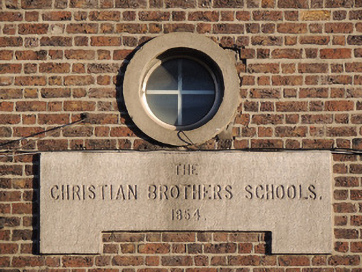
Previous Name
The Christian Brothers Schools
Original Use
School
In Use As
Community centre
Date
1850 - 1855
Coordinates
315406, 235195
Date Recorded
25/11/2012
Date Updated
--/--/--
Description
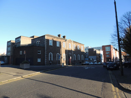
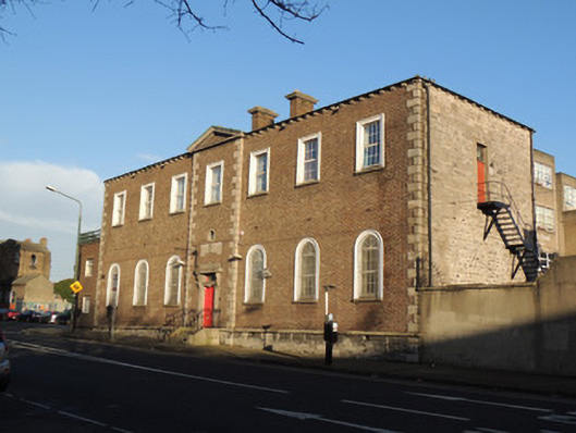
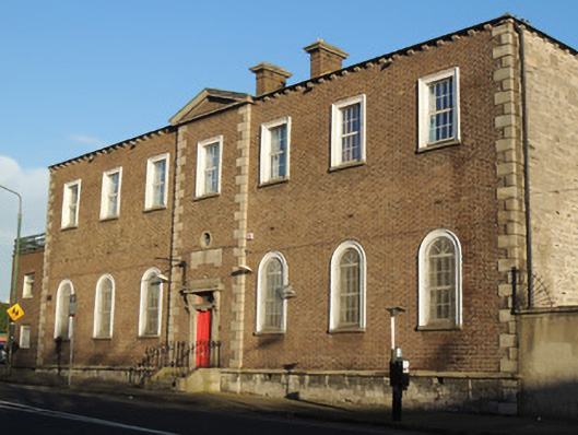
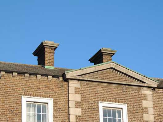
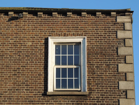
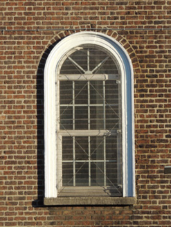
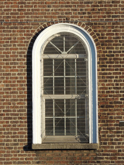
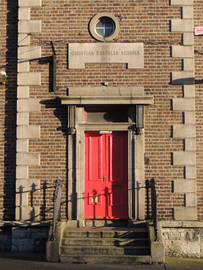
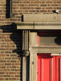
Detached seven-bay two-storey school, dated 1854, having lower single-bay two-storey return to rear (north) elevation with pitched roof, and lower single-bay two-storey flat-roofed extension to west elevation. Now in use as community centre. Hipped slate roof, paired red brick chimneystacks, carved stone corbels to eaves. Red brick walls to front (south) elevation laid in Flemish bond, having block-and-start quoins and central breakfront bay with carved pediment. Cut granite plinth course over calp limestone plinth wall. Carved limestone plaque over door "THE/CHRISTIAN BROTHERS SCHOOLS/1854". Calp limestone walls to rear, east and west elevations. Square-headed window openings to first floor, round-headed window openings to ground floor, having cut granite sills and replacement uPVC windows, and having moulded render surrounds to front elevation. Bullseye window to breakfront, having uPVC window. Some timber sash windows to return to rear, including round-headed window opening flanked by square-headed sidelights. Square-headed door opening, having carved granite door surround with consoles and cornice, timber panelled double-leaf door and plain overlight. Granite platform and steps, flanked by cast-iron railings on granite plinth wall.
Appraisal
This school was adapted as a clubhouse-cum-hostel in 1989 and was adapted as Open Heart House in 1997 to provide support for individuals and families affected by HIV. The school retains much of its early form and fabric, notably a finely carved stone doorcase to the south elevation. This was one of several schools in the area, and is of social significance as a repository of memory for local men who attended the school. Saint Mary’s Place North was created c.1830, extending north-west from Granby Row from Rutland Square (now Parnell Square), to the newly laid out Mountjoy Street (c.1820).