

Survey Data
Reg No
50060523
Rating
Regional
Categories of Special Interest
Architectural, Social, Technical
Previous Name
Mountjoy Barracks
Original Use
Building misc
In Use As
Office
Date
1890 - 1895
Coordinates
310028, 236081
Date Recorded
15/08/2014
Date Updated
--/--/--
Description
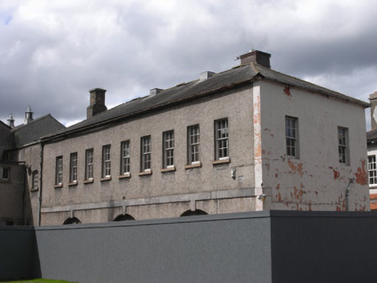
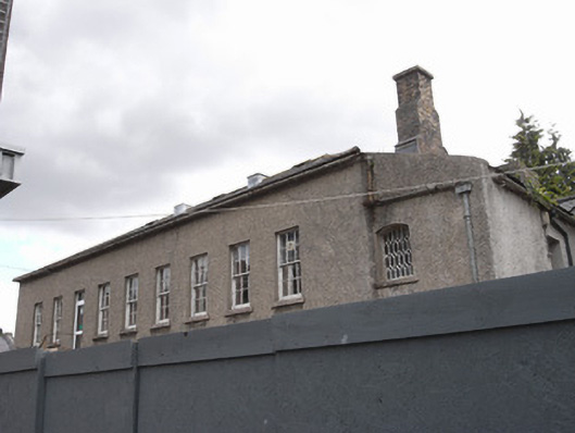
Attached nine-bay two-storey map store to Ordnance Survey of Ireland, built 1891, now in use as offices, having single-bay lean-to addition to south end. Pitched slate roof with brick chimneystacks, one stepped, and cast-iron rainwater goods. Roughcast rendered walls to east elevation with limestone ashlar plat-band between floors and painted rendered walls to rear and side elevations. Six-over-six pane timber sliding sash windows to first floor and three stepped arches to ground floor with limestone keystones meeting plat-band. Rear elevations have mixture of single-pane timber sash windows and replacement timber casement windows, and addition has geometrical glazing to first floor window, with stone sills.
Appraisal
This former map store was a key building for the Ordnance Survey, a body that produced one of the world's earliest country-scale detailed surveys. This building has classical detailing that enhances the building to which it is attached, Mountjoy House. The arcading and limestone details add visual interest and craft quality.