


Survey Data
Reg No
50030026
Rating
Regional
Categories of Special Interest
Architectural, Social, Technical
Previous Name
St Anne's
Original Use
Walled garden
Date
1810 - 1830
Coordinates
321842, 237243
Date Recorded
24/11/2014
Date Updated
--/--/--
Description
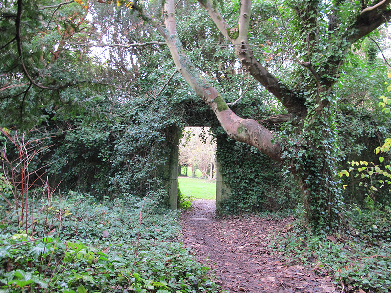
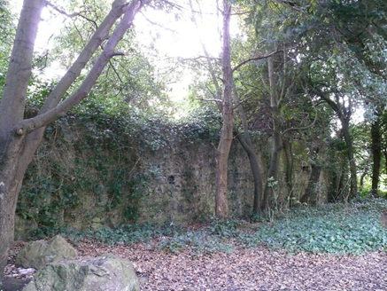
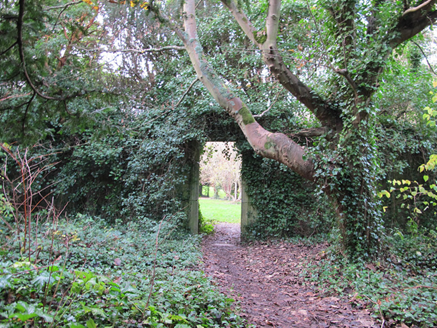
Remains of walled garden, built c. 1820. Uncoursed rubble stone walls, with yellow brick laid in English garden wall bond to interior walls. Red brick and rubble stone buttresses to north elevation to exterior. Square-headed door opening to east elevation with carved limestone architrave. Remains of entrance to south elevation, with cut granite jamb. Rubble stone pier to north-east corner, detached from wall.
Appraisal
The remains of this walled garden formed part of St. Ann's estate and, together with the other structures on the grounds, forms an interesting related group. It was located to the east of St. Ann's house, which is no longer extant, and was one of two walled gardens in the estate. This garden is marked on the first edition Ordnance Survey map, and also on the deed maps of Thornhill House, indicating that it predates the acquisition of Thornhill Estate by Benjamin and Arthur Lee Guinness in 1835. Carved limestone and granite detailing to the doorcases enliven the rustic rubble stone walls. It also contributed to the formal layout of the estate, as the door to the east was aligned with the entrance to the yew-enclosed fountain to the east, creating an interesting vista. This garden provides an interesting insight into the complex resources required in the maintenance of a large country estate during the nineteenth century.