


Survey Data
Reg No
50010530
Rating
Regional
Categories of Special Interest
Architectural
Previous Name
Cow Pock Institution
Original Use
House
In Use As
Amusement arcade
Date
1740 - 1760
Coordinates
315869, 234685
Date Recorded
30/10/2011
Date Updated
--/--/--
Description
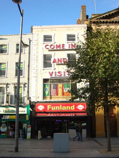
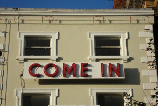
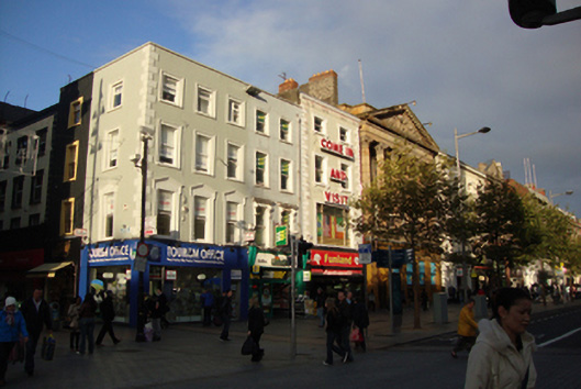
Terraced two-bay four-storey house over basement, built c.1750, now in use as amusement centre/arcade, with recent shopfront to ground floor. Flat roof with hipped component to north hidden behind rendered parapet with moulded cornice. Red brick chimneystack to party wall with No.66 to north and No.68 to south. Rendered wall to front (east) elevation with raised moulded quoins. Large fluorescent tube lighting on red lettering "COME IN AND VISIT" to upper. Rendered rear elevation having angular return to north and replacement uPVC rainwater goods. Diminishing square-headed window openings having moulded rendered shouldered surrounds with moulded brackets below granite sills. Single-pane timber sliding sash windows to second and third floors. Square-headed window opening to first floor having moulded rendered surround and recent timber-framed window. Single-storey extension to rear on Henry Place with pitched roof and recent metal railings.
Appraisal
The plan of the current building is very similar to that shown on Rocque's map of 1756. This former Georgian townhouse contributes to the eighteenth-century character of O'Connell Street Upper and is a valuable reminder of the former residential nature of the street. Sackville Mall was initiated by Luke Gardiner from 1749 when he purchased land from the Moore Estate and demolished the northern part of Drogheda Street, widening it to create a rectangular Mall. Leases were issued in 1751 and private mansions were built on the east and west sides of the street over the next decade. Gardiner's Mall was extended to the river as Lower Sackville Street by the Wide Streets Commissioners in the late eighteenth century. Astonishingly, given their proximity to the GPO, Nos.60-68 O'Connell Street Upper escaped the destruction of the 1916 Rising. A perspective view of Sackville Mall in the eighteenth century shows No.67 as a two-bay townhouse with a basement enclosed by railings and a pedimented entrance on the east elevation and No.67 maintains a higher parapet than No.68 to the south. No. 67 is labelled as "Cow Pock Institution" on the Ordnance Survey City of Dublin Sheet 14 (1847); the Cow Pock institution had relocated to No. 45 by 1864 (see 50010551).