

Survey Data
Reg No
50010148
Rating
Regional
Categories of Special Interest
Architectural, Artistic
Original Use
House
In Use As
Shop/retail outlet
Date
1810 - 1830
Coordinates
316312, 234780
Date Recorded
16/10/2011
Date Updated
--/--/--
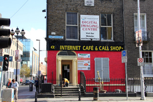
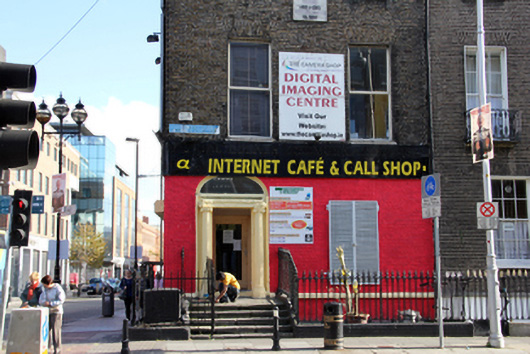
Description
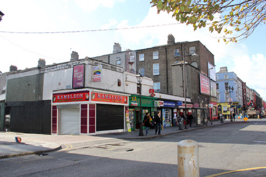
Corner-sited terraced two-bay four-storey house over raised basement, built c.1820, now in use as shop with shopfront to front (west) and side (north) elevations. M-profile hipped slate roof with shared brown brick chimneystacks, concealed behind parapet wall with squared granite coping and cast-iron hopper and downpipe. Flemish bond brown brick walls with granite plinth course over rendered basement area. Recent applied signage boards to shop unit partially concealing entrance door fanlight. Remnants of earlier painted advertisements to side (north) elevation with three recent billboards and feature lighting. Diminishing square-headed window openings with gauged-brick voussoirs, granite sills, patent rendered reveals and replacement aluminium windows. Historic timber sliding sash windows to rear (east) elevation having eight-over-three pane arrangements visible to third floor. Recent louvered aluminium shutters to ground floor window to front elevation. Square-headed window opening to side elevation of ground floor having fixed single-pane display window. Three-centred-arch door opening with gauged brick voussoirs to front elevation, having moulded stucco doorcase comprising engaged fluted Ionic columns surmounted by replacement lead-clad timber pediment surmounted by single-pane fanlight. Replacement glazed timber door opening onto granite flagged platform with five square-nosed steps in granite flanked by later wrought-iron gates. Rectangular concrete plinth with wrought-iron railings enclosing basement area, having portion of original granite plinth with cast-iron railings to northern section of enclosure. Square-headed door opening to side elevation having recent timber door. Recent two-storey flat-roofed structure to rear of site.
Appraisal
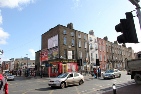
This pleasantly-proportioned, partially altered former Georgian house terminates the northern end of a terrace of similarly-scaled houses running from Frenchman's Lane to Talbot Street. The building retains its domestic scale and fenestration pattern to Gardiner Street, its original return and possibly historic painted advertisements to the brickwork of its side elevation glimpsed in spots under new billboards. This street was laid out in the 1790s by Luke Gardiner as part of a planned route which linked the new symbol of the mercantile power base, the Custom House, with Mountjoy Square, Gardiner's planned upper-class residential development on an elevated site to the north. The houses on Gardiner Street Middle and Lower formed a vista focused on the rear portico of the Custom House, though later disrupted by the installation (1888-89) of the raised Loop Line Bridge to this end of Gardiner Street.