Survey Data
Reg No
41401811
Rating
Regional
Categories of Special Interest
Architectural
Original Use
House
In Use As
House
Date
1830 - 1875
Coordinates
267666, 323884
Date Recorded
29/04/2012
Date Updated
--/--/--
Description
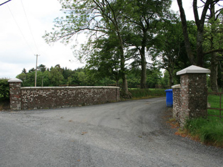
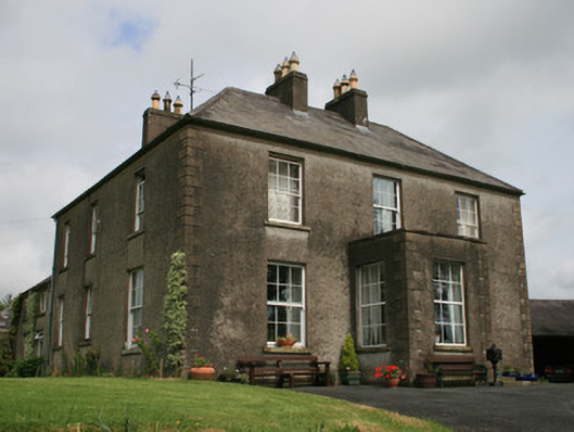
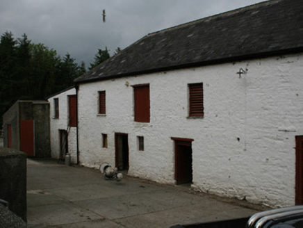
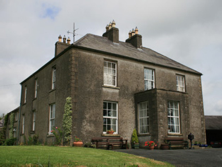
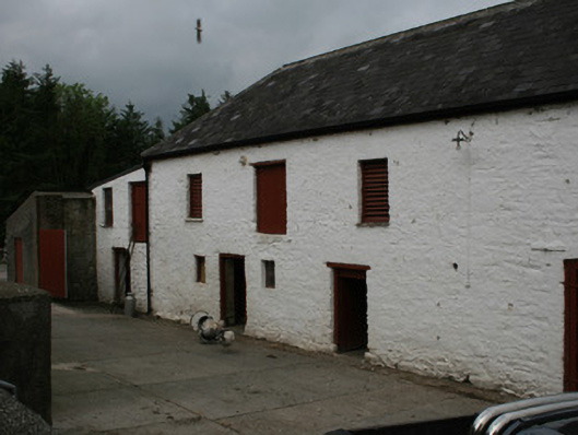
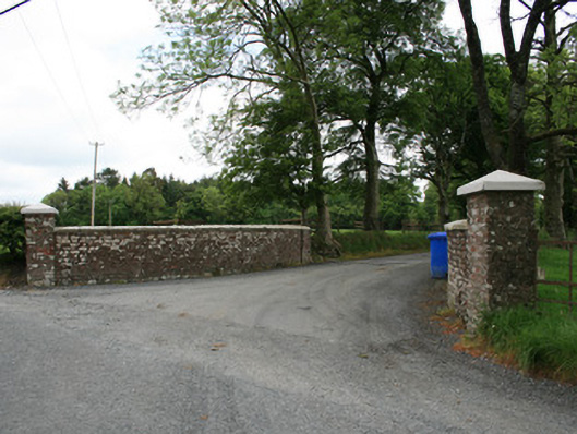
Detached three-bay two-storey L-plan house, built c.1840, having flat-roof porch of c.1870 to front elevation, three-bay and two-bay side elevations, and lower, later additions stepping down to rear (north-west) of original block. L-plan hipped slate roof with paired rendered chimneystacks to south-east elevation, and red brick chimneystacks to extensions to north-east, having decorative terracotta chimneypots. Cast-iron rainwater goods. Roughcast rendered walls with smooth rendered eaves course, plinth course and block-and-start quoins. Square-headed window openings with six-over-six pane timber sliding sash windows, rendered reveals and rendered sills. Some timber casement windows to north-west elevation, and some replacement uPVC windows to south-west. Square-headed replacement timber panelled door to porch, with two large stone steps. Screen wall to north, with camber arch abutting L-plan slate-roof former stables, now in use as garage with double-leaf timber and glazed stable door. Yard and large two-storey lime-ashed coursed rubble-walled farm building to north-west having camber-headed openings with six-over-six pane timber sliding sash windows inserted to first floor and square-headed double-leaf and single-leaf doors fitted to ground floor. Avenue from house south-west to road, having splayed red brick wall with stone coping and square-plan piers with replacement concrete capstones to road. Situated north-east of rural country road opposite Lisnaveane House and south-west of nearby Cahans Presbyterian church.
Appraisal
This attractive house retains its early nineteenth-century character with elegant Georgian proportions, maintaining six-over-six pane timber sliding sash windows throughout. The classical proportions are enhanced and reflected by the paired chimneystacks which retain terracotta pots. The farm buildings to the north-west illustrate that this was a productive farm, and are still in farming use today. Clover Hill is shown to be present on the 1835 Ordnance Survey map and though the house acquired a porch and was extended to the north-east, the plan has remained much the same since the early nineteenth century. The attractive red brick splayed wall and piers to the entrance address the rural country road opposite Lisnaveane House to the east and Cahans Presbyterian Church is located close by to the north-west.