


Survey Data
Reg No
41401801
Rating
Regional
Categories of Special Interest
Architectural, Technical
Original Use
Mill (water)
Date
1800 - 1930
Coordinates
260689, 323191
Date Recorded
03/06/2012
Date Updated
--/--/--
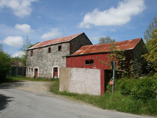
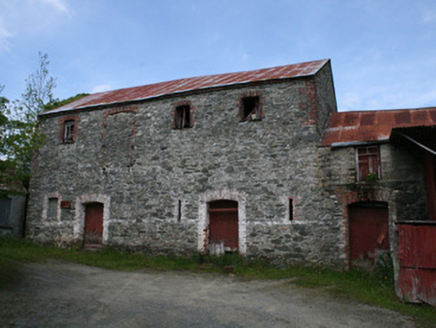
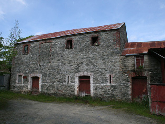
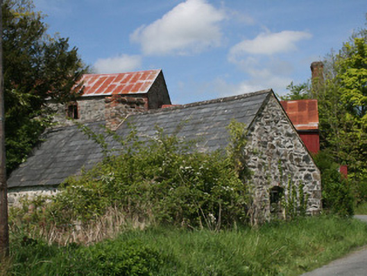
Description
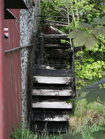
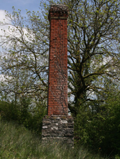
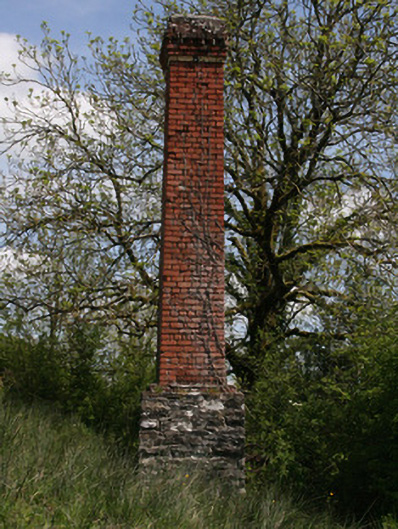
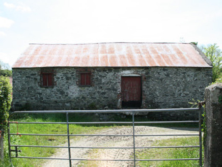
Complex of mill buildings, built c.1820, with additions of c.1910. Now disused. Comprising water-powered corn mill, kiln and store, engine-driven grain mill, engine house, and mill office. Attached multiple-bay two-storey corn kiln and store, comprising five-bay ground floor and three-bay first floor, with one blocked door loading door opening to first floor front (south) elevation. Single-storey to rear (north) due to slope of site. Pitched corrugated-iron roof. Random rubble walls, linked to corn mill to east, with brick eaves course and brick quoins to first floor level to gable walls. Segmental-headed window openings with block-and-start surrounds, and some timber-framed windows. Square-headed loop window openings to ground floor. Segmental-headed door openings with brick surrounds and timber battened doors. Attached two-storey corn mill to south-east, having engine-driven mill, built c.1910, at south-east, and with abutting corrugated-iron-sided grain mill at south-east. Single-storey to north due to slope of site. Pitched corrugated-iron roof, gabled to east and west. Random rubble walls with some cement rebuilt sections. External water-wheel to north-east gable with cast-iron rim and angled wooden buckets and sole-plate. Square-headed window openings with timber-framed windows, with cast-iron lattice-pane window to rear. Gauged-brick door opening with red brick block-and-start surrounds and timber battened door to front. Square-headed door openings with timber battened fittings to rear. Single-bay two-storey grain mill abutting south-east of corn mill. Corrugated-iron flat roof and wall cladding. Cement rendered, breeze-block and corrugated-iron-clad engine house, with flat corrugated-iron roof, attached to south-east of grain mill. Square-headed window opening with timber-framed window. Square-headed door openings. Three-bay single-storey mill office to south-west of corn kiln. Pitched corrugated-asbestos roof, gabled to north and south. Cast-iron rainwater goods. Cement wet-cast rendered walls. Timber name-plate over door, trace of lettering, illegible. Square headed window openings with render sills and corrugated-iron closure. Square-headed door opening with timber battened door. Free-standing tapered square-plan brick chimneystack north of mill complex, built c.1910, on square-plan random rubble walled base, and with dentillated brick cornice. Red brick shaft in English Garden Wall bond with queens closers. Detached two-bay single-storey mill-related house with attic and aligned east-west along south side of road at junction. Pitched slate roof with clay ridge tiles and central brick chimney. Random rubble walls, some remaining lime render, with dressed quoins. Square-headed and gauged brick openings with some timber fittings. Remains of water-powered flax mill to north-east of corn mill, comprising two-bay single-storey mill building and single-bay single-storey shed. Pitched corrugated-asbestos roof to mill, with mono-pitch corrugated-iron roof to shed. Cement wet-dash rendered walls to mill. Coursed rubble and corrugated-iron cladding to shed. Square-headed window and door openings, with timber battened door and timber pivoted and casement windows to mill. Water channel to east of complex, with remains of mill pond and sluices to north-east. Located to north of Ballybay to Newbliss road, north of Dundalk to Enniskillen branch of Great Northern Railway opened in 1855.
Appraisal
Although now disused Doupy Mills survives as a fine example of a substantial early nineteenth-century water- and engine-powered corn and flax mill complex with some interesting later additions. A corn mill and flax mill are both cited on the 1835 and 1858 OS maps, the 1861 Griffith Valuation describes the premises as 'miller's house, offices, corn & flax mills', all operated by Joseph Crawford and rated at £12. Doupy Corn and Flax Mills are named on the 1908 OS map, as are the mill pond, mill race and sluices to the north-east. Neither the engine-powered corn and flax mills, nor the chimney, are shown on this 1908 map. Doupy Mills was a focal point for the local community, playing a key role in the economic prosperity of the area before and after the Great Famine. The building also serves as a reminder of past industrial processes and represents an integral element of the industrial heritage of predominantly agricultural rural Monaghan, which had a high proportion of grain mills and flax industry. Technically, the water-wheel is of note, and the red brick and rubble stone mill buildings are complimented by attractively-aged corrugated-iron roofs and an original latticed window to the north. The overall mass and height of this prominent roadside grouping of mill buildings make this complex a significant element in the landscape.