

Survey Data
Reg No
41401608
Rating
Regional
Categories of Special Interest
Architectural, Technical
Original Use
Bridge
In Use As
Bridge
Date
1790 - 1810
Coordinates
249974, 323250
Date Recorded
22/05/2012
Date Updated
--/--/--
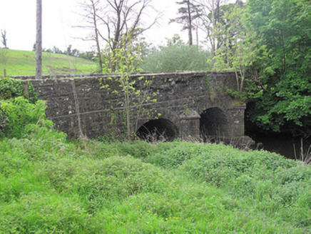
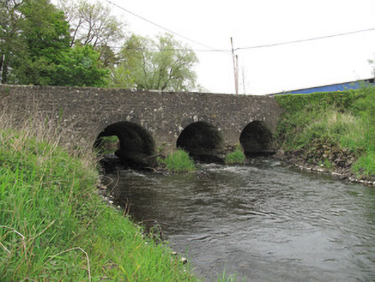
Description
Triple-arch limestone bridge, built c.1800, carrying road over River Finn, having additional dry arch to west. Segmental arches, with dressed stone voussoirs, and gunnelled soffits. V-shaped cut-waters to north elevation having dressed stone quoins and capping. Roughly coursed squared stone to cut-waters, soffits and parapets, squared sandstone copings to parapet walls. Some damage to parapet to north. Piers reinforced with concrete.
Appraisal
The arches to the south elevation of this simple but well-executed bridge form an attractive, rhythmical silhouette in the landscape, with the additional arch to the west intended to take increased flow at times of flood. V-shaped cutwaters to the north fulfill an important practical function in protecting the central piers from the flow of the current by deflecting debris. This bridge reflects the skill and craftsmanship employed in infrastructural engineering endeavours, as well as the overall development of the road network at the beginning of the nineteenth century.