
Survey Data
Reg No
41401219
Rating
Regional
Categories of Special Interest
Architectural, Technical
Original Use
Bridge
In Use As
Bridge
Date
1810 - 1830
Coordinates
254368, 328404
Date Recorded
02/05/2012
Date Updated
--/--/--
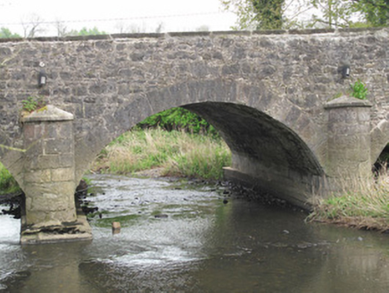
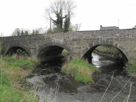
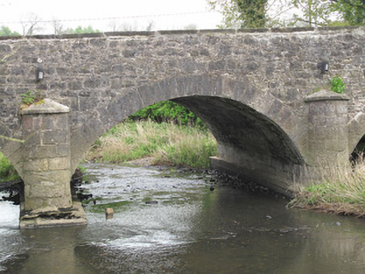
Description
Triple-arch bridge, built c.1820, carrying road over River Finn. Segmental arches with dressed limestone voussoirs and squared stone soffits. Dry arch to west. U-plan dressed limestone cut-waters to each elevation, having tooled limestone capping. Piers and abutments reinforced with concrete. Coursed roughly squared rubble stone to spandrel and parapet walls, south parapet wall rebuilt. Tooled stone capping to parapets.
Appraisal
This well-designed and well-executed bridge is testament to the skill and craftsmanship of civil engineers and stonemasons in the early part of the nineteenth century, and is representative of the expansion in the road network at that time. Tooled stone detailing provides a contrast to the rubble stone of the spandrels and parapets, while U-plan cutwaters fulfil an aesthetic as well as a practical function in providing a sense of symmetry to each elevation. The dry arch is indicative of fore planning for potential floods, and the continued use of the site is a testament to the skill of nineteenth-century engineers.