Survey Data
Reg No
41401102
Rating
Regional
Categories of Special Interest
Architectural, Historical, Technical
Original Use
Bridge
In Use As
Bridge
Date
1790 - 1810
Coordinates
250187, 328988
Date Recorded
05/05/2012
Date Updated
--/--/--
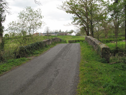
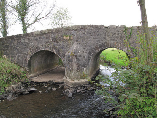
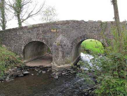
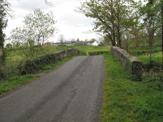
Description
Double-arch humpback limestone bridge, built c.1800, carrying road over stream. Round arches, having dressed stone voussoirs and gunnelled soffits. Arch to west now dry and having cement to river bed. Arches and central pier reinforced with concrete. V-shaped cutwaters of squared stone with conical caps to each elevation. Random rubble stone to spandrels and parapets, portions of dressed stone copings to parapets.
Appraisal
This simple but well-executed bridge carries a road over a stream, and is representative as such of the improved road network in the early nineteenth century. It also straddles the border between the island's two jurisdictions. Its name, Benson’s Bridge, signifies that it may have a connection to the adjacent windmill, built by Samuel Benson. Tooled stone detailing to the voussoirs and copings provide contrast to the rubble stone walls.