

Survey Data
Reg No
41401017
Rating
Regional
Categories of Special Interest
Architectural, Technical
Original Use
Mill (water)
Date
1825 - 1835
Coordinates
272217, 333884
Date Recorded
26/03/2012
Date Updated
--/--/--
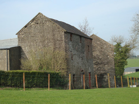
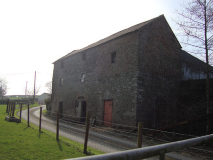
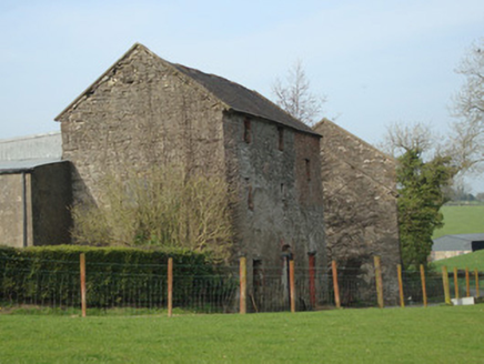
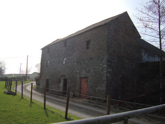
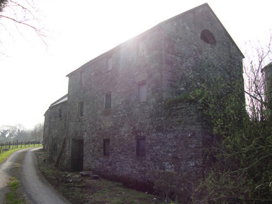
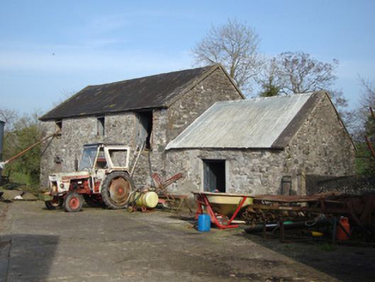
Description
Complex of three former mill structures, built c.1830, comprising three-bay three-storey mill house and office, single-bay two-storey drying kiln, and three-bay three-storey water-powered corn mill. Mills gutted of all plant and machinery. House on sloping site with two-storey elevation to north, pitched slate roof gabled to east and west with limestone copings to gables. Rubble limestone walls, upper half of west bay having red brick in Flemish bond. Yard between house and kiln, having limestone steps with wrought-iron gate to upper level to north. One-bay two-storey kiln to north-west, one-storey to north elevation, having pitched corrugated-metal roof, cement verges and rubble limestone walls. Corn mill attached to north-west of kiln, having coursed rubble limestone three-bay two-storey elevation facing west, with pitched slate roof, gabled to east and west and having cement verges and stone dressing to eaves, segmental-arch for tail-race to north of west elevation, having tooled limestone voussoirs, and infilled water-wheel pit to north gable, round-headed window openings with brick voussoirs to upper gables. Square-headed window openings to all three buildings, with tooled and rubble limestone voussoirs, lacking sills, and some having timber shutters. Central segmental-arch gauged-brick vehicular opening to house, with brick surround. Segmental-headed single-width door opening to kiln, with rubble stone voussoirs, and double-width segmental-headed door opening to corn mill with cut-stone voussoirs. Pedestrian entrance to house or offices from west, having two cement rendered gate piers with pointed four-apexed carved stone cap on either side of wrought-iron gate. Cement rendered wall to south and north of gate having limestone coping. Wall curves west at north with wide service entrance to large concrete yard to north of mill buildings, late twentieth-century farm sheds to yard.
Appraisal
Although gutted of plant and machinery, Dromore Corn Mill is a good example of a medium-sized early-nineteenth century corn mill occupying a prominent road side setting. A corn mill is cited on the 1835 OS map, and the 1830s Ordnance Survey Memoir notes that the slated stone mill was erected in 1833 and operated by Francis Evans. The corn mill is also named in the 1858 OS map and in the 1860 Griffith Valuation as ‘house, offices, corn mill’. Dromore Mill was a focal point for the local community, providing the majority of formal employment for the nearby Clonlonan. It played a key role in the economic prosperity of the area in particular its role as a corn mill after the Great Famine. The building also serves as a reminder of past industrial processes and represents an integral element of the industrial heritage of predominantly agricultural rural Monaghan, which had a high proportion of grain mills. This fine and imposing mill, now disused, took advantage of it’s hill-side location and fall of water to power a mill wheel, which in turn would have powered the mechanism to grind corn. The site maintains some physical remnants of its former use such as a pond to the south of the mill and the tail race, the head race and small pond to the west of the mill have been infilled. The visually pleasing contrast of red-brick and rubble stone elements in the walls coupled with the overall mass and height of the complex, make this series of buildings a significant and irreplaceable element in the landscape.