

Survey Data
Reg No
41401005
Rating
Regional
Categories of Special Interest
Architectural, Technical
Original Use
Canal (section of)
Date
1835 - 1845
Coordinates
270307, 336066
Date Recorded
19/03/2012
Date Updated
--/--/--
Description
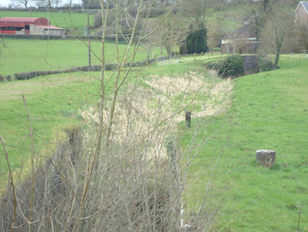
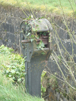
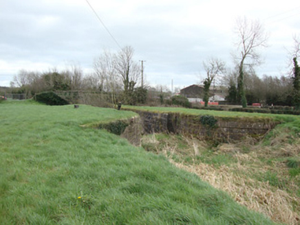
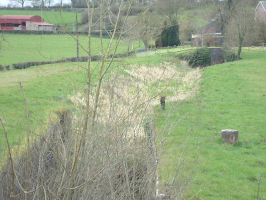
Length of disused canal, built c.1840, with two masonry locks, having a mooring bollard and cast-iron winding mechanism to towpath. Largely cut into earth without any trace of lining along its length. Bridged at western end by single-arch road bridge. Two sets of peck-dressed limestone walled locks, having single set of gate recesses, ashlar stone walls with curved terminals. Western lock significantly higher than eastern lock. Granite mooring bollard and cast-iron winding mechanism situated on northern towpath at 13th lock, with carved stone milestone to north of canal.
Appraisal
This section of canal forms a section of the 13th and 14th locks of the Ulster Canal, which was built between 1825 and 1841 and was 74 km (46 mi) long with 26 locks. The now disused canal ran through Armagh, Monaghan, Tyrone and Fermanagh, from Charlemont on Lough Neagh to Wattle Bridge on Lough Erne. The canal was an ill-considered venture, with the locks built narrower than the other Irish waterways, preventing through-trade, and had an inadequate water supply. The canal fell into rapid decline from the mid-nineteenth century and was finally declared abandoned in 1931. This section of locks, milestone and canal bridge is of considerable historical and social significance as a reminder of canal network development in Ireland. The survival of the early mechanism used to open the (now removed) timber gates is of certain technical or engineering merit while the site as a whole forms an attractive grouping in the landscape.