
Survey Data
Reg No
41400607
Rating
Regional
Categories of Special Interest
Architectural, Technical
Original Use
Bridge
In Use As
Bridge
Date
1815 - 1825
Coordinates
267070, 343343
Date Recorded
30/03/2012
Date Updated
--/--/--
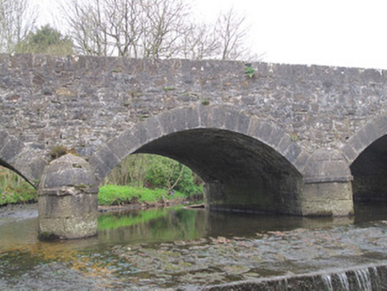
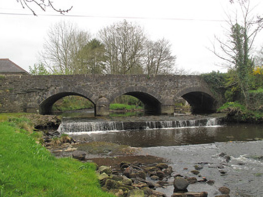
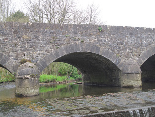
Description
Triple-arch masonry road bridge, built c.1820, carrying road over unnamed stream. Segmental arches with tooled limestone voussoirs and gunnelled soffits. V-shaped tooled limestone cut-waters with rounded caps, having tooled limestone plat-bands at impost level and matching square-profile piers to banks. Coursed squared limestone spandrel and parapet walls, parapets terminating in square-plan piers with cut limestone capping.
Appraisal
This well-executed bridge is enlivened by several examples of good-quality stonework, most notably its tooled voussoirs and rounded V-shaped cut-waters, which add aesthetic interest to the structure as well as playing an important role in protecting the stability of the bridge and deflecting debris in times of flood. These provide a pleasing contrast to the coursed rubble stone of the walls and highlight the skill and craftsmanship in engineering and stone working in the early nineteenth century. Sited at a locally important angling spot, this bridge makes a strong aesthetic contribution to the surrounding landscape.