

Survey Data
Reg No
41309007
Rating
Regional
Categories of Special Interest
Architectural, Technical
Original Use
Bridge
In Use As
Bridge
Date
1800 - 1805
Coordinates
293234, 307052
Date Recorded
03/04/2013
Date Updated
--/--/--
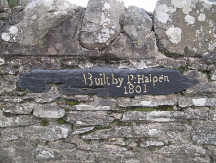
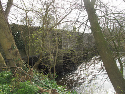
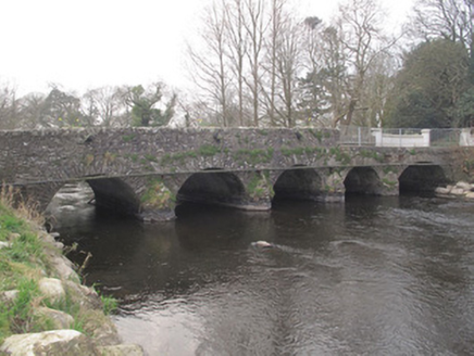
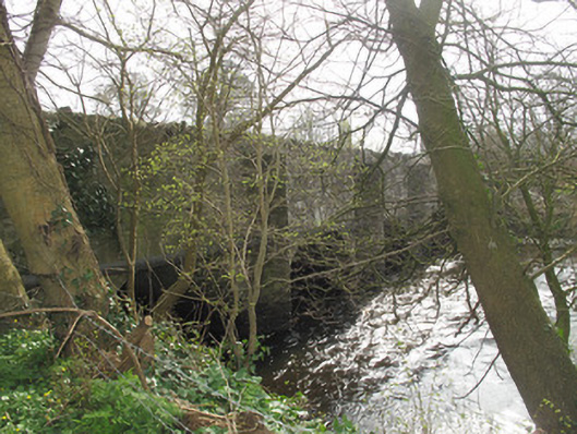
Description
Five-arch masonry bridge carrying road over River Fane, dated 1801. Rubble limestone walls and parapet walls, with rubble limestone coping. Portion of east parapet wall to north replaced with recent mild steel palisade. Inscribed painted date-stone to roadside elevation of east parapet. Round arches with dressed masonry voussoirs. V-profile rubble stone cutwaters to both elevations, those to west elevation being full-height with render coping.
Appraisal
This well-designed and well-executed structure is testament to the skill of local craftspeople and stonemasons. While the inscription may post-date the bridge, it nonetheless adds contextual interest. The arches form a strong, rhythmical silhouette, bringing architectural interest to the landscape, and the position of the bridge at a bend in the road affords pleasing views of it from the street.