
Survey Data
Reg No
41308001
Rating
Regional
Categories of Special Interest
Architectural, Technical
Original Use
Bridge
In Use As
Bridge
Date
1740 - 1780
Coordinates
282758, 320690
Date Recorded
02/10/2011
Date Updated
--/--/--
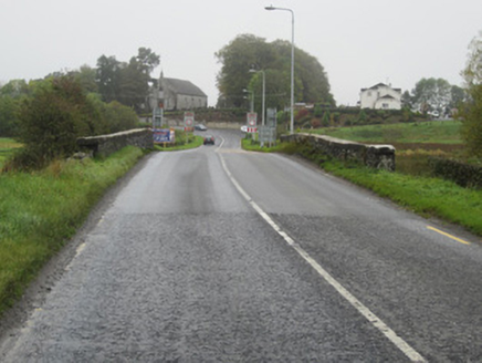
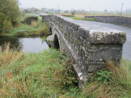
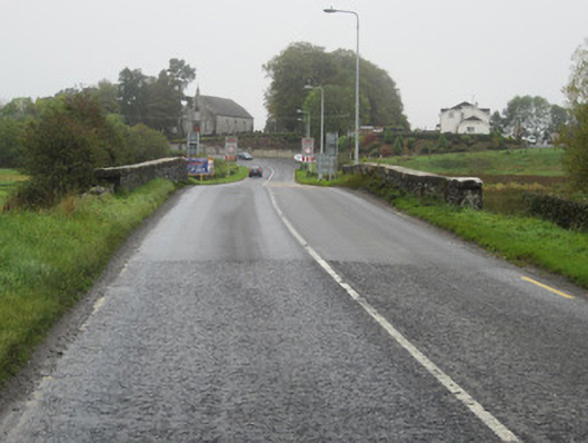
Description
Two-arch slightly humpbacked stone bridge, built c.1760, carrying Castleblayney to Newtownhamilton road over stream linking Drumillard and Muckno Loughs. Walls of uncoursed rubble sandstone with segmental arches having heavy, punch-finished ashlar voussoirs and punched chamfered string course narrowing wing walls and spandrels to parapet wall with heavy, punched flat coping stones. Parapets are terminated on both sides by square piers and are splayed slightly outward on each side of road crossing with some recent repairs with guillotined stone to south-east parapet. South-east parapet abuts low rubble stone field wall continuing on both sides of bridge. Bridge surface has soft grass margin to each side and no positive drainage. Upstream and downstream sides both have curved, pointed cutwaters.
Appraisal
This is a reasonably well maintained example of late eighteenth-century bridge architecture although its width with no apparent extension evident, and high quality stone dressings suggests a later date closer to the early to mid-nineteenth century. Regardless, this remains a well designed and executed masonry structure which has served its purpose for one hundred and fifty years at least and with no visible major repairs is thus a testament to the quality of the original designer and mason.