Survey Data
Reg No
41302006
Rating
Regional
Categories of Special Interest
Architectural, Technical
Original Use
Bridge
In Use As
Bridge
Date
1840 - 1880
Coordinates
267914, 335367
Date Recorded
14/10/2011
Date Updated
--/--/--
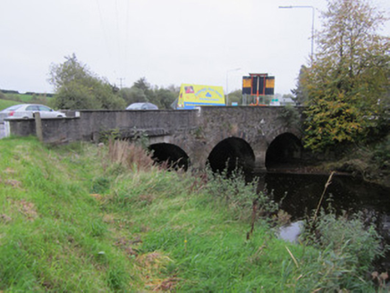
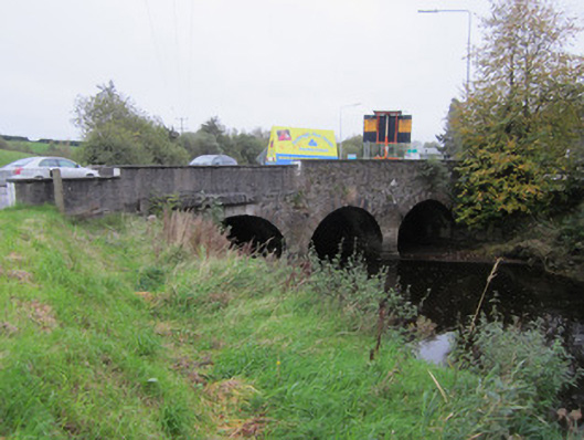
Description
Three-arch skew limestone bridge, built c.1860, carrying N2 road over River Blackwater, widened to southeast by concrete structure of c.1980. Visible, northwest upstream, elevation of stone bridge has walls of uncoursed rubble stone with round arches of slightly different heights, having punch-finished ashlar voussoirs, and similarly finished V-plan cut-waters. Part of parapet over north arch rebuilt in cast concrete to facilitate footpath held on concrete plinth and projecting over arch ring and north wing wall. Parapet has concrete capping, roughcast render to road elevation, and concrete skirting around base of cut-waters and abutments. Later, widened part of bridge holds multiple drainage and service ducts and pipes and has roughcast rendered parapet. Round arch of original southeast elevation visible through this later structure.
Appraisal
This late nineteenth-century bridge replaces an earlier structure that is depicted on the first edition Ordnance Survey map. It is well constructed of rubble and ashlar limestone, with good round arches, and forms a point of interest in the landscape and roadscape. It is still functioning well after two centuries.