


Survey Data
Reg No
40910806
Rating
Regional
Categories of Special Interest
Historical, Social
Previous Name
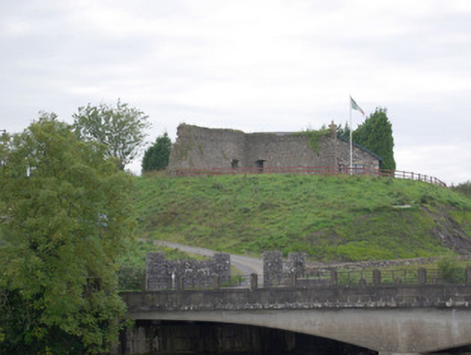
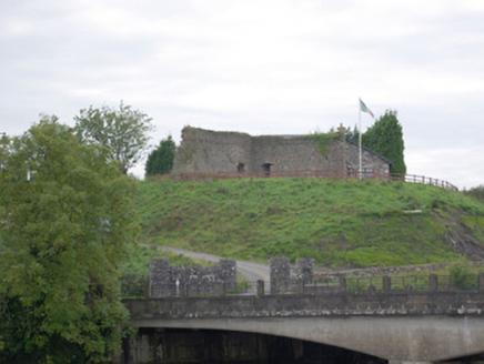
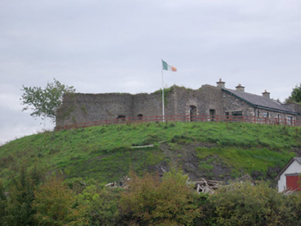
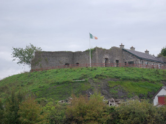
Belleek Battery
Original Use
Battery
Historical Use
Barracks
Date
1790 - 1810
Coordinates
193866, 358900
Date Recorded
02/10/2007
Date Updated
--/--/--
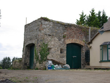
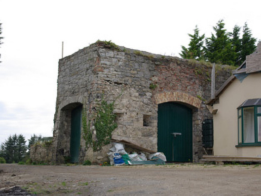
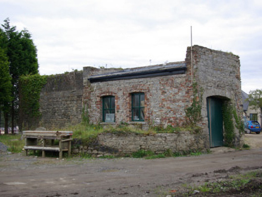
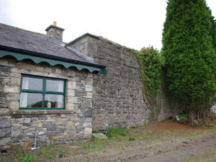
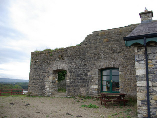
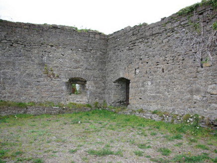
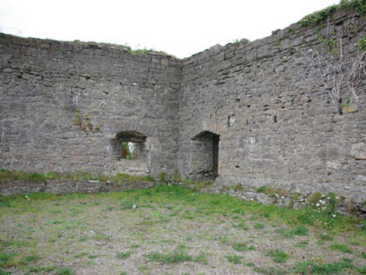
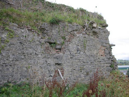
Description
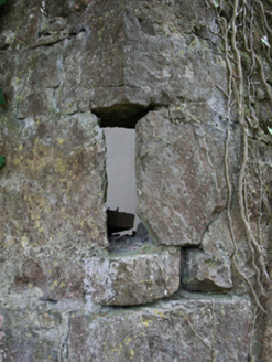
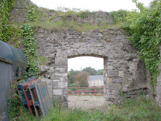
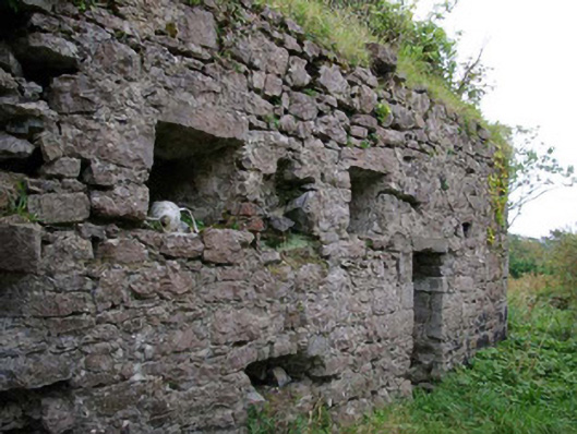
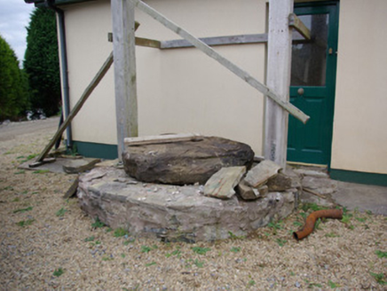
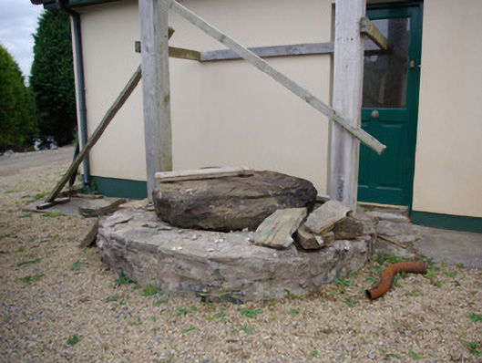
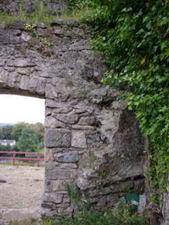
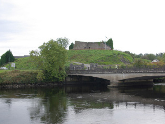
Remains of former battery, built c. 1798, having projecting bastions to the east elevation creating star-shaped plan. Remains of bastion, on semi-circular plan, to the west elevation. Possibly containing earlier fabric. Later in use as a garrison fort and then as a military barracks. Now partially demolished and partially incorporated into modern dwelling; modern building constructed using stone salvaged to site. Coursed squared and random rubble stone walls, battered to the east elevations, having projecting rubble stone plinth course to interior faces, and with roughly squared and dressed stone quoins to the corners. Evidence of increase in height to the east elevation at some stage with additional courses of squared and coursed rubble stone walling. Square-headed artillery embrasures to the east elevation, splayed to interior faces, having roughly dressed voussoirs to interior. Square-headed gun loops at intervals along length. Segmental-headed doorway to the north having roughly dressed voussoirs over, and with stone steps. Single-storey section of former battery to the south-west, now converted for use as outbuilding with modern roof over, having shallow segmental-headed carriage-arch to the south-east/east side having roughly dressed voussoirs and modern timber doors; shallow segmental-headed window openings to the west/south-east side having red brick surrounds and modern window fittings; modern segmental-headed carriage-arch to the east face having modern brick voussoirs over. Rubble stone well surround, on circular-plan to the interior of site. Evidence over former brick vaulting to interior, now demolished. Located on an elevated site overlooking the River Erne and bridge, and the town of Belleek, to the east. Located adjacent to the border with County Fermanagh and subsequently Northern Ireland.
Appraisal
Although partially demolished and now partially incorporated into a modern dwelling, this interesting former military structure is an integral element of the heritage and social history of the Belleek area, and indeed the wider region. This battery was apparently built as part of an extensive programme of military construction carried out around by the British military in Donegal (Lough Swilly and Lough Foyle) and along the Erne in the aftermath of the 1798 Rebellion to defend against possible seaborne invasion by the French during the Napoleonic era. It was built to defend the strategically important bridge at Belleek, where roads from Derry, Sligo, Enniskillen and Ballyshannon converged. The works were carried out under the orders of a General Knox and were supervised by the military engineer Captain (Sir) William Smith. A sketch of Belleek Battery by Smith dated 1799 indicates that it was probably constructed by this time. It was originally built with a central bastion to the east elevation overlooking the bridge. This elevation (east) was defended by eight artillery embrasures with a series of musket loops over. The west, north and south walls were defended with musket loops, while a semi-circular bastion to the west elevation protected this side of the fort/battery. To the interior, along the north, south, and west walls, were originally a series of barrack buildings (apparently for a garrison of some fifty men) and stores, now largely demolished. The single-storey building to the west of the fort, now in use as an outbuilding associated with the modern house, was probably originally one of these store rooms. It is interesting to note that this battery/fort had an internal well, a feature of vital importance in the event of any prolonged siege. It is interesting to note that this bridge was built to defend the approaches to the bridge from the east, suggesting the primary concern on behalf of the British authorities was to defend the crossing from a ‘native’ Ulster rebellion to the east. This fort, and its contemporaries in Donegal, were later heavily scaled down in importance after 1815 and the end of the Napoleonic wars. This fort later became of high strategic importance once again during the mid 1920s, in the years in the immediate aftermath of Irish Independence, which was a period of frequent hostility and limited military action along the border between Donegal and Fermanagh. During these years the battery was occupied by four different forces in four years; the A Specials, the IRA, the British Army, and finally the Irish Free State Army. The fort was taken by the British army following a short assault on the battery in June 1922, which was carried out within the intention of defending the bridge crossing from IRA raids and incursions into Northern Ireland from across the border. Pettigoe was also occupied in early June 1922 by British forces for the same reasons. It is ironic to note that the only military assault ever carried out on this fort was by British forces, the original builders and occupiers. Hostilities between the British forces and the IRA in the area died down following the outbreak of the Irish Civil War later in June 1922. The fort/battery remained in British military hands as late as August 1924, and it was apparently the last point in the Republic of Ireland occupied by British forces, which adds another layer of significance to this intriguing site. Given the strategic importance and setting of this location, it seems quite possible that it may have been the site of earlier castles or fortifications (although none recorded by Archaeological Survey of Ireland), and a number of military engagements took place in this area over the centuries. Occupying a highly strategic elevated location that has been used for military advantage for many centuries, with panoramic views over Belleek and County Fermanagh to the east and south, this sadly now fragmentary former battery and barracks is an integral element of the built heritage and social history of the surrounding area.