
Survey Data
Reg No
40909423
Rating
Regional
Categories of Special Interest
Historical, Social
Original Use
Milestone/milepost
Date
1750 - 1800
Coordinates
200163, 382695
Date Recorded
14/11/2007
Date Updated
--/--/--
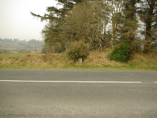
Description
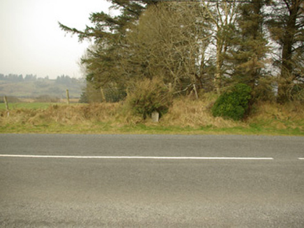
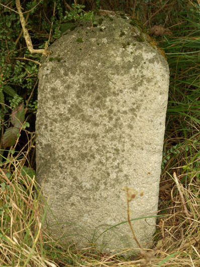
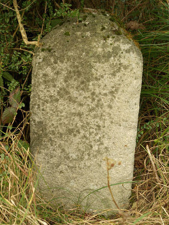
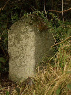
Freestanding granite milestone on rectangular-plan, erected c. 1775, having pyramidal head. Inscriptions to the faces now illegible. Located adjacent to the former main road, and to the north-east of Donegal Town close to the south-west end of the Barnesmore Gap.
Appraisal
This milestone is an interesting and subtle historical survival in the rural landscape to the north-east of Donegal Town. Unfortunately the inscriptions are now illegible but the distance would have been in ‘Irish Miles’, which are longer than the standard mile measurement used today. It probably dates to the second half of the eighteenth-century, a period when the Grand Juries were responsible for a great deal of improvement in the road transport network throughout Ireland, particularly the development of a series of ‘turnpike roads’ (from 1729) on which milestones are usually found. Milestones appears to be marked along this road on the Taylor and Skinner road maps of 1777 – 1783, although there were no turnpike roads in Donegal before 1805. This may have been ‘milestone marker 34’ along the main road from Donegal Town to Derry, although it was probably moved to its present location from a site close by due to road widening over the years etc. This simple item of street furniture acts as a subtle historical reminder the great coach travel in Ireland, and is an integral element of the built heritage of the local area.