
Survey Data
Reg No
40909108
Rating
Regional
Categories of Special Interest
Architectural, Technical
Original Use
Bridge
In Use As
Bridge
Date
1740 - 1800
Coordinates
172420, 378197
Date Recorded
19/08/2011
Date Updated
--/--/--
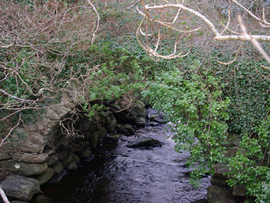
Description
Single-arch road bridge over Bungostee River, built c. 1770. Now out of use and overgrown with vegetation. Round-headed arch having roughly squared rubble stone voussoirs; rubble stone construction to arch barrel. Rubble stone construction to spandrels and parapets. Squared coursed rubble stone construction to spandrels and parapets. Located at the point where Bungostee River discharges into Killybegs harbour. Later bridge adjacent to the south (see 40909101), now superseded by modern bridge and embankment over Killybegs Harbour to the south. Located to the north-east of Killybegs.
Appraisal
This modest single-arch bridge retains its early form and character, and is an interesting feature in the landscape at the point where the Bungostee River discharges into Killybegs Harbour. Although long out of use, it is robustly-constructed in local rubble stone masonry, and its continued survival is testament to the quality of its original construction. This bridge was superseded by a later bridge adjacent to the south (see 40909101), which in turn has been by a modern bridge and embankment further to the south. The rather crude and utilitarian nature of this bridge contrasts with the more refined stonework found at its later neighbour to the south. This bridge originally carried the main road from Donegal Town to the important harbour at Killybegs and is probably of considerable antiquity, perhaps dating to the mid-eighteenth century or maybe even earlier (a road and bridge is indicated somewhere near this point on Moll’s map of Ireland dated 1714, and on the Taylor and Skinner Map of the area from 1777 – 1783). This simple bridge is an integral element of the built heritage and transport history of the Killybegs area, and is an appealing feature in the local landscape.