


Survey Data
Reg No
40907819
Rating
Regional
Categories of Special Interest
Architectural
Original Use
Country house
In Use As
House
Date
1780 - 1820
Coordinates
220735, 394585
Date Recorded
05/04/2008
Date Updated
--/--/--
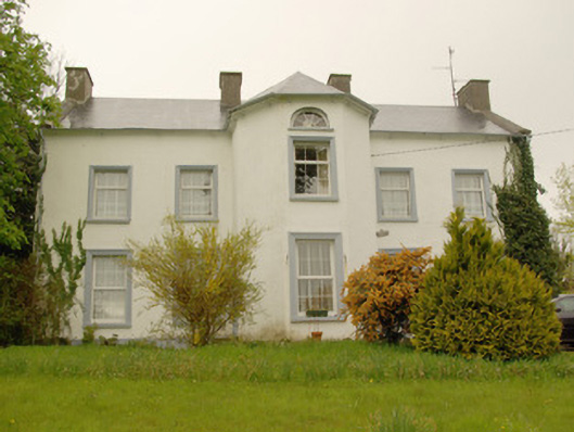
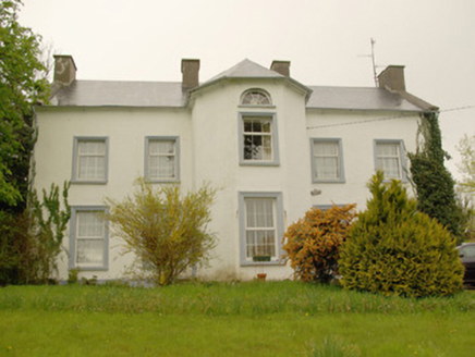
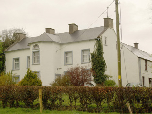
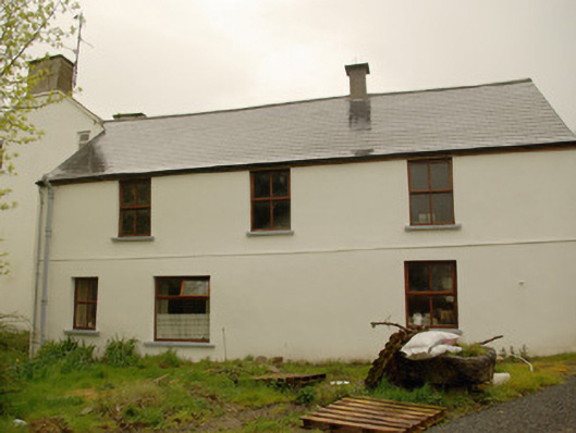
Description
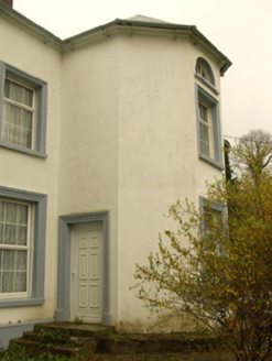
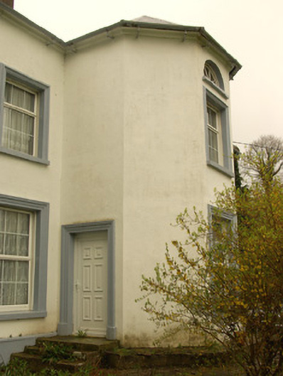
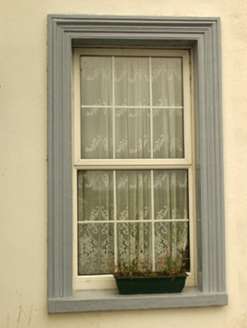
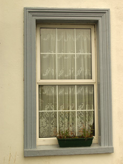
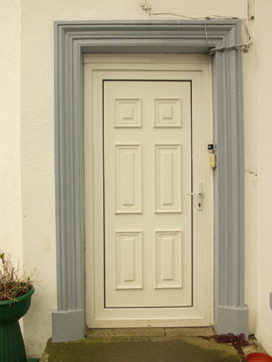
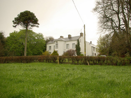
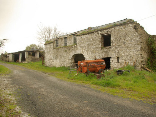
Detached five-bay two-storey over basement country house, built c. 1780, having central full-height canted projection to the main elevation (south), central single-bay two-storey gable-fronted return with attic and basement levels to the rear elevation (north) having single-bay two-storey addition to the east side with mono-pitched roof, and with four-bay two-storey extension to rear at the north-east corner. Pitched artificial slate roof to main body of building having projecting eaves course, raised rendered verges to the gable ends (east and west), cast-iron rainwater goods, and four rendered chimneystacks (one to either gable end and two to the centre flanking central canted projection); hipped artificial slate roof to canted projection. Smooth rendered walls. Square-headed window openings with render architraved surrounds to main elevation (south), painted stone sills, and replacement window fittings. Diocletian\semi-circular window opening to central canted breakfront at attic level having spoked timber fitting. Square-headed doorways to either side elevation of projecting canted breakfront having rendered architraved surrounds, painted plinth blocks, stone thresholds, and replacement doors. Set well-back from road in elevated mature site to the east of Killygordon. Complex of single- and two-storey outbuildings, and former walled garden to the rear (see 40907844). Main gateway to the south-east of house.
Appraisal
This plain but interesting and well-proportioned house, of late eighteenth-century appearance, retains much of its early character and form despite recent alterations. The projecting full-height canted breakfront provides a strong central focus, and is a feature that this house shares with a number of houses in the area including Edenmore House and Summer Hill. The unusually large space between the heads of the first floor windows and the eaves hints that this building may have formerly had an additional storey. The simple architraved surrounds to the openings to the main elevation adds an element of decorative interest to the otherwise plain façade but the loss of the original fittings to the openings, and the replacement of the slate roof, detracts from its integrity and appeal. This fine house was possibly originally built or altered during the last decades of the nineteenth century. It is possible that it contains the fabric of an earlier house or houses to site (see DG078-023003-/DG078-023004-). The lands (1,000 acres) in this area were granted to a Captain Ralph Mansfield in 1610 who built a three-storey house and bawn somewhere around this site that was described as ‘unslated’ in 1619 but ‘completed’ by 1622 (Treadwell 1953-5). It is possible that the present house or, perhaps, the complex of outbuildings to the rear contains fabric from this earlier house. The Mansfields probably originally established the town of Killygordon during the first decades of the seventeenth century (Pynnar writing in 1618/9 recorded that Capt. Mansfield built a’ Stone House three Stories high [that] is ready to be slated, himself with his family there dwelling; and near to this place he hath made a Village, consisting of 9 Houses, and standing on a Passage very commodious for the King's service (Hill 1877). Another account from the 1620s records ‘Captain Ralph Mansfield hath built a house near the river of Finn, of lime, clay and stone, 60 ft. in length, and 20 ft. wide with some returns, 2 stories high, slated, some of the partitions and floors not finished, with a bawn adjoining to the forefront of the house, 120 ft. square and 9 ft. high, with 4 flankers, 15 ft. square apiece, with birch timber and thatched, wherein Captain Mansfield's son's wife and family dwell. Near thereunto he hath erected a village consisting of 10 cottages thatched, inhabited with British, and about half a mile from the river, he hath erected another village [Crossroads?] consisting of 8 cottages which are decayed, and two of them without any tenants in them’. However, according to local tradition Killygordon House was built in 1652, the foundation stone laid on June 16th of that year. The architect was an Edmond Baker from Bermingham\Birmingham. Killygordon House was still in the ownership of the Mansfield family in 1777-83 (Taylor and Skinner map). It was later the home of a Captain Mansfield in 1836 (Ordnance Survey Memoirs) and a Ralph Mansfield in 1854-6 (Griffith’s Valuation), when the estate was some 609 acres in size, but the house was later the residence of a John S. Johnston J.P. in 1881 and later a Patrick Bonnor or Bonner in 1894, possibly both leased (both Slater’s Directory). The Johnston family (the Mansfield possibly married into a branch of the Johnston family) also had further seats in the area including Rockfield to the south-west. The estate appears been sold to a number of tenants in 1907, when Killygordon House itself was possibly sold to the Bonner family (Estate Commissioners Record). This house is an integral element of the built heritage and social history of the local area. The simple complex of outbuildings and the former walled garden (see 40907844) to the rear add to the setting and context, and complete this composition.