

Survey Data
Reg No
40907056
Rating
Regional
Categories of Special Interest
Architectural, Artistic
Original Use
House
In Use As
House
Date
1840 - 1860
Coordinates
225879, 400349
Date Recorded
14/10/2010
Date Updated
--/--/--
Description
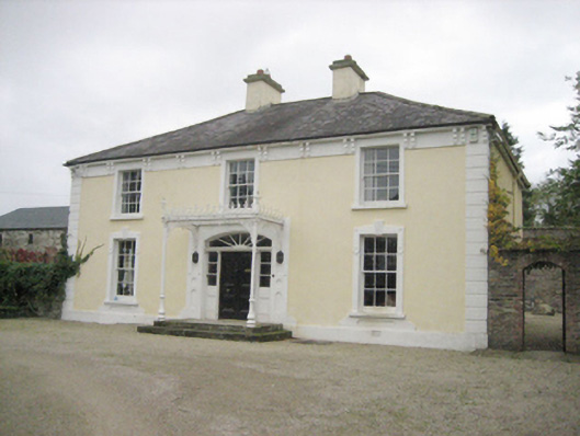
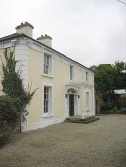
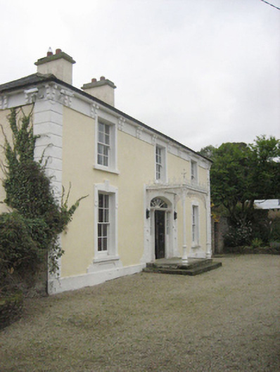
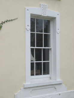
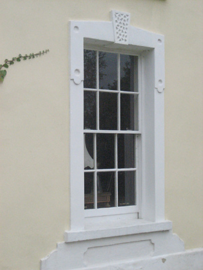
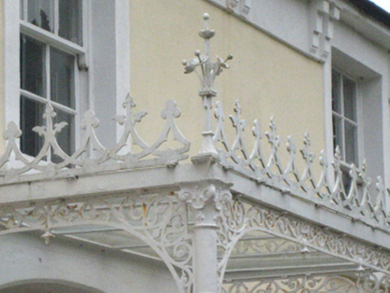
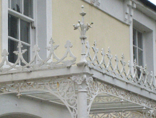
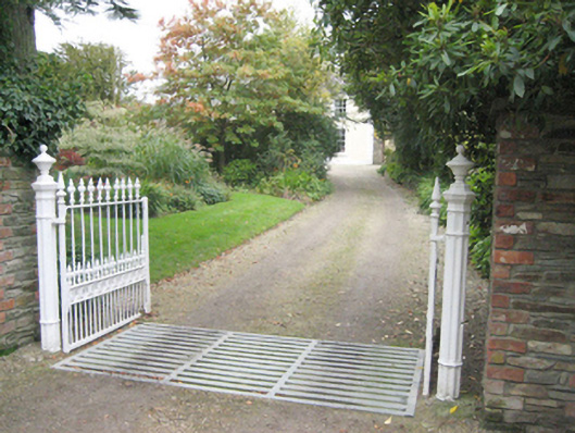
Detached three-bay two-storey house, built c. 1852, having central decorative open cast-iron porch to front elevation (east) added c. 1880, and with single-bay two-storey wing to the rear at the south end having single-storey entrance porch to south. Single-storey with attic level and single-storey flat-roofed extensions to rear (west). Hipped slate roof with overhanging eaves having paired corbelled brackets, smooth rendered eaves course, cast-iron rainwater goods, and with a central pair of smooth rendered chimneystacks having smooth rendered coping and clay pots over. Roughcast rendered walls over smooth rendered plinth course, and having smooth rendered block quoins to the corners. Square-headed window openings with smooth rendered surrounds, stone sills, and having six-over-six timber sliding sash windows; vermiculated keystones over ground floor window openings and curvilinear smooth rendered apron panels to base of ground floor window openings. Central segmental-headed door opening having timber panelled double-doors flanked by sidelights over timber panels with bolection mouldings, spoked fanlight over, and with cut stone steps; doorway flanked by smooth rendered panels having inset circular and shouldered rectangular motifs. Decorative open cast-iron porch to front having cast-iron Composite columns (on circular-plan), decorative cast-iron spandrels, decorative ridge cresting with alternating shamrock and fleur-de-lys motifs, and with wrought-iron floral finials to corners. Set back from road in own grounds in the rural countryside to the south of Raphoe. Garden to front and two-storey outbuilding to the rear (west) having hipped natural slate roof, rubble stone walls, and square-headed openings. Additional two-storey outbuilding to the north, c. 1860, now ruinous, having formerly hipped and pitched roof, rubble stone walls, and square-headed window and door openings, red brick voussoirs over ground floor openings and shallow segmental-headed carriage-arch with red brick voussoirs. Rubble stone boundary walls surrounding house with soldier coursing over. Gateway to the east of house comprising a pair of decorative cast-iron gate posts (on octagonal-plan) with urn finials over, and with a pair of decorative cast-iron gates with fleur-de-lys finials over.
Appraisal
This handsome and well-proportioned house, dating to the middle of the nineteenth century, retains its early form and character. Its visual appeal and integrity are enhanced by the retention of salient fabric including timber sliding sash windows. The extensive rendered detailing, particularly the surrounds to the openings, enliven the front elevation while the bracketed eaves and the tall chimneystacks add incident at roofscape level and create further decorative interest. Of particular note is the elegant open cast-iron porch to the front, which is probably a later addition c. 1880, with intricate cast-iron spandrels, Composite columns, and decorative ridge cresting with delicate wrought-iron floral finials to the corners. This porch helps to give this building a strong character and elevates it above many of its contemporaries in the county. The robust two-storey rubble stone outbuilding to the south-west adds significantly to the setting and context. This outbuilding has the incised date ‘1852’, which may well be the construction date of this house. The two-storey outbuilding to the north, which was probably originally associated with another house, now demolished, also adds to the setting. The simple rubble stone boundary walls, and particularly the fine cast-iron gateway to the east complete this composition, which is an integral element of the built heritage of the local area. It is one of the better surviving examples of its type in a part of Donegal marked by relatively large numbers of surviving substantial nineteenth century houses and farmhouses, which reflects the good quality agricultural land in the locale. Some of the outbuildings to the south-west (not viewed, map information) appear to predate the house and were originally associated with corn mills, corn kilns and possible earlier house(s) to site (Ordnance Survey first edition six-inch map of c. 1837). There may be a house on the site of the present building at this time but it looks to be a smaller structure though on the L-shape plan of the current structure. This house appears to have been the home of a branch of the Wilson family during the last decades of the nineteenth century, and ‘The Tops’ is recorded as the residence of a James, William, and a Robert Carson Wilson in 1881 and 1894 (Slater’s Directories). These are all recorded as ‘farmers’ at this time. John and Eliza Wilson are also recorded at The Tops in Griffith’s Valuation in 1857; John, of ‘The Tops’ was a ‘Ruling Elder in the Presbyterian church at Raphoe (death record, December 1860). This may have been the home of a John Wilson of The Tops in 1845 (Marriage record of his daughter in January of that year) and there are records relating to the Wilsons of The Tops dating back into the 1807. The Wilson family were an important local family in the area during the nineteenth century, and owned a number of houses in the area, including Drumineney House (see 40907019) to the west, as well as being responsible for a number of buildings constructed in Raphoe to the north.