
Survey Data
Reg No
40907055
Rating
Regional
Categories of Special Interest
Architectural
Original Use
Outbuilding
Date
1830 - 1860
Coordinates
225908, 400261
Date Recorded
14/10/2010
Date Updated
--/--/--
Description
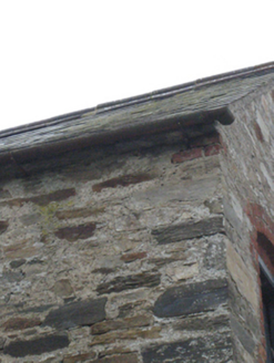
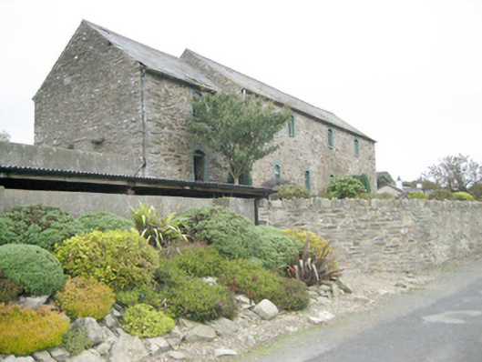
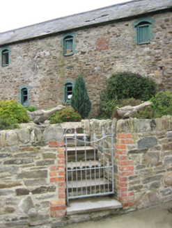
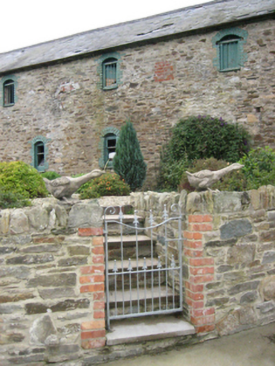
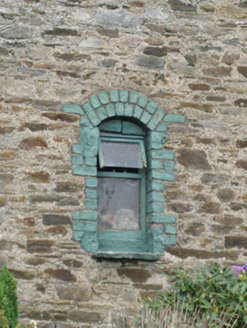
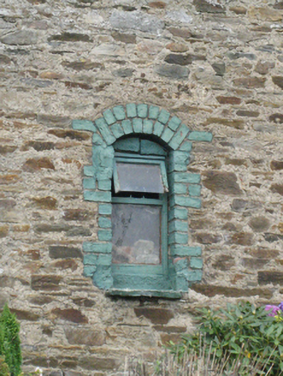
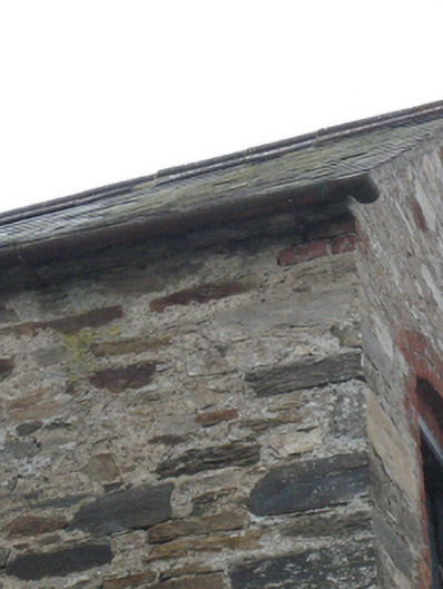
Possibly originally in use as a corn store/warehouse associated with corn mill to site, now demolished. Pitched natural slate roof with projecting cut stone eaves course, and with cast-iron rainwater goods. Random rubble stone walls with remains of roughcast lime render over; flush red brick margin to the bottom half of the south-east margin. Segmental-headed window openings with painted red-brick surround and voussoirs, flat stone sills, and with replacement timber casement windows at ground floor level and batten timber shutters at first floor level having wrought-iron security bars. Square-headed carriage-arch to the north end of the east elevation having metal double-doors. Set slightly back from road with rubble stone boundary wall to road-frontage to the east having rubble stone coping over. Detached three-bay two-storey house adjacent to the north (not in survey).
Appraisal
This substantial two-storey outbuilding, dating to the mid nineteenth-century, retains much of its original character and form. Its visual appeal and integrity are enhanced by the retention of the natural slate of and battened timber shutters. It is robustly built in local rubble stone masonry, and its survival in good condition despite being now largely out of use is testament to its durability. The red brick dressings to the openings are a common feature of outbuildings of its type an date in Ireland, and add some modest textural and tonal variation to the main elevation to the east. This outbuilding is unusually substantial to find with a modest two-storey house such as the building adjacent to the north (not in survey). This suggests that it was probably originally associated with a corn mill (now demolished) that lay adjacent to the north during the mid-nineteenth century (ordnance Survey first edition six-inch map of c. 1837), possibly as a store or warehouse. This building is one of the better examples of its date and date, and makes a positive contribution to the rural landscape to the south of Raphoe.