


Survey Data
Reg No
40907022
Rating
Regional
Categories of Special Interest
Architectural
Original Use
Country house
In Use As
Country house
Date
1740 - 1790
Coordinates
222873, 399650
Date Recorded
02/10/2007
Date Updated
--/--/--
Description
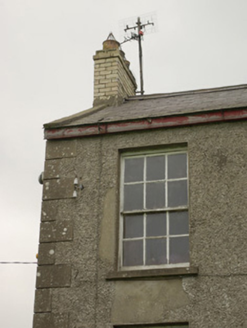
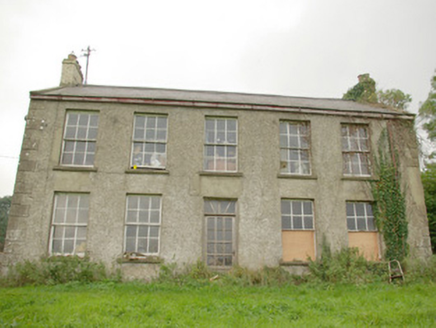
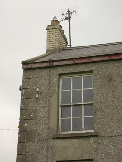
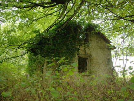
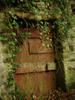
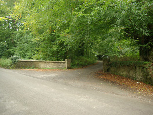
Detached five-bay two-storey over basement house, built c. 1770 and altered c. 1870. Later possibly in use as an outbuilding, now in use as a house. Pitched natural slate roof having yellow brick chimneystacks to the gable ends (north and south) with terracotta pots, raised cement rendered copings to the gable ends, and cast-iron rainwater goods. Roughcast rendered walls over red brick and rubble stone construction (partially exposed to rear) with raised render block-and-start quoins to the corners of the main elevation (west). Blocked former segmental-headed carriage arch to the centre of the rear elevation (east) having roughly squared rubble stone voussoirs. Square-headed window openings having cut stone sills, smooth rendered reveals, and with mainly six-over-six pane timber sliding sash windows. Central square-headed door opening to the main elevation (west) having smooth rendered reveal, replacement glazed timber door, and with overlight. Set well back from road in extensive mature grounds with stands of mature trees to site. Located in the rural countryside to the south-west of Raphoe. Complex of single- and two-storey former outbuildings and possible former house to site (see 40907030). Main gateway to the north-east comprising a pair of gate piers (on square-plan) flanked to either side by splayed sections of rubble stone walls with cement coping over. Detached two-bay single-storey with attic level former gate lodge adjacent to gateway, now ruinous, having remains of pitched natural slate roof with projecting cut stone eaves course, roughcast rendered rubble stone walls, square-headed window openings with stone sills and remains of timber fittings, and square-headed doorway with timber door. Freestanding turret or folly (see 40907031) located to the south-west of house.
Appraisal
This plain but well-proportioned and substantial former country house, of probable late eighteenth-century date, retains much of its early form and character despite some alterations. Its visual expression and integrity is enhanced by the retention of salient fabric such as the timber sliding sash windows and the natural slate roof. This building is an example of the language of classical architecture stripped to its fundamental elements, which is a feature of many minor Irish country houses, rectories etc., dating from the eighteenth and early-nineteenth-centuries. The brick chimneystacks etc. suggests that this building was altered at some stage during the second half of the nineteenth century. This structure appears to have being the front block of the much larger structure (Ordnance Survey first and third edition six-inch maps of 1837 and 1906) that was demolished sometime during the twentieth century. The largely blank rear elevation is evidence of this while the central probable former carriage arch suggests that this building may have been altered after the demolition of the rear block to form an outbuilding. The original building date is not known but Green Hill (or Greenhill) is indicated on the Taylor and Skinner road map of the area (1777-83) when it was the residence of a Nesbitt Esq. This may be an earlier house to site (see 40907030). The Nesbitts appear to have initially received lands in this area in 1676 from the Hamilton family. There is mention of a house at Green Hills/Greenhills from 1750 at the latest in the will of James Nesbitt. It later passed into the ownership of William Fenwick, c. 1825, after he married Rebecca Sophia Nesbitt, the daughter of the previous owner. Lewis (1837) records that it has the home of a W. Fenwick, Esq., while it remained the residence of William Fenwick in 1846 (Slater’s Directory). It was later the home of a Charles Bisset Fenwick J.P. (1828 – 1895) in 1881 and 1894 (Slater’s Directory). The Green Hill estate amounted to some 5,005 acres in 1876. This building forms the centrepiece of a group of related buildings along with the complex of mainly ruinous outbuildings and possible former house to site (see 40907030), the turret or folly to the south-west (see 40907031), the former walled garden to the north, and the altered gateway and the associated former gate lodge, now ruinous, to the north-west, and is an integral element of the built heritage of the local area.