


Survey Data
Reg No
40905327
Rating
Regional
Categories of Special Interest
Archaeological, Architectural
Original Use
Church/chapel
Date
1600 - 1750
Coordinates
219307, 413023
Date Recorded
25/11/2008
Date Updated
--/--/--
Description
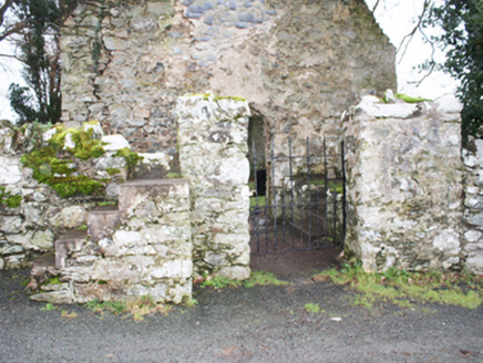
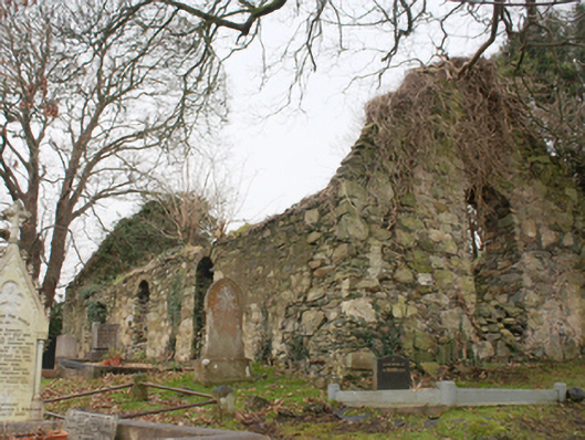
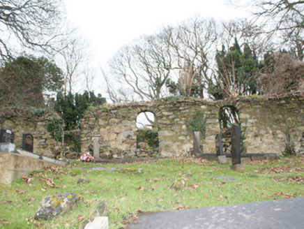
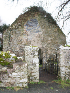
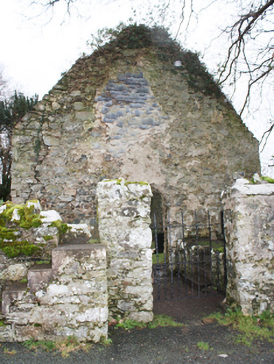
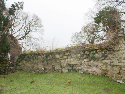
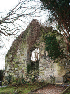
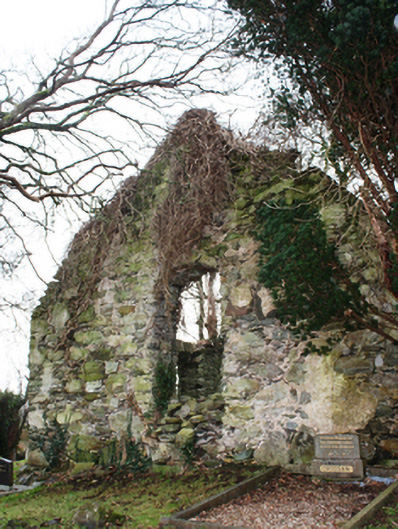
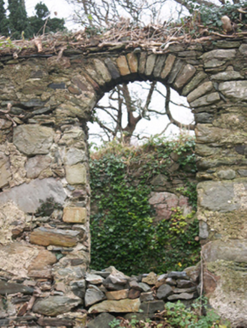
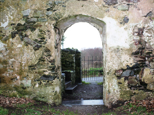
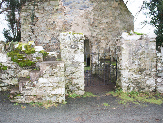
Freestanding former Church of Ireland church, built c. 1630 and altered c. 1750, comprising three-bay hall. Now ruinous (since c. 1850). Pitched natural slate roof, now collapsed. Rubble and coursed rubble stone walls with remains of roughcast lime render over; remains of slate-hung walls to the west gable end. Some roughly squared dressed quoins to corners. Segmental-headed window openings to the south, east and west elevations; no fittings remain. Segmental-headed doorway to the west gable end; no fittings remain. Graveyard (on rectangular-plan) to site with collection of gravemarkers dating from 1756 until 2003 but mainly of nineteenth century date. Graveyard surrounded by rubble stone boundary wall. Gateway to the west comprising a pair of partially rendered rubble stone gate piers (on square-plan) with wrought-iron gate. Rubble stone steps to gate stile adjacent to the north of gateway. Located in the rural countryside to the north-east of Letterkenny.
Appraisal
The interesting remains of a small-scale hall-type single-cell church that now acts as a feature of some archaeological and historical in the rural landscape to the north-east of Letterkenny. It is robustly built using local rubble stone masonry with some dressed quoins to the corners. The west gable end was slate-hung, a feature that adds some interest to the entrance gable. The fragmentary remains of roughcast render to the exterior indicate that it was originally or formerly roughcast rendered. The surviving church ruins were probably built post 1622 (see Royal Commission, 218) and appears to have been altered during the mid-eighteenth century. The architectural remains, particularly the window forms, are indicative of a seventeenth century date for this building. The church continued in use until the mid-nineteenth century when the Church of Ireland chapel of ease (see 40905302) was built at Cornagill townland a short distance to the east. This church is depicted on the Taylor and Skinner map of 1777-83; Lewis (1837) records that this church was ‘in a very dilapidated state’ at this time. According to local tradition this may be the site of a Franciscan abbey that was established at Aughanunshin during the thirteenth or fourteenth century. The Franciscan monks are thought to have remained in the monastery until c. 1610 when they were evicted. The church is surrounded by a graveyard with mainly nineteenth and twentieth century gravemarkers, some of modest artistic interest. The earliest legible gravemarker is dated 1756 and commemorates the Revd. John Robertson. The simple boundary walls and the gateway to the west with wrought-iron complete the setting of this site, which is an integral element of the built heritage and social history of the local area, and a feature of some picturesque merit in the rural countryside to the north-east of Letterkenny.