


Survey Data
Reg No
40904701
Rating
Regional
Categories of Special Interest
Historical, Social
Original Use
Distillery
Historical Use
Mill (water)
In Use As
Building misc
Date
1730 - 1780
Coordinates
233383, 418635
Date Recorded
21/10/2008
Date Updated
--/--/--
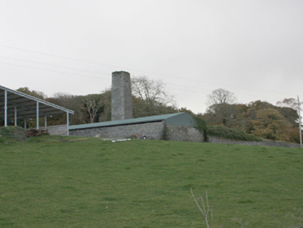
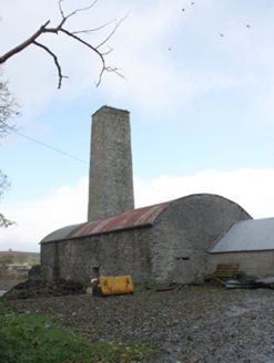
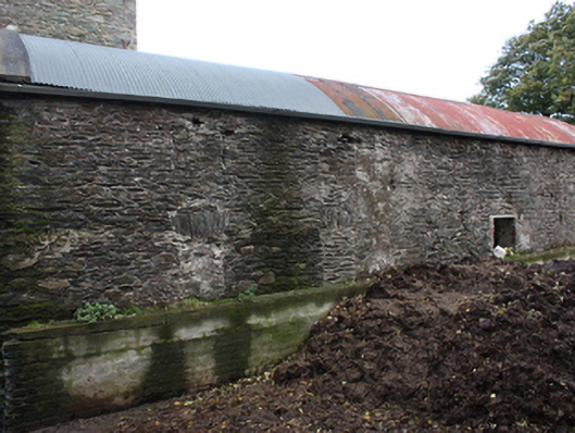
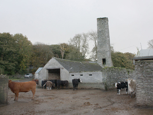
Description
Detached four-bay single-storey former distillery, built c. 1750, with large square-plan chimney tower to west and single-storey modern shed to east gable. Vaulted corrugated metal roof. Rubble stone walls with metal wall ties to chimney, northern elevation now opened up as hay barn. Square-headed window openings now mostly blocked up. Square-headed door openings to west elevation and to first floor of tower. Complex of detached outbuildings and remains of outbuildings to the north and the north-west. Single-storey outbuilding with pitched slate roof, roughcast rendered walls and square-headed window and door openings. Surviving rubble stone walls with red brick dressings to door and window openings. Site bounded by high random rubble walls on rectangular plan.
Appraisal
This rare building is a real landmark on the eastern side of the N13 near Burt. The structure is sound but unfortunately due to current use has been modified somewhat, mostly as a precautionary stabilisation measure. A large distillery complex is marked on the Ordnance Survey first edition six-inch map of c. 1837. The distillery here would have been of great economic importance, providing employment and bringing mercantile activity to the area, and as such constitutes an integral part of the region's architectural and industrial heritage.