
Survey Data
Reg No
40904617
Rating
Regional
Categories of Special Interest
Architectural
Original Use
Walled garden
Date
1770 - 1790
Coordinates
226247, 419315
Date Recorded
30/11/2016
Date Updated
--/--/--
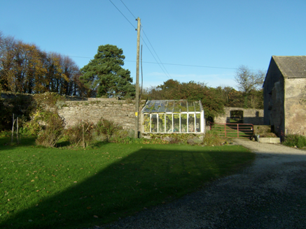
Description
Former walled garden, built c.1780, on rectilinear plan. Now disused. Rubble stone boundary walls enclosing overgrown garden with series of segmental-arch openings in southwest stretch to rear of Fort Stewart House. Section of road elevation missing.
Appraisal
An extensive walled garden that forms part of a group of structures associated with Fort Stewart. It indicates the resources needed to run and maintain a country house in the eighteenth and nineteenth centuries. The original layout is still evident and many openings survive.