

Survey Data
Reg No
40903801
Rating
Regional
Categories of Special Interest
Architectural, Artistic, Technical
Previous Name
Mores's
Original Use
House
In Use As
House
Date
1720 - 1740
Coordinates
233041, 425228
Date Recorded
28/10/2008
Date Updated
--/--/--
Description
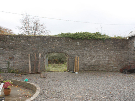
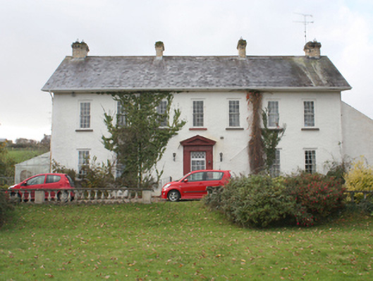
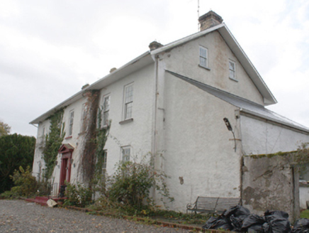
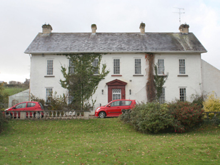
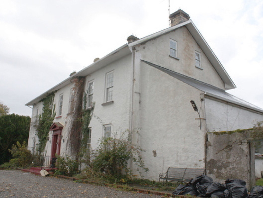
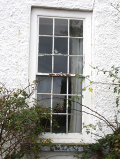
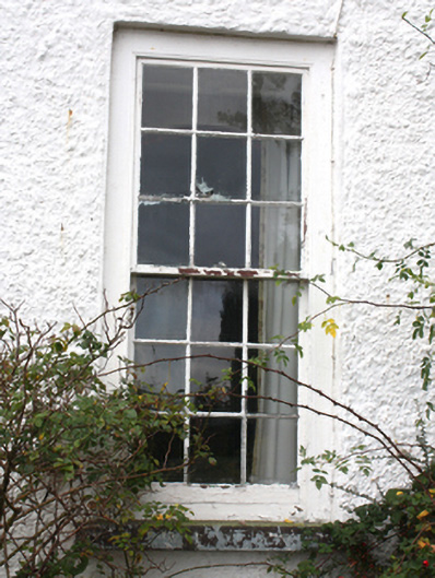
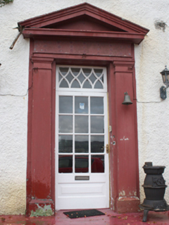
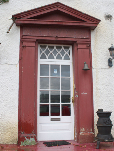
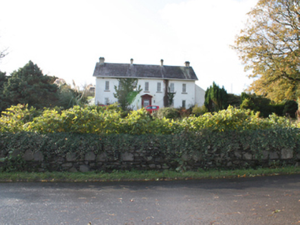
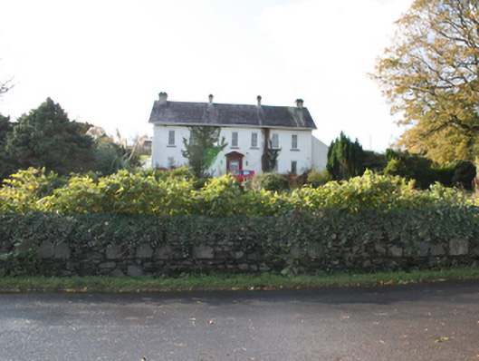
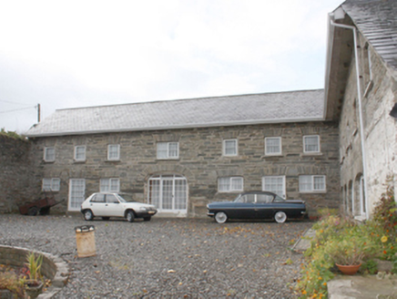
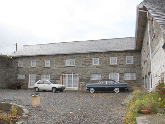
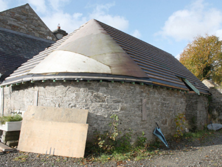
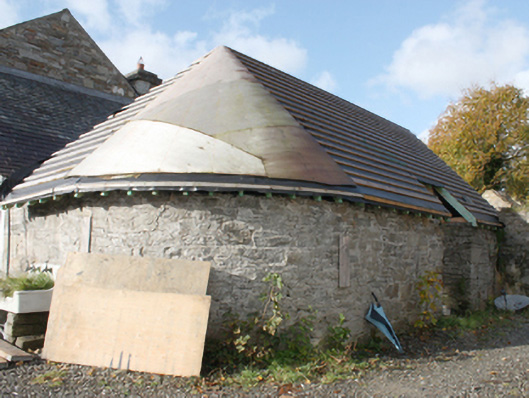
Detached seven-bay two-storey over basement with attic house, built c. 1730, with lean-to extension to north gable, modern single-storey extension to rear and lean-to conservatory to south gable. Pitched slate roof with modern skylights to west pitch, lean-to artificial slate roof to north extension, blue-black clay ridge tiles, deeply projecting painted timber eaves, four rectangular yellow brick chimneystacks with cogging cornice to cap; replacement rainwater goods, some round cast-iron downpipes. Roughcast rendered walls, lined-and-ruled rendered to south gable. Square-headed window openings, with nine-over-nine hornless sash windows with exposed sash boxes and painted stone sills; six over-six to north gable and six-over-three to basement. uPVC windows to south gable and timber casements to modern extensions. Square-headed entrance door opening with Tuscan pilaster and pediment doorcase with timber glass panelled door and overlight with X-tracery. House set back from road on elevated site. Courtyard to west with L-plan two-storey multiple-bay former stables and coach house built c. 1840, renovated 2006, with modern pitched slate roof with block stone modillions to eaves, rubble stone walls, square-headed door and window openings with roughly dressed voussoirs, and three-centre-headed carriage arch with roughly dressed stone voussoirs; single-storey rubble stone outbuilding with curved south-east corner and replacement roof. Former orchard to south-east enclosed by rubble stone wall, with three-centre-headed carriage arch with dressed stone voussoirs.
Appraisal
An important early eighteenth-century house but with an early nineteenth-century appearance, possibly arising from a remodelling at that time. However it has retained its characteristic eighteenth century nine-over-nine sashes with exposed sash boxes. Rowan (1979) refers to interiors with angled fireplaces, bolection-moulded panelling and an upper hall the depth of the house, all early eighteenth century details. The retention of the outbuildings, recently renovated, and the wall of the former orchard add to the property’s significance. The house is named Mores's on the Ordnance Survey first edition six-inch map of c. 1837. Curiously it shows that the road to the east had a slight bend, now straightened out, responding to a formal layout of the grounds to the front of the house. The former stables and coach house were possibly used to house British army officers station at Inch Fort in the nineteenth century. The outbuildings were apparently used as thread factory at one point. This was the house of the Lord of the island (possibly named Lord Templemore).