

Survey Data
Reg No
40901901
Rating
Regional
Categories of Special Interest
Archaeological, Architectural, Social
Original Use
Church/chapel
Date
1770 - 1810
Coordinates
232506, 438786
Date Recorded
22/11/2008
Date Updated
--/--/--
Description
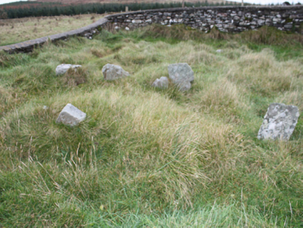
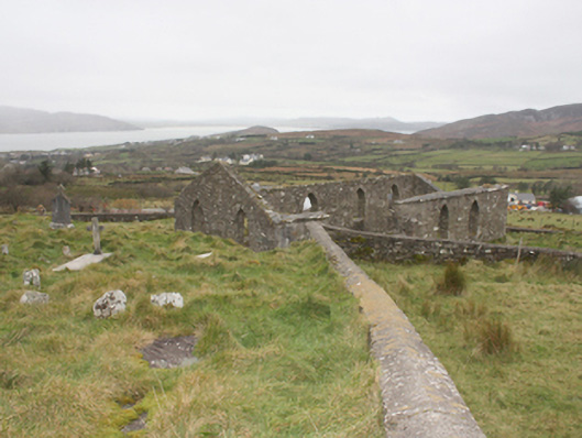
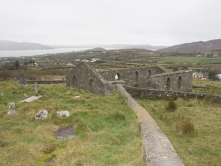
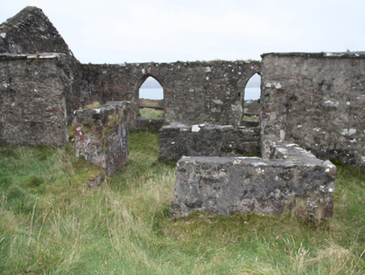
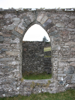
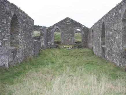
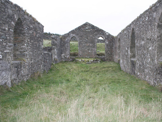
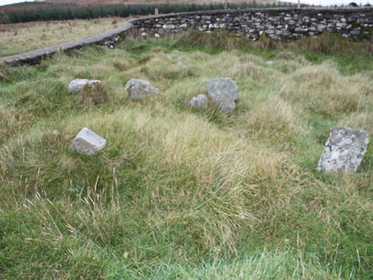
Freestanding four-bay Catholic chapel, built c. 1790, on a hall plan with attached vestry, now a ruin. Roof not extant, cut stone eaves course. Rubble stone walls with remnants of roughcast render. Pointed-arch headed window openings with roughcast rendered reveals. Open interior with semi-circular raised altar area to the south-east. Set within large graveyard containing numerous grave slabs and uninscribed grave makers, bounded by rubble stone wall with smooth rendered saddle-shaped coping.
Appraisal
Although now a ruin, this small former pre-Emancipation church is an important reminder of the religious beliefs and aspirations of the local community. The pointed-arched openings give it the bare minimum of a Gothic Revival character. It is shown on the Ordnance Survey first edition six-inch map of c. 1837 but is indicates as 'disused' on the Ordnance Survey twenty-five inch map of c. 1905. It replaced an earlier church to site (see RMP DG019-5001-) that was abandoned in 1693, attesting to a longstanding religious focus of this site. The graveyard contains a number of crude stone crosses (DG019-005002-), cross-inscribed stones (DG019-005003-), and a cross-shaped stone with cupmarks (DG019-005004-) that related to earlier activity to site.