


Survey Data
Reg No
40901825
Rating
Regional
Categories of Special Interest
Architectural, Historical
Previous Name
Fort Dunree
Original Use
Watch tower
Date
1900 - 1940
Coordinates
228510, 438858
Date Recorded
29/11/2008
Date Updated
--/--/--
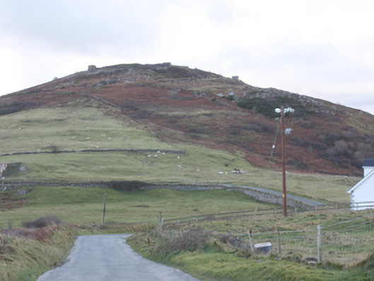
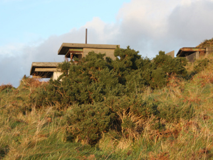
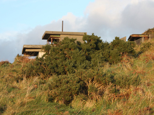
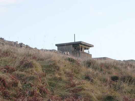
Description
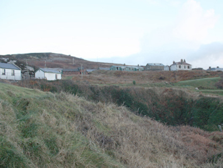
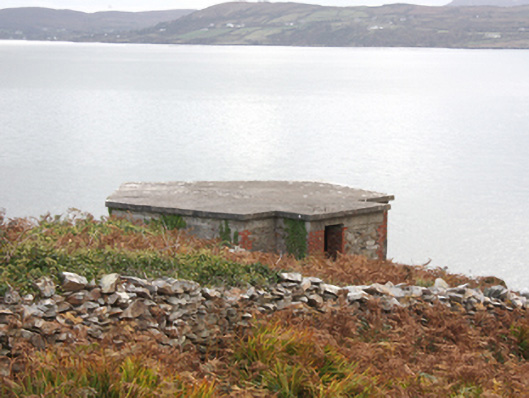
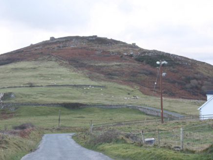
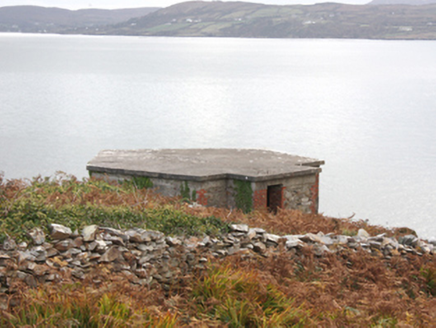
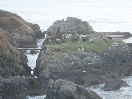
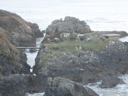
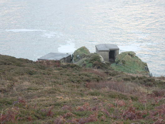
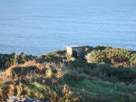
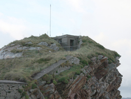
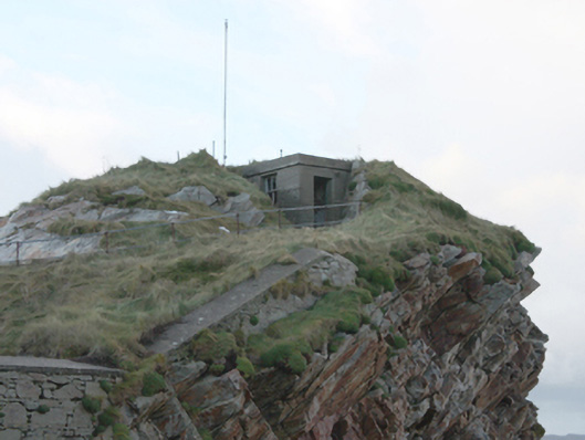
Complex former single-storey pillboxes and single-storey lookout positions associated with Fort Dunree (see 40901813 and 40901826), built c. 1920 and c. 1940. Now disused. Flat concrete roofs, some gently sloping from front to rear creating larger field of vision. Reinforced concrete and cement rendered walls; red brick construction in places to a number of the former watch huts\stations. Square-headed window and door openings with remains of metal fittings. Pillboxes\watch posts (on canted-plan) located along perimeter of later fort (see 40901826), c. 1897, to the summit of Dunree Hill. Two former pillboxes and\or look-out posts located on an island to the south-west of site, connected to mainland by timber footbridge with timber safety railings. Single-bay single-storey structure located on highest point to north-east of original Fort Dunree (see 40901813), probably originally in use as a communications\radio hut, having flat concrete roof, reinforced concrete walls, and square-headed window opening with remains of two-over-two pane timber sliding sash window, square-headed doorway with remains of timber door, and with radio aerial\antennae adjacent. Buildings located throughout site, strategically positioned to afford viewing\field of fire in majority of directions. Located on cliff-edge and slopes of Dunree Hill at Dunree Head peninsula to east bank of Lough Swilly.
Appraisal
This interesting and substantial collection of utilitarian former pillboxes, watch huts, and ancillary structures forms an integral element of the group of sites associated with Fort Dunree (see 40901813 for original fort; see 40901826 for later fort on summit of Dunree Hill). Although out of use and unassuming in form, these structures provide an interesting insight into the defence considerations afforded an important coastal battery at the time of construction. These structures are scattered throughout site, strategically positioned to afford viewing\field of fire in majority of directions. A number of the larger former pillboxes have roofs sloping away from the gun ports\viewing posts to allow for greater field of view; some of these probably date to c. 1940 and may have been used to accommodate larger calibre machine guns etc. Many of these structures were probably originally built in conjunction with the construction of the later fort (see 40901826) by the British Military, built c. 1897, located around the summit of Dunree Hill to the east of the earlier fort; this includes the collection of structures on canted-plan with gun loops located at intervals around the perimeter wall of this fortification. Other pillboxes and ancillary structures were probably added by British authorities during World War One (1914 – 1918). As a treaty port, this site remained in British military hands until 1938, and it was later garrisoned by the Irish Army during World War Two\’The Emergency’ when a number of anti-aircraft guns were added to site. It is likely that a number of structures to site were added by the Irish military during this phase of the history of the site. This extensive complex of structures is an integral part of the Dunree batteries, and provide an interesting insight into the history of Ireland’s coastal defences. They form part of a site that together constitute one of a number of coastal batteries built by the British military around Lough Swilly along with Inch Fort and Ned’s Point to the south, Lenan Head to the north, and Muckamish, Rathmullan and Knockalla to the far side of the Lough. Furthermore, the site provides insight into the defensive thinking of military planners and the skills of military engineers during the first half of the twentieth century.