
Survey Data
Reg No
40901767
Rating
Regional
Categories of Special Interest
Architectural, Technical
Original Use
Bridge
In Use As
Bridge
Date
1860 - 1880
Coordinates
214827, 437308
Date Recorded
04/10/2010
Date Updated
--/--/--
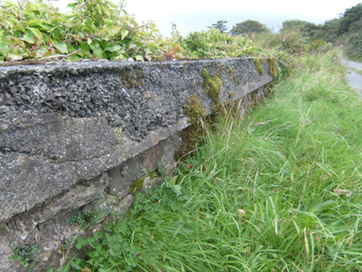
Description
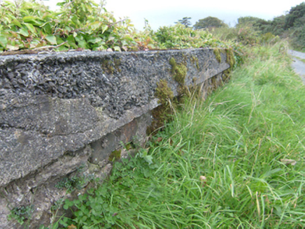
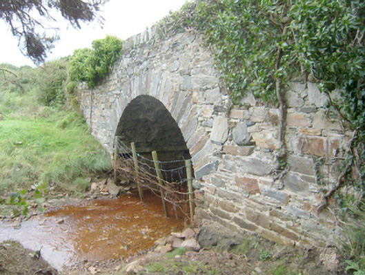
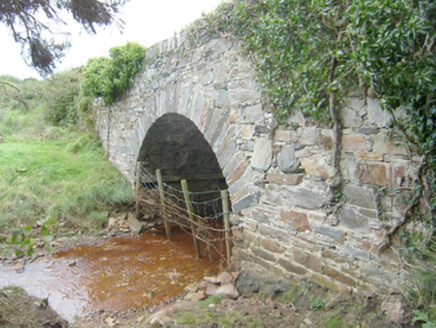
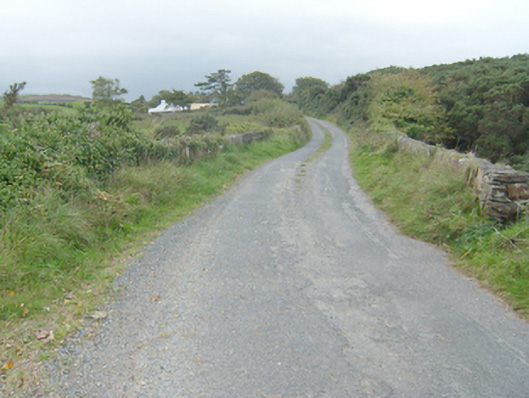
Single-arched bridge carrying road over Owenwee River, built c. 1865. Segmental-headed arch with roughly dressed stone voussoirs; squared rubble stone construction to arch barrel with projecting cut stone stringcourse at arch-springing point. Randomly rubble stone construction to spandrels and abutments. Rubble stone construction to parapets with rubble stone soldier coursing over; modern cement repairs on places. voussoirs over. Tarmacadam deck with grass verges. Located in the rural countryside to the east\north-east of Carrickart, and to the west of Mulroy House.
Appraisal
This single but appealing single-arch bridge, dating to the second half of the nineteenth century, retains its original form and character, and is an appealing feature in the landscape to the east\north-east of Carrickart overlooking Tirloughan Bay to the north. It is robustly-constructed in local rubble stone masonry, and its continued survival and use stands as testament to the quality of its original construction, and of the skill of the masons involved. The single wide graceful arch with well-crafted voussoirs and the cut stone stringcourse at arch-springing point are features of some interest. This bridge replaced an earlier ford at the same location (Ordnance Survey first edition six-inch map of c. 1836). It carries an approach road to Mulroy House (see 40901712), and may have been made around the same time that the house was constructed in 1865-6. This unassuming rustic bridge is an addition to both the built heritage of the local area and to the extensive transport heritage of County Donegal.