


Survey Data
Reg No
40901737
Rating
Regional
Categories of Special Interest
Social
Previous Name
Fanad Church of Ireland Rectory
Original Use
Walled garden
Date
1790 - 1810
Coordinates
219967, 440412
Date Recorded
07/10/2010
Date Updated
--/--/--
Description
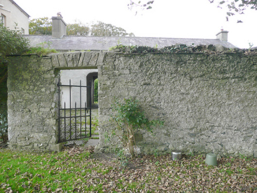
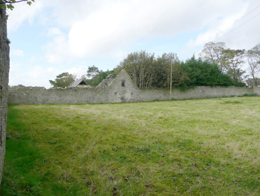
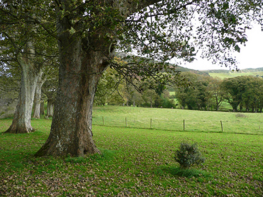
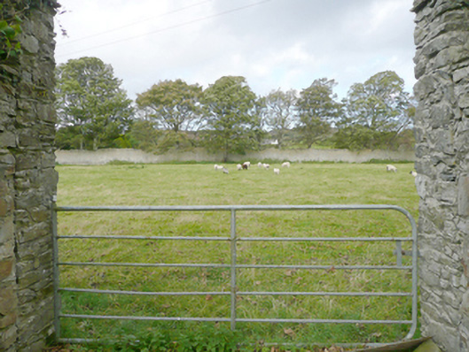
Walled garden (on square\rectangular-plan) associated with former Fanad Church of Ireland rectory (see 40901705), built\laid-out c. 1795. Now in use for agricultural use. Limestone rubble stone boundary walls (bonded with lime mortar) having remnants of lime render over, and with narrow cut stone coping course with rubble stone coping over. Square-headed entrance to the south-east corner having cut stone plinth blocks to base, stone voussoirs over, and with wrought-iron flat bar gate. Gateway to the south having rubble stone gate piers (on circular-plan) with stepped cut stone coping over surmounted by rubble stone, and having modern gate. Ruinous single-storey with attic level outbuilding built into the west boundary wall having remains of pitched natural slate roof (now partially collapsed), cut stone eaves course, roughcast lime rendered rubble stone walls, and square-headed openings, some now blocked, having red brick reveals, and with integral segmental-headed carriage-arch to the south elevation having roughly squared rubble stone voussoirs over. Located to the rear (north) of associated house, and to the north of Tamney to the south-west end of the Fanad Peninsula. Mature trees to interior of garden.
Appraisal
This small but intact former walled garden complex retains its early form and character, and adds significantly to the context and setting of the former Fanad Church of Ireland rectory (see 40901795) adjacent to the south. The imposing if utilitarian rubble stone boundary walls with remnants of roughcast lime render survive in relatively good condition. Much of the original slate-like cut stone coping also survives along large sections and illustrates the attention to detail afforded to the most utilitarian of features at the time of construction. The simple gateways add interesting, particularly the pedestrian entrance with wrought-iron flat bar gate. An early map of the site (Ordnance Survey first edition six-inch map of c. 1837) suggests that this walled garden was in use as a kitchen garden supplying produce for use in the rectory, while a number of mature trees survive to the north side, adding interest. Although relatively small in scale, this walled garden provides an interesting historical insight into the resources required to run and even a modest country estate in Ireland at the turn of the nineteenth century. This former walled garden adds context to the setting of the main house, acting as a reminder of a period when self-sufficiency was an integral part of a working estate, and is an addition to the built heritage of the local area.