


Survey Data
Reg No
40901245
Rating
Regional
Categories of Special Interest
Social, Technical
Original Use
Kiln
Date
1830 - 1870
Coordinates
259121, 446017
Date Recorded
25/09/2008
Date Updated
--/--/--
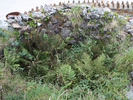
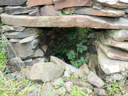
Description
Freestanding lime kiln, arranged on circular plan, erected c. 1850, comprising of dry random rubble stone walls, rounded to parapet. Square-headed opening to north with flat stone lintel. Flue largely filled-in and partially overgrown. Located to side of road, south of Carrowmenagh. Site bounded by modern rubble wall and circular gate piers.
Appraisal
The production and use of lime was an essential part of land improvement and management, as well as building construction. As such this kiln is a reminder of a once important part of farming practice in Ireland. Although no longer in working condition, it retains its form relatively well and it is still possible to interpret its function. It is marked and described on the Ordnance Survey twenty-five inch map series (1888-1913). An interesting addition to the vernacular heritage of County Donegal.