
Survey Data
Reg No
40901116
Rating
Regional
Categories of Special Interest
Architectural, Historical, Technical
Original Use
House
In Use As
House
Date
1780 - 1820
Coordinates
247830, 447514
Date Recorded
20/09/2008
Date Updated
--/--/--
Description
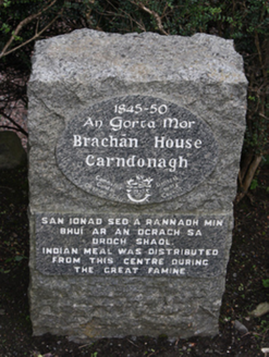
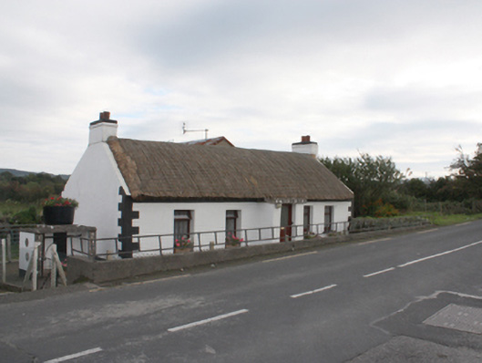
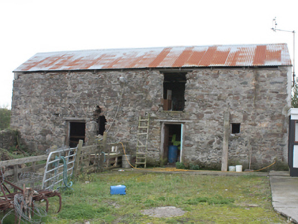
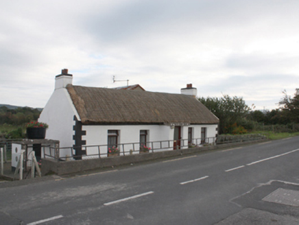
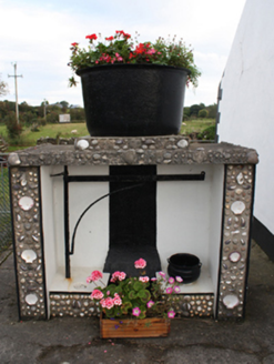
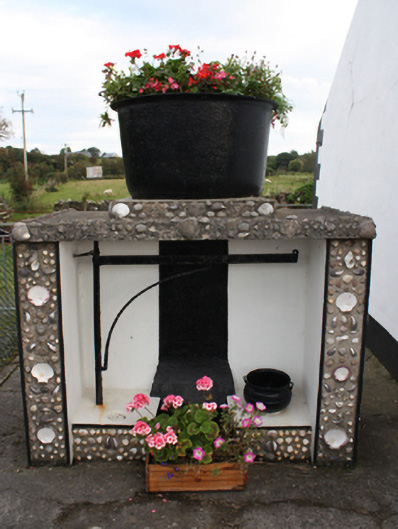
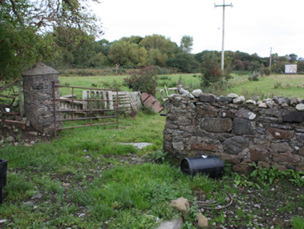
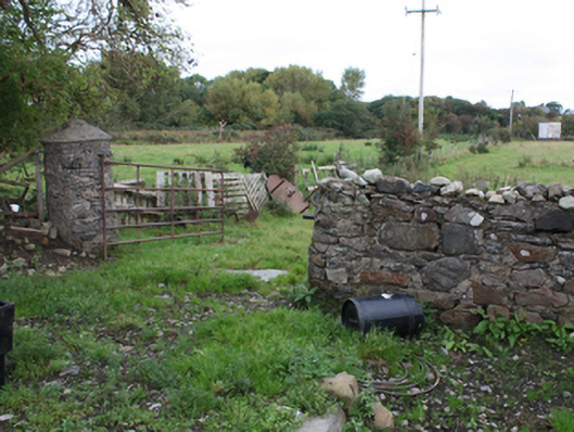
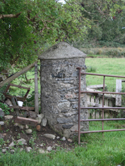
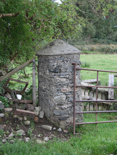
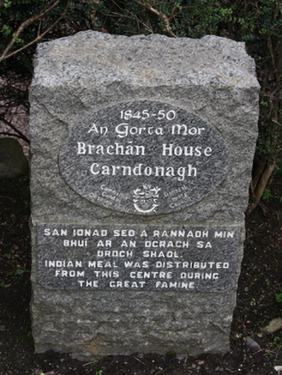
Detached five-bay single-storey thatched house, built c. 1800, with windbreak porch to front and open porch to rear. Rounded thatched roof with rope netting restraint metal rope stays to eaves, smooth rendered chimneystacks with stepped coping and terracotta pots to gables, rendered gable-coping, and flat concrete roof with shell-clad frieze to porch. smooth rendered walls with articulated block-and-start quoins, and smooth rendered plinth. Square-headed window openings with modern casement windows and painted sills. Square-headed door openings with replacement timber door. Four-bay two-storey outbuilding to rear comprising of random rubble walls and pitched corrugated-metal roof. Detached two-bay single-storey corrugated-metal-clad outbuilding to north-east. Brachan pot and hinge set in rendered-unit to north of house, with granite memorial. Rubble walls to rear with vernacular gate-piers on round plan. Set back from main road within own grounds to north of Carndonagh.
Appraisal
An attractive thatched house, which survives in fine condition. A good example of its type and a valuable addition to the vernacular heritage of the area. The rounded pitched roof, designed to minimise the impact of high winds, demonstrates a subtle adaptation of thatch roof construction, to accommodate local climatic conditions in exposed areas such as Inishowen. It is also of historical interest having served as a food distribution point during the Great Famine. Its continued use as a house and its surviving context including outbuildings and rubble walls and piers enhances greatly its appreciation. The house is shown on the Ordnance Survey first edition six-inch map of c. 1837.