

Survey Data
Reg No
40851009
Rating
Regional
Categories of Special Interest
Architectural, Technical
Original Use
Bridge
In Use As
Bridge
Date
1850 - 1880
Coordinates
181851, 358842
Date Recorded
01/01/2007
Date Updated
--/--/--
Description
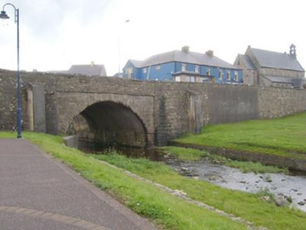
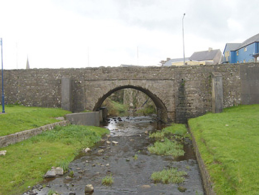
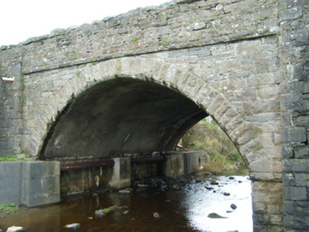
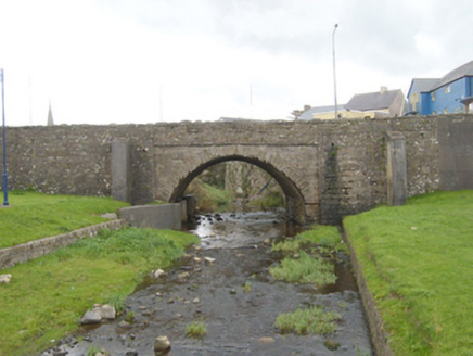
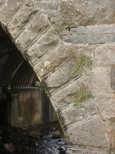
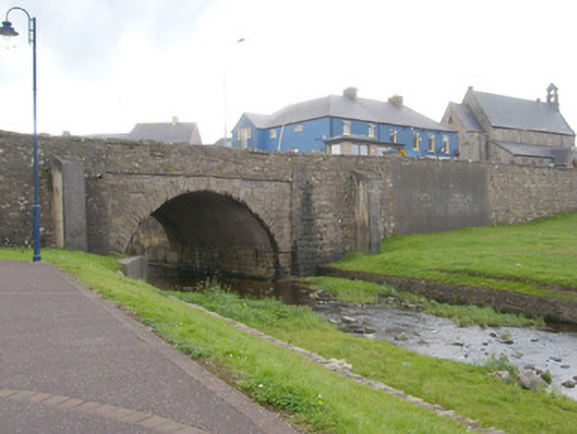
Single-arch road bridge, built c. 1860, carrying road over the Bradoge River. Widened to south-east elevation c. 1980. Possibly incorporating the fabric of an earlier bridge to site (Ordnance Survey first edition six-inch map c. 1836). Segmental-headed arch to north-west elevation with rock-faced sandstone voussoirs to arch having dressed margins. Arch flanking by rubble stone buttresses to either side (to north-west elevation) having roughly dressed quoins to corners. Coursed squared rubble stone masonry to spandrel walls, abutments and to parapets. Projecting rock-faced stringcourse at arch springing points, running under arch barrel. Cement rendered finish to arch barrel. Rock-faced coping to north-west parapet; projecting rock-faced stringcourse at road deck level to the north-west elevation. Rubble stone wing walls to either side of north-west elevation (north-east and south-west) having rock-faced coping over. Random rubble sandstone to modern south elevation extension with stone coping to parapets and stone coping over retaining walls. Located to the south-west end of the Main Street, Bundoran, close to where the Bradoge River flows into Donegal Bay.
Appraisal
A robustly-built small-scale bridge, of mid nineteenth-century appearance, which is a pleasing feature in the streetscape to the south-west of Bundoran town centre. Its integrity has been compromised by the extension to the south-east elevation, which was applied with minimal respect to the original structure. However, the north-west elevation retains it original aspect and form. The form of the north-west elevation suggests that it was built during the mid-to-late nineteenth-century, and the present bridge replaced an earlier triple-arch bridge with cutwaters at this location (Ordnance Survey first edition six-inch map c. 1836). The rock-faced masonry used in the construction (voussoirs, coping to parapets and stringcourses) is a typical feature of the many bridges constructed throughout Ireland by the Board of Works during the mid-to-late nineteenth century, and particularly between c. 1847 - 60, suggesting that they may have been responsible for its construction. This bridge is an integral element of the built heritage of Bundoran, and the civil engineering and transport heritage of south County Donegal.