


Survey Data
Reg No
40850001
Rating
Regional
Categories of Special Interest
Architectural, Historical, Technical
Previous Name
Ardnaglass Corn and Saw Mill
Original Use
Mill (water)
Historical Use
Mill (water)
Date
1810 - 1870
Coordinates
210875, 367181
Date Recorded
31/10/2007
Date Updated
--/--/--
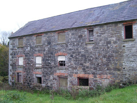
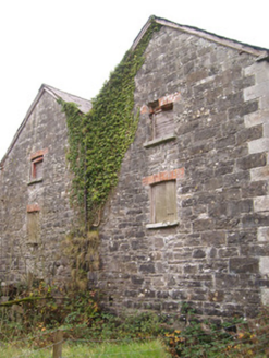
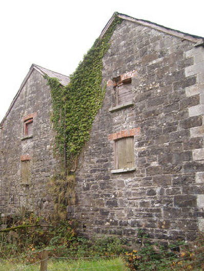
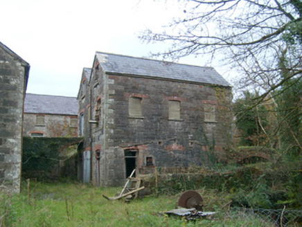
Description
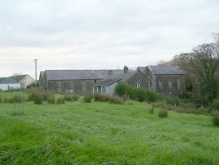
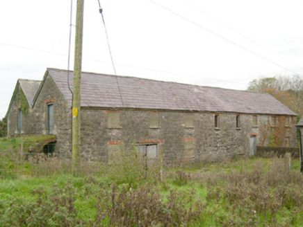
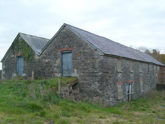
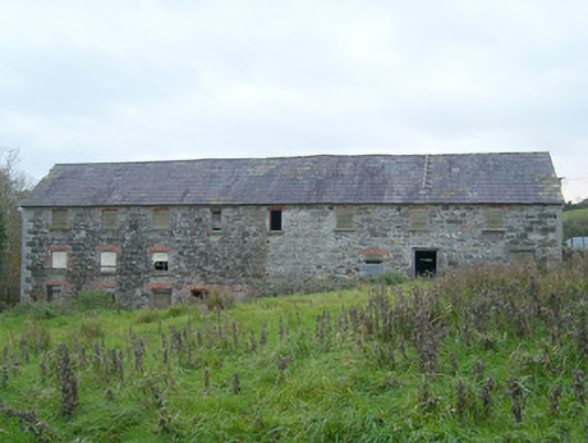
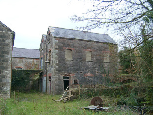
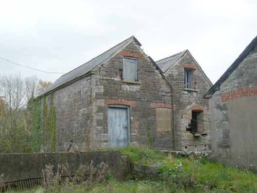
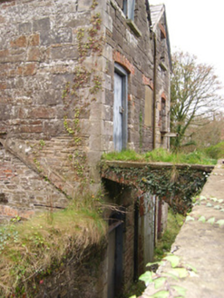
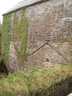
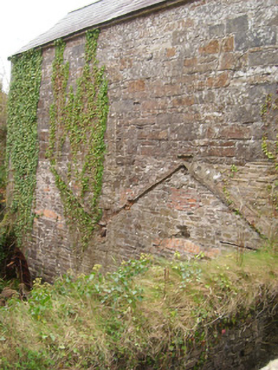
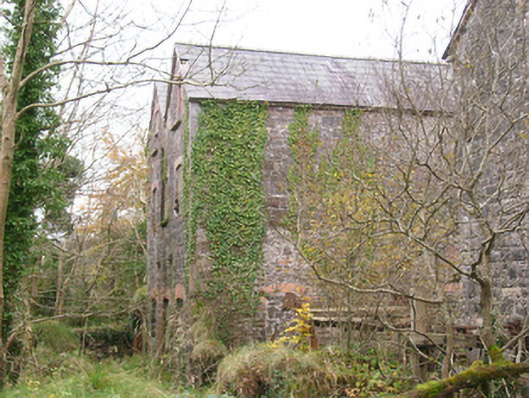
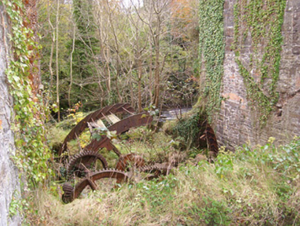
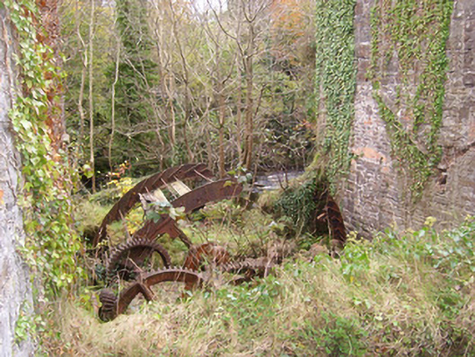
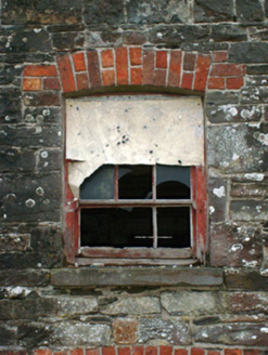
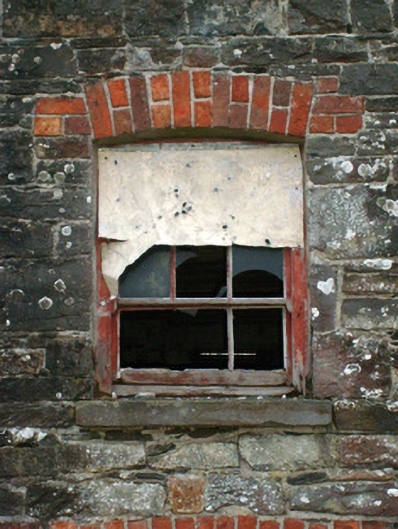
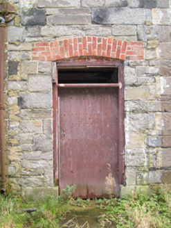
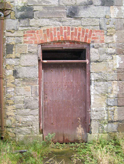
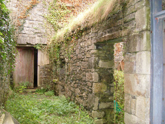
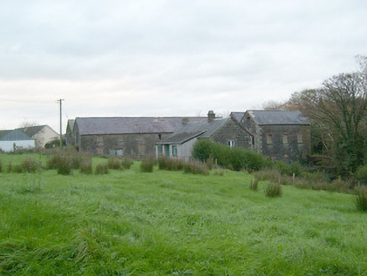
Complex of former corn and saw mill buildings, built c. 1820 and extended in 1851, comprising main eight-bay two- and storey building to building to the north and three-bay three-storey building to the south. Later also in use as a power generation station c. 1930 – 1962. Now out of use. Possibly incorporating fabric from earlier corn mill to site in existence in 1756. Brick and stone bridge over basement level to north-east elevation of main building, giving access to entrances to upper storey. Cut stone and brick bridge over basement level to three-storey building to the south. Remains of iron mill wheel with timber paddles and associated machinery to south-east corner of main building; mill wheel set in wheel pit with rubble stone retaining walls. Pitched natural slate roofs with clay ridge tile, projecting stone eaves courses, and some remaining sections of cast-iron rainwater goods. Coursed squared rubble stone walls having flush ashlar block-and-start quoins to the corners. Shallow segmental-headed windows having stone sills, red brick voussoirs and with remains of multi-pane timber sliding sash windows. Segmental-headed door openings having red brick voussoirs and remains of timber sheeted doors and double-doors. Cut stone surrounds and cut stone plinth blocks to a number of doorways. Set back from road in extensive grounds on the west bank of the Termon River. Site slopes from the west to the east towards the river. Located to the north of Pettigoe. Rubble stone walls and remains of buildings, now demolished, to site. Remains of former weir to the north-east of complex. Former offices (see 40850002 located adjacent to the south-west. Rubble stone boundary wall with rounded rock-faced coping over to road-frontage to the west and south-west. Gateways to the north and south ends of boundary wall comprising a pair of ashlar stone gate piers (on square-plan) having cut stone coping over with stone ball finials; wrought-iron flat bar gates.
Appraisal
This substantial former mill complex retains its early form and character despite being out of use for a number of decades. It is well-built using local rubble stone construction with good quality cut stone quoins to the corners, and its continued survival in good condition is testament to the quality of its original construction. Its integrity is enhanced by the retention of much of its early fabric, including timber sliding sash windows and natural slate roof, while the survival of some of the early machine provides an insight into past industrial processes and adds industrial archaeological merit to this interesting site. The contrast between the grey dimension stone and the red brick detailing creates some visual interest to the elevations of these functional utilitarian buildings. This mill complex is of social historical interest to the local community as a significant employer during the nineteenth-century. A possibly terrace of former mill worker’s houses (not in survey) stands a short distance to the south-west of this complex. These buildings form a pair of related sites with the structure adjacent to the south-west (see 40850002), and are an important element of the built heritage and social history of the Pettigoe area. The boundary walls and the good-quality gateways, and the remains of the weir to the north-east, complete the context and add considerably to the setting. This mill was built by the Leslie family, the local landlords and proprietors of Pettigoe and surrounding areas from the mid-seventeenth to the mid-twentieth century. It is likely that the town of Pettigoe developed where it has on account of the mill and the waterpower potential of the Termon River. Apparently this mill at Pettigoe could operate all year round, which is unusual, due to a system of sluices established at three small lakes up stream (namely Lough Naeague, Lough Navarnog, and Lough Veenagrean) that were used to supply the supply of water into the river during dry periods. The exact date of original construction is not know but a mill stood on this site in 1756 and a much smaller corn mill building is indicated on a map of the area in 1836 (Ordnance Survey first edition six-inch map). The Leslie family (Sir John Leslie, 1st Baronet) later built a large flax mill at this site in 1851, possibly incorporating parts of this earlier building. The majority of the buildings to site probably date to this period. A saw mill was later established at this site during the late nineteenth century, and timber egg boxes were constructed to site amongst other produces. This mill was also used to generate electricity and it produced enough to power the village of Pettigoe during the 1930s. The mill was later purchased by the ESB in 1957 from the then owner, a Mr Shaw, who generated electricity to site into the 1960s before the mill closed.