


Survey Data
Reg No
40840033
Rating
Regional
Categories of Special Interest
Architectural, Technical
Original Use
Bridge
In Use As
Bridge
Date
1750 - 1770
Coordinates
226286, 394584
Date Recorded
08/04/2008
Date Updated
--/--/--
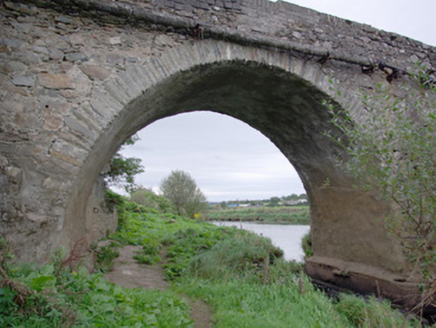
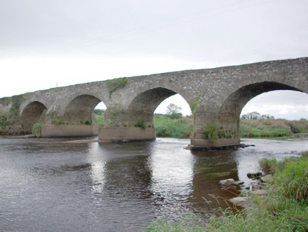
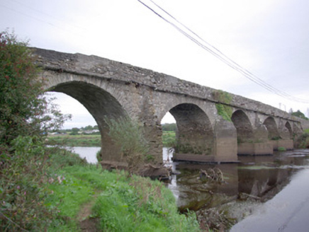
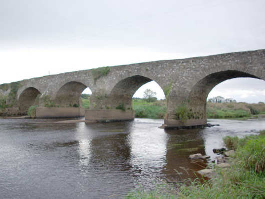
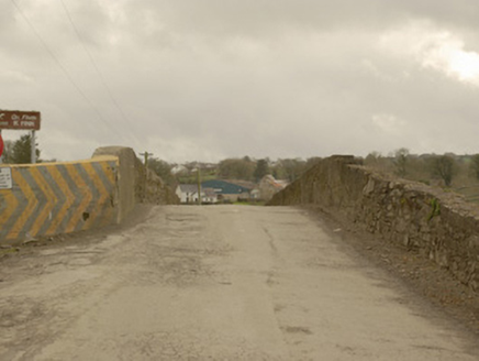
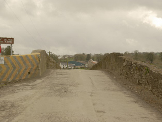
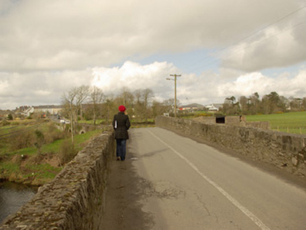
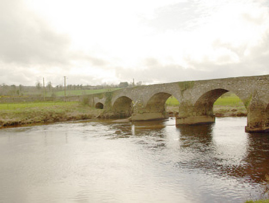
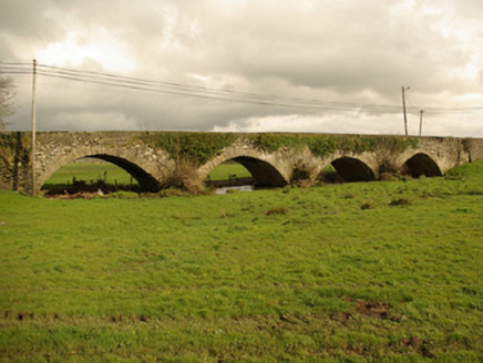
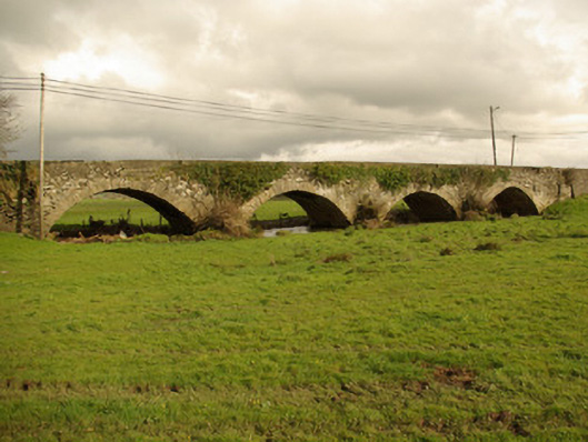
Description
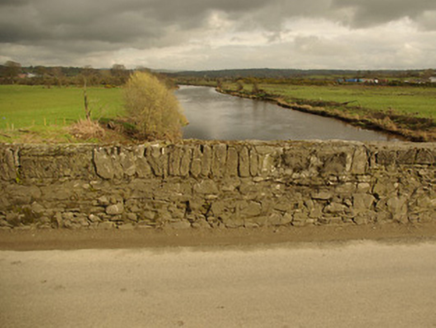
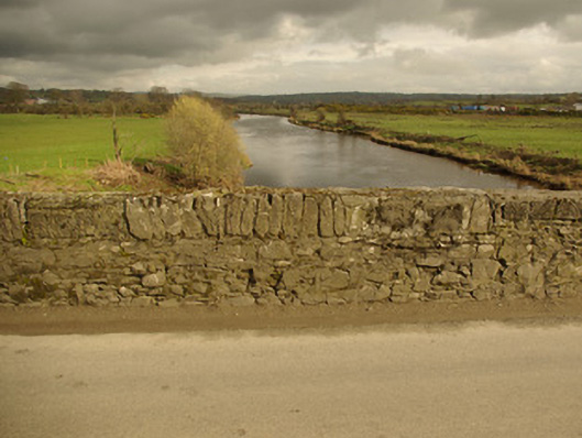
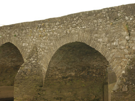
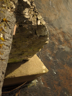
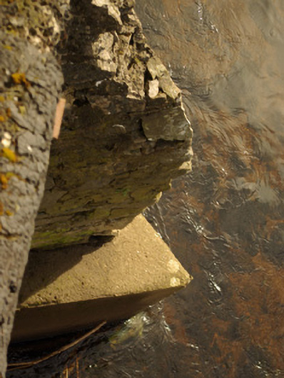
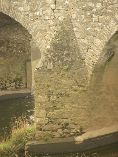
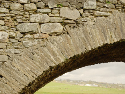
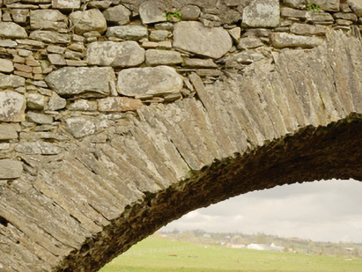
Ten-arch (or twelve-arch) bridge carrying road over the River Finn, built c. 1760, having five-arches to centre over river, four dry arches to the north end and single dry arch to the south. V-profile rubble stone cutwaters to central piers to both upstream and downstream elevations,; modern reinforced underpinning and repairs to central piers. Segmental-headed arches having rubble stone and dressed voussoirs and squared rubble stone construction to arch barrels. Rubble stone construction to spandrels, piers and abutments. Rubble stone parapets having modern repairs in places. Tarmacadam deck. Water pipe attached to the east elevation. Located in the countryside to the south of Castlefinn.
Appraisal
This impressive large-scale bridge retains its early character and form, and is an appealing feature in the rural landscape to the south of Castlefinn. It is robustly-constructed in good quality squared local rubble stone masonry, and its continued survival and use stands as testament to the quality of its original construction, and of the skill of the masons involved. The graceful wide arches to the central section over the River Finn demonstrate a sophisticated level of design and engineering. The relatively narrow plan, rubble stone construction, and the V-shaped cutwaters to the central piers are all indicative of its relatively early date. This bridge originally dates to the late-eighteenth century, a period that saw a great deal of road and bridge-building in Ireland, particularly by the Grand Juries (the forerunners of the County Councils) - a bridge is depicted here on the Taylor and Skinner map of the area from 1777 – 1883, though not on Moll’s map dated 1714, which suggests that it dates to between these dates. According to the Ordnance Survey Memoirs of 1836 Castlefinn Bridge ‘…at the entrance of that town from Castlederg, is a structure of 6 water arches and 6 land ones… It was built by a Mr Mason and cost about 900 pounds, raised by assessment from the county, and was built at so little cost on account of the stones being procured from the ruins of a castle [DG079-023001- site to the north-west side of bridge, associated with the O’Donnell’s] which stood close to the place. A large corn store and quay for loading and unloading boats have been built at the bridge by Dr Rogan of Londonderry, who is the principal proprietor of Castlefin. 4 boats are usually employed’. This bridge apparently originally had twelve-arches (see above) although only ten are visible today due to build up of the land to the north end adjacent to the river. There is a record of repairs in 1774 costing £47, which indicates that the bridge dates to before this time. This bridge probably replaced an earlier ford to site or close to site, hence a presence of the site of a castle to the north side, and there was a ferry here in the seventeenth century. This bridge is one of a number of fine bridges over the River Finn, and is an important element of the built heritage and transport history of County Donegal.