


Survey Data
Reg No
40839021
Rating
Regional
Categories of Special Interest
Architectural, Technical
Original Use
Bridge
In Use As
Bridge
Date
1760 - 1830
Coordinates
219932, 393123
Date Recorded
02/04/2008
Date Updated
--/--/--
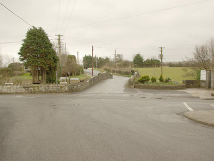
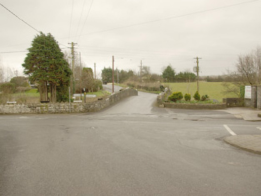
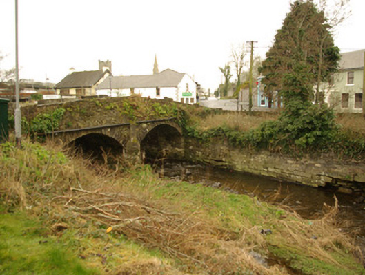
Description
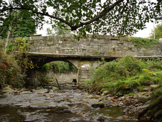
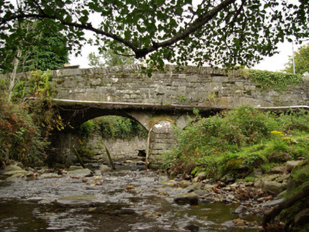
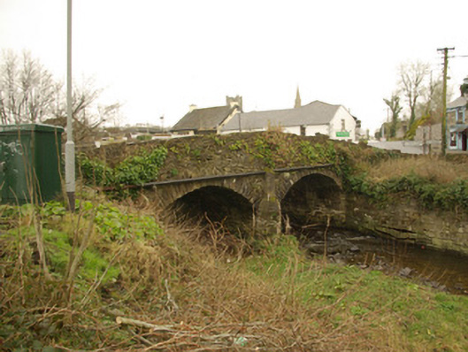
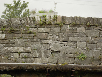
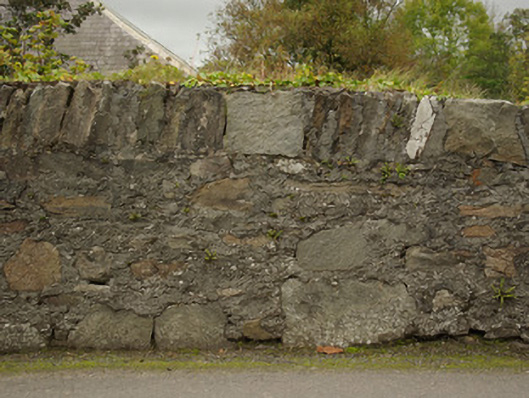
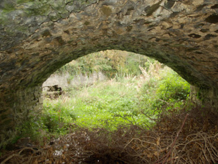
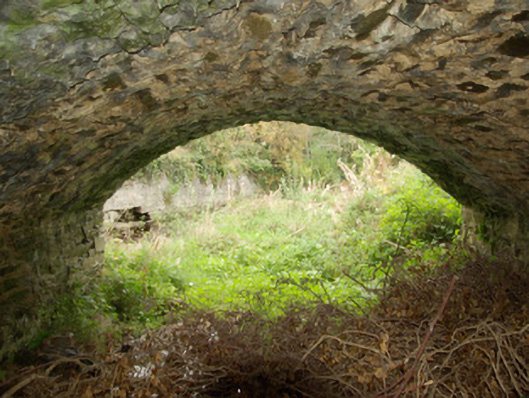
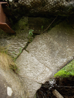
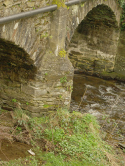
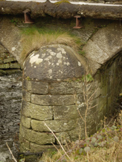
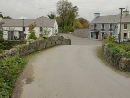
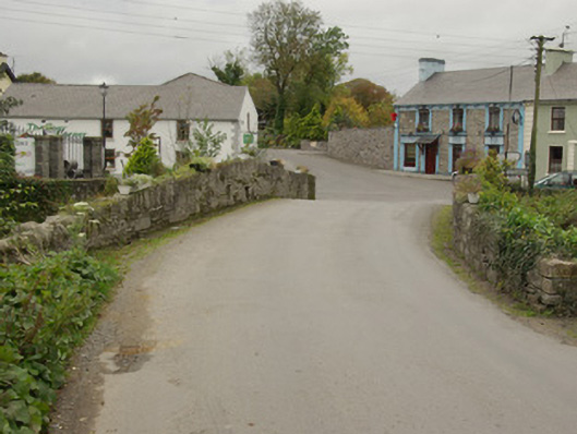
Double-arched bridge carrying road over unnamed stream/tributary flowing into the River Finn to the north-west, built c. 1770 and altered c. 1830, having V-profile rubble stone cutwater to the central pier to the north-east elevation and semi-circular cut stone cutwater to central pier to the south-west elevation. Bridge rises from either end to centre creating slightly hump-backed from. Segmental-headed arches having dressed cut stone voussoirs to the south-west) elevation and rubble stone voussoirs to the north-east elevation; rubblestone construction to the arch barrel. Random rubble stone construction to pier, spandrels, and parapets to the north-east elevation with rubble stone coping over parapet; squared and roughly coursed rubble stone construction to the south-west elevation having rubble stone and soldier coursed stone coping over. Utility pipes to either side elevation. Tarmacadam deck. Squared rubble stone embankment to northeast of bridge at site of former police\RIC barracks. Located to the east end of Crossroads, adjacent to road junction, and to the south-west of Killygordon.
Appraisal
This simple but appealing double-arched road bridge retains much its early character and form, and is an appealing feature in the streetscape to the east end of the village of Crossroad. This bridge is robustly-constructed in local rubble stone masonry, and its continued survival and use stands as testament to the quality of its original construction, and of the skill of the masons involved. The slightly hump-backed form of this bridge, and the form of the arches, suggests that this bridge may date to the second half of the eighteenth century, a period that witnessed a large expansion in the rural road network in Ireland - and the subsequent building of numerous bridges - which was mainly carried out by the Grand Juries (the forerunners of the County Councils). The semi-circular cutwater to the south-west elevation is an interesting and well-built feature that contrasts with the more unrefined V-profile rubble stone cutwater to the north-east. This, and different treatment of the stonework to the north-east and south-west elevations, strongly suggests that this bridge was altered and probably widened at some stage, probably to the south-west elevation, and perhaps during the first decades of the nineteenth century. This appealing bridge is an integral element of the built heritage and transport heritage of the local area, and makes a positive contribution to the landscape.