

Survey Data
Reg No
40834010
Rating
Regional
Categories of Special Interest
Architectural, Technical
Original Use
Bridge
In Use As
Bridge
Date
1700 - 1780
Coordinates
230464, 399803
Date Recorded
19/01/2011
Date Updated
--/--/--
Description
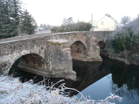
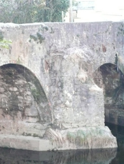
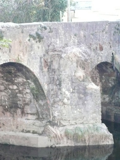
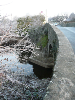
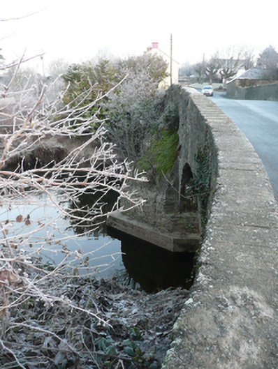
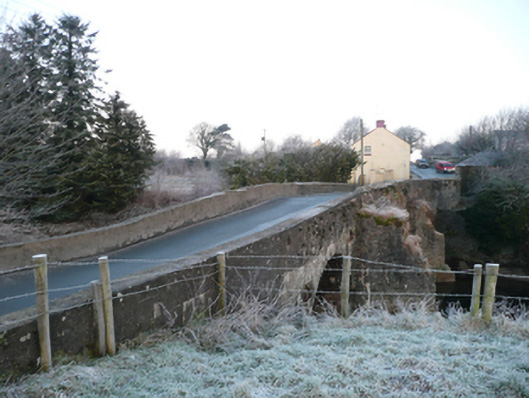
Triple-arch slightly humpbacked bridge carrying road over the Deele River, built c. 1740 and altered c. 1900, having partially rendered stepped V-profile rubble stone cutwaters to piers. Modern concrete underpinning to piers and cutwaters. Segmental-headed arches to south and north ends of bridge having rubble stone voussoirs, and rubble stone construction arch barrels. Round-headed arch to central pier having red brick voussoirs, c. 1900, and with rubble stone construction to arch barrel. Rubble stone construction to piers, abutments, and spandrels having remains of render over. Cast-iron pattrice plate to the south end. Rubble stone parapets with rubble stone over parapet to central arch, and with cement coping elsewhere. Modern blockwork repairs to parapets in places. Rubble stone and modern wing walls to either end of parapets (north and south). Tarmacadam deck. Located to the south end of the village of Ballindrait.
Appraisal
This appealing triple-arch bridge retains its early character and form, despite some later modifications and repairs, and is an appealing feature in the landscape to the south end of Ballindrait. It is robustly-constructed in local rubble stone masonry, and its continued survival and use stands as testament to the quality of its original construction, and of the skill of the masons involved. The unrefined rubble stone construction creates rather a picturesque and rustic appearance. The form of the arches to either end of the bridge, the slightly humpbacked form, the pronounced stepped rubble stone cutwaters and the relatively narrow plan all suggest that this bridge is of considerable antiquity, perhaps dating to the first half of the eighteenth century, or perhaps earlier. The red brick voussoirs to the east side of the central arch suggests that this was rebuilt during the late-nineteenth or early-twentieth century. The varied construction along the parapets and to the spandrels indicates that this bridge was modified over the centuries. This bridge gives its name to the town of Ballindrait (Baile an Droicheaid - the town or place of the bridge), and there may have been a bridge here by the start of the seventeenth century at the latest. According to local tradition, Rory O'Donnell, Chief of Tirconnaill, and O'Neill, Earl of Tyrone, met at the bridge at Ballindrait on their way to Rathmullan to join there extended families and other noblemen of Ulster in the Flight of the Earls on September 14th 1607. A bridge is indicated somewhere in this vicinity on the Down Survey map of Raphoe from 1654-6 when it was called 'Bolerskens(?) Bridg' A bridge is depicted here on Moll’s map of Ireland from 1714 while the town is indicated as Ballindrait; this suggests that this was the site of a bridge for a considerable period by this date. It is unclear if this is the bridge depicted on the map, however. The bridge is also indicated on the Taylor and Skinner map of the area from 1777-83. The Ordnance Survey first edition map of c. 1837 shows a five-arch(?) bridge over the Deele at this point; whether the bridge was altered after this or the depiction on the map is inaccurate is difficult to ascertain. This bridge was likely built or upgraded by the Grand Juries who carried out many improvements to the road infrastructure throughout Ireland in the latter part of the eighteenth century. This appealing bridge is an integral element of the built heritage and transport heritage of the local area, and makes a positive contribution to the landscape.