


Survey Data
Reg No
40833028
Rating
Regional
Categories of Special Interest
Architectural, Social
Original Use
House
Historical Use
School
In Use As
House
Date
1820 - 1860
Coordinates
225762, 403116
Date Recorded
12/01/2011
Date Updated
--/--/--
Description
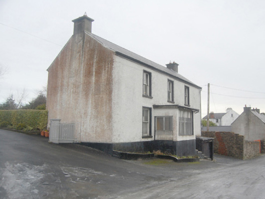
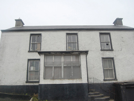
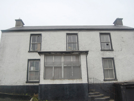
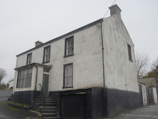
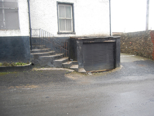
Detached three-bay two-storey former house and\or school over basement level, built c. 1830, having central flat-roofed single-bay single-storey enclosed porch to front (south-west), single-bay single-storey flat-roofed store at basement level to the south-east end of the front elevation, and modern extensions to the rear (north-east). Later in use as a school (c. 1860, perhaps earlier) and then probably later in use as a commercial premises, now out of use. Pitched artificial slate roof (fibre cement) with projecting eaves course, cast-iron rainwater goods, and with smooth rendered chimneystacks to the gable ends (north-west and south-east). Roughcast rendered walls over projecting smooth rendered basement\plinth level. Square-headed window openings to main body of building have smooth rendered reveals, painted sills, and two-over-two pane timber sliding sash windows. Square-headed window openings to front face of porch having timber casement windows. Square-headed doorway to the south-east face of porch having modern door and overlight; doorway reached out flight of cement rendered steps. Single-bay single-storey flat-roofed store to the south-east end of the front elevation (partially sunken) having modern metal shutter door. Various modern additions to the rear (north-east). Set slightly back from road in own grounds with enclosed yard to rear (north-east) with detached too-bay single-storey outbuilding having roughcast rendered walls, corrugated-metal roof, and square-headed openings. Located to the north-west end of Close Lane to the north\north-east of the centre of Raphoe.
Appraisal
This simple two-storey building retains much of its early form and character despite some later alterations and currently (2013) being out of use. Its visual expression is enhanced by the retention of timber sliding sash windows. This building was formerly in use as a school during the mid-to-late nineteenth century (Valuation map of c. 1860). There were two schools located along Close Lane in Raphoe during the second half of the nineteenth century (a girls school and a Robertson school are recorded here in Slater’s Directories of 1881 and 1894). It is possible that this was originally a Robertson school are these are commonly of the two-storey form and originally generally had an external staircase giving access to a doorway at first floor level (possibly later removed here). A Robertson school is recorded in Raphoe in Lewis’ Topographical Dictionary of 1837 (location unknown). There are a number of surviving examples of this type of Robertson school still surviving in Donegal, albeit in altered form (examples can be seen in Killybegs and Tamney). Robertson schools are a building type particular to Donegal, and were built wholly or partially using funds bequeathed in the will of Colonel Robertson (died 1790), who stipulated that £15 be made payable to each parish in Donegal to fund the salary of a schoolmaster to ‘instruct children of all denominations’. Later this fund increased and this enabled the trustees to grant £40 per annum per parish for the erection of a school house. It is estimated that the fund supported upwards of a hundred schools in Donegal during the mid-nineteenth century. This building appears to have been converted to some commercial use sometime after c. 1905, and the porch dates to after this date. A later school was built a short distance to this building sometime during the second half of the nineteenth century (not on Valuation map of c. 1860 but on Ordnance Survey twenty-five inch map of 1904-5. This building appears to be still extant (not investigated). This simple building is an interesting addition to the built heritage and social history of Raphoe, and if sensitively restored would make a positive contribution to the streetscape to the north of the town centre.