


Survey Data
Reg No
40823073
Rating
Regional
Categories of Special Interest
Archaeological, Architectural, Artistic, Historical, Social
Previous Name
Tullyaughnish Old Church
Original Use
Church/chapel
Date
1610 - 1800
Coordinates
222687, 421008
Date Recorded
01/07/2014
Date Updated
--/--/--
Description
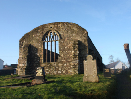
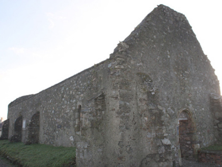
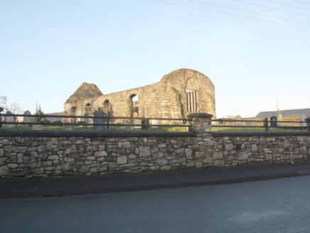
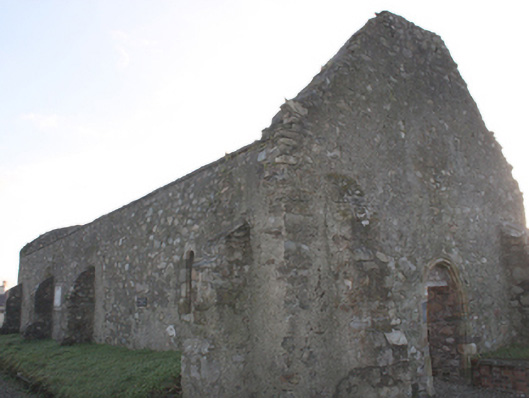
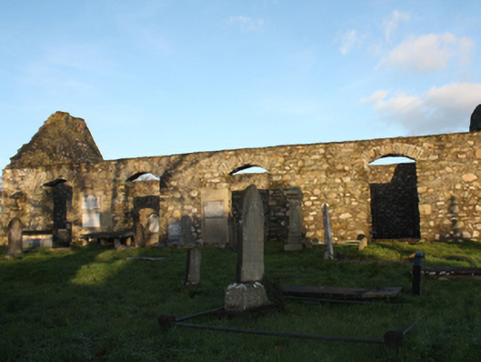
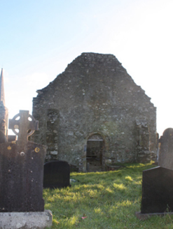
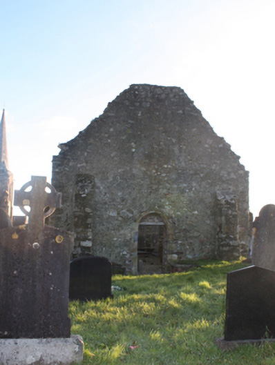
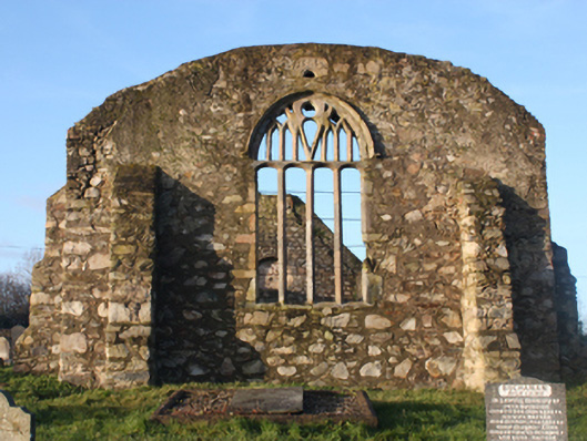
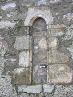
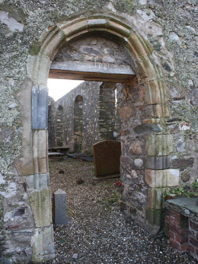
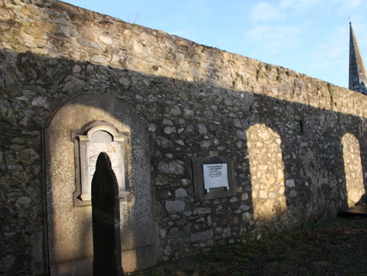
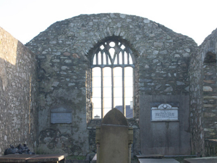
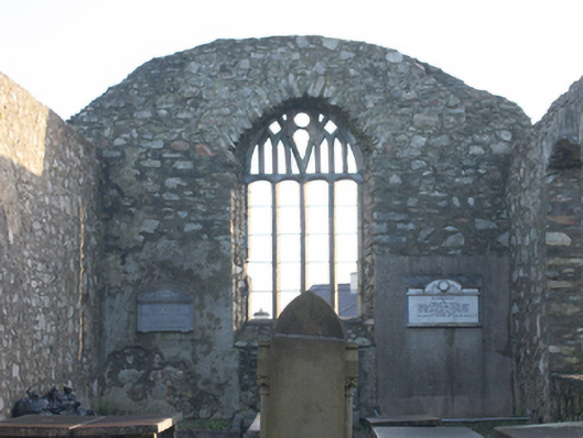
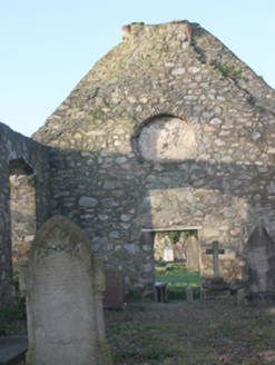
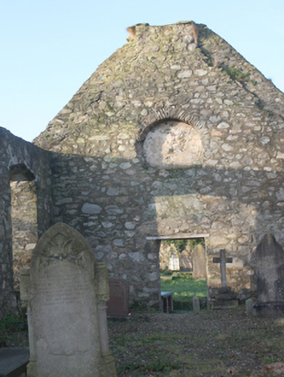
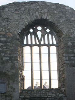
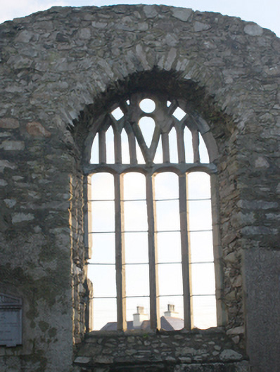
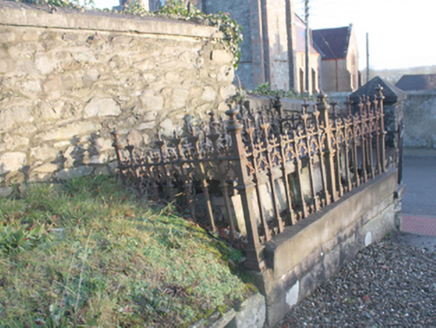
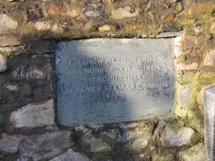
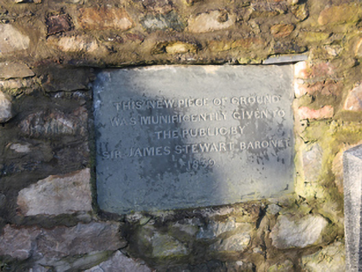
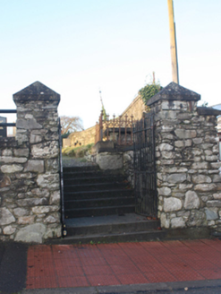
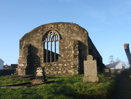
Freestanding single-cell hall-type former Church of Ireland church, built 1619-22. Remained in use until construction of later Church of Ireland church (see 40800505) to the south-west. Now out of use and derelict. Roof now removed\collapsed, formerly pitched with cut stone eaves course to the long elevations. Remains of lower section of a bellcote to the west gable end. Coursed rubble sandstone walls, partially roughcast rendered, with stepped clasping rubble stone buttresses to the corners and to the north elevation. Segmental headed window openings to the south elevation having rubble stone voussoirs; fittings now removed and openings now extended to ground level. Pointed four-light window to the chancel gable (east) having cut stone tracery, cut stone surround, and with cut stone hoodmoulding over; carved Romanesque architectural fragment (RMP DG046-005004-) from church on Aughnish Island c. 1150, incorporated over. Small pointed-arched window opening to the west end of the north elevation, now blocked, having moulded cut stone surround. Roundel opening over doorway to the west gable, now blocked. Round-headed doorway to the west gable having carved sandstone surround with roll moulding, and with modern lintel to head. Set back from road in own grounds to the south of the centre of Ramelton. Graveyard to site (RMP DG046-005006-) with collection of gravemarkers of upstanding, recumbent, and table types dating from the eighteenth century (and probably the seventeenth century) to recent times. Grave off the Stewart family of nearby Fort Stewart (see 40904601) located to the north-east corner of site having decorative cast-iron surround. Site surrounded by coursed rubble and rubble stone boundary walls. Modern railings over boundary wall to the east. Plaque to the east of site reading 'This new piece of ground was municifently given to the public by Sir James Stewart Baronet 1839.Gateway to the north-east corner of site comprising a pair of rubble stone gate piers (on square-plan) having pyramidal coping over, and with a pair of wrought-iron gates.
Appraisal
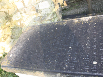
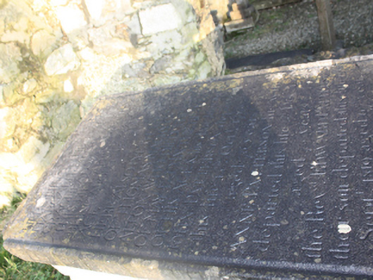
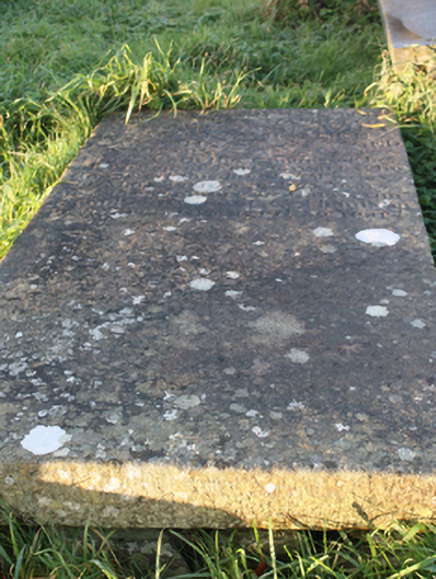
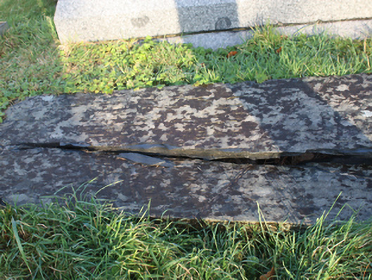
This substantial if plain early seventeenth-century church was originally built by Sir William Stewart who founded the town of Ramelton at the time of the Plantation. It was described as ‘almost completed’ at the time of Pynnar’s Survey of 1622. Its plain unadorned long single-cell form is typical of many Church of Ireland churches of its date. It remained in use as the Church of Ireland parish church until the construction of the new Church of Ireland church (see 40800505) a short distance to the south in 1822-6. It is likely that this older church was modified on a number of occasions from its originally construction until deconsecration. The north elevation appears to have been substantially rebuilt at some stage. It is constructed using local rubble stone masonry with the clasping rubble stone buttresses creating a robust composition. Of particular note is the very fine four-light window to the chancel gable (east) with intricate if rather thick Perpendicular Gothic tracery, and with a carved hoodmoulding over. The rather jumbled tracery to the head of the window is the result of the reuse of two fragments of tracery from a late Medieval church and, possibly, due to modern reconstruction. This window appears to have provided a stylistic inspiration for the window tracery at the fine First Ramelton Presbyterian Church (see 40800504) located adjacent to the east, built in 1906. The carved Romanesque architectural fragment over the east window was taken here from St. Columb’s Church on Aughnish Island. It dates to around 1150 and features a round-headed arch to the base with raised bead mouldings over with two beasts (lions?) with a tree between depicted over. The window with cut stone surround to the west end of the north elevation and the doorway with roll moulding to the west gable end add some additional interest; the fabric of these may have been reused. The graveyard RMP DG046-005006-) adds significantly to the setting and context of the church. This contains an interesting collection of gravemarkers of upstanding, recumbent, and table types dating from the eighteenth century to recent. The earliest legible gravemarker is dated ‘1712’ although there are likely to be seventeenth century memorials to site. The majority date to the nineteenth and twentieth centuries. Some of the graves have elaborate cast-iron enclosures, adding some decorative interest to the site. Also of interest the graves of the Stewart family of Fort Stewarts, the descendants of the founder of Ramelton at the start of the seventeenth century. This church is an important element of the built heritage and social history of the local area. The graveyard to site, the gateway to the north-east corner, and the rubble stone boundary walls all add to the setting and context.