


Survey Data
Reg No
40801014
Rating
Regional
Categories of Special Interest
Architectural, Technical
Original Use
Bridge
In Use As
Bridge
Date
1740 - 1780
Coordinates
246783, 450035
Date Recorded
11/10/2008
Date Updated
--/--/--
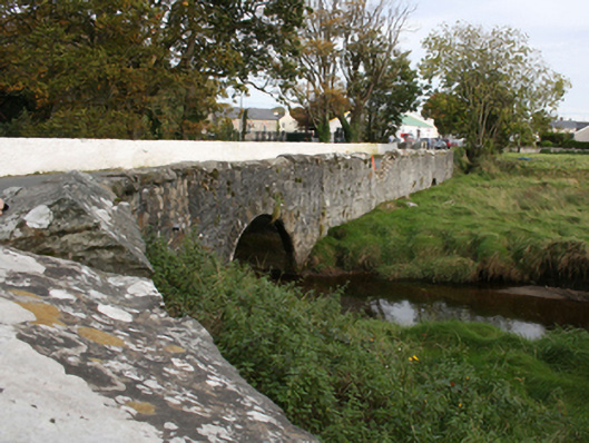
Description
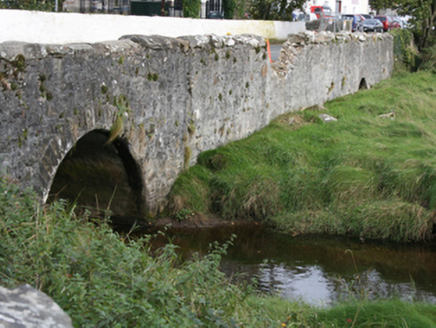
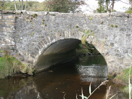
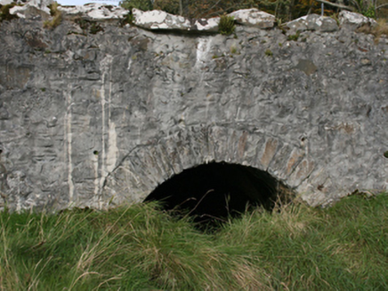
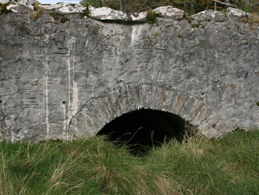
Single-arched bridge carrying road over small unnamed stream flowing into the estuary of the Ballyboe River, built c. 1760, with and causeway with small dry arch to the east. Segmental-headed arch with roughly dressed stone voussoirs; cement rendered lining to arch barrel. Rubble stone construction to spandrels and abutments. Rubble stone construction to parapets with large rubble stone coping over. Tarmacadam deck. Located a short distance to the west of the centre of Malin adjacent to the main entrance to Malin Hall (see 40801015).
Appraisal
This modest single-arch bridge retains its early form and character, and is a feature of some rustic appeal in the landscape to the west of the centre of Malin. It is robustly-constructed in local rubble stone masonry, and its continued survival and use stands as testament to the quality of its original construction, and of the skill of the masons involved. The large stone coping is an attractive feature that it shares with the much larger Malin Bridge (see 40801008) located a short distance to the south-east, which hints that these two bridges may have been built as part of a single project. The location of this bridge adjacent to the main entrance to Malin Hall (see 40801015) suggests that it may have been originally built c. 1758, the date when Malin Hall was built. This unassuming bridge is an addition to both the built heritage of the local area and to the extensive transport heritage of County Donegal. The causeway to the east with an overflow arch adds to the setting and context.