


Survey Data
Reg No
40801008
Rating
Regional
Categories of Special Interest
Architectural, Technical
Original Use
Bridge
In Use As
Bridge
Date
1740 - 1780
Coordinates
247041, 449917
Date Recorded
11/10/2008
Date Updated
--/--/--
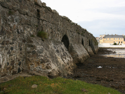
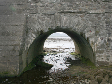
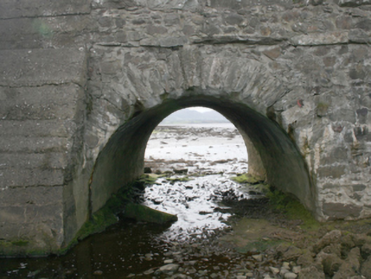
Description
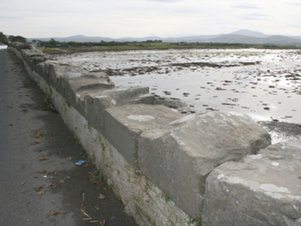
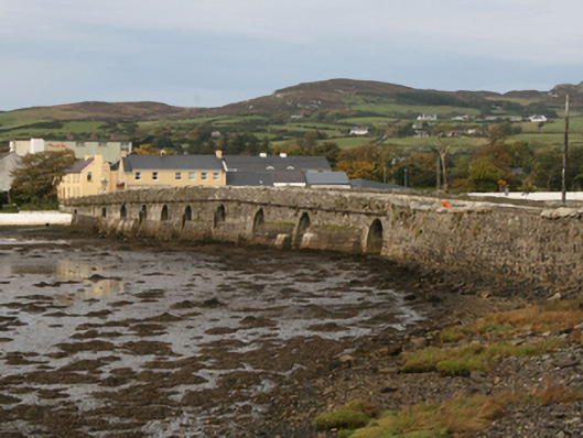
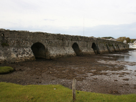
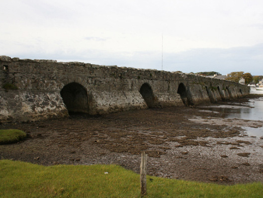
Ten-arch bridge carrying road over the Ballyboe River, erected, c. 1760. Possibly containing earlier fabric. Round-headed arches with squared rubble stone voussoirs and random rubble stone construction to arch barrels. Random rubble stone sloping buttresses to piers. Random rubble boulders to parapet walls with large rubble boulder coping stones over. Double carriageway with tarmacadam deck. Located to the south of Malin village. Located adjacent to the east of where the Ballyboe River discharges into Trawbreaga Bay.
Appraisal
An attractive and majestic bridge creates a particularly impressive entrance into the seventeenth century Plantation village of Malin. It is robustly-constructed in local rubble stone masonry, and its continued survival and use stands as testament to the quality of its original construction, and of the skill of the masons involved. The largely unrefined rubble stone construction, the slightly humpbacked form, the wide piers with buttresses, and the small round-headed arches all suggest that bridge is of considerable antiquity, perhaps dating to the mid-eighteenth century. It is possible that this bridge contains earlier fabric, though unlikely dating back as far as the establishment of Malin in the seventeenth century. It is possible that it may date to c. 1758, the date when Malin Hall (see 40801015) was originally built by George Harvey. The impressive stature and attractive form make this bridge an important part of the area’s architectural heritage, as well as a good example of a multiple-arch bridge of its date. It constitutes an integral part of the area's historic environment and complements its rural setting.