


Survey Data
Reg No
40800422
Rating
Regional
Categories of Special Interest
Architectural, Historical, Technical
Original Use
House
In Use As
House
Date
1820 - 1870
Coordinates
222924, 421205
Date Recorded
11/06/2014
Date Updated
--/--/--
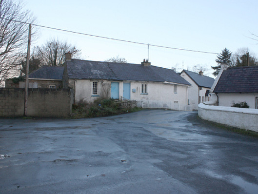
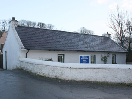
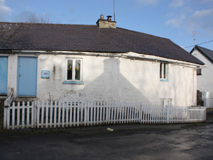
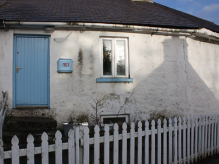
Description
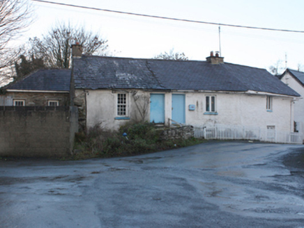
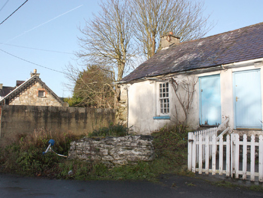
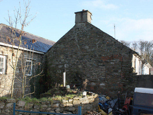
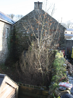
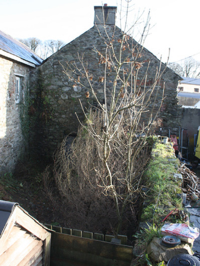
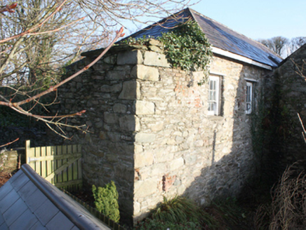
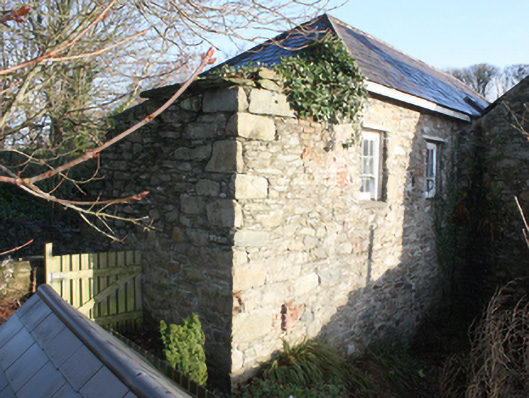
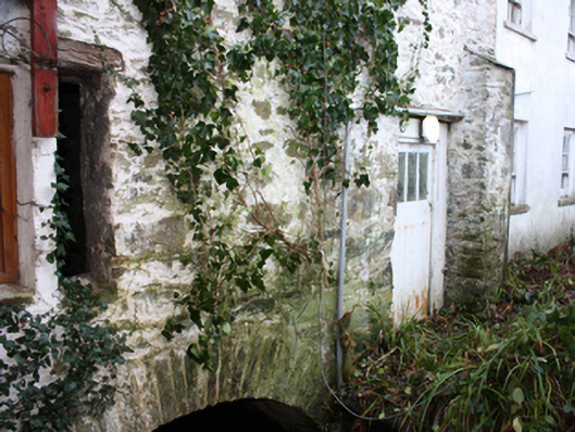
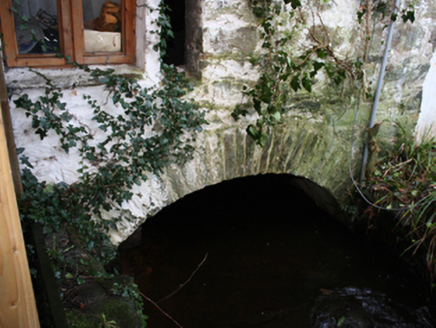
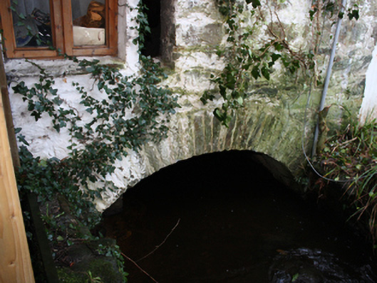
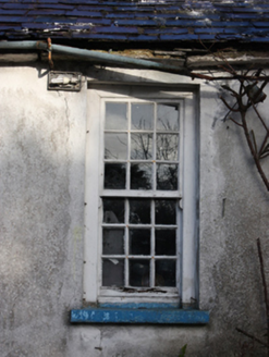
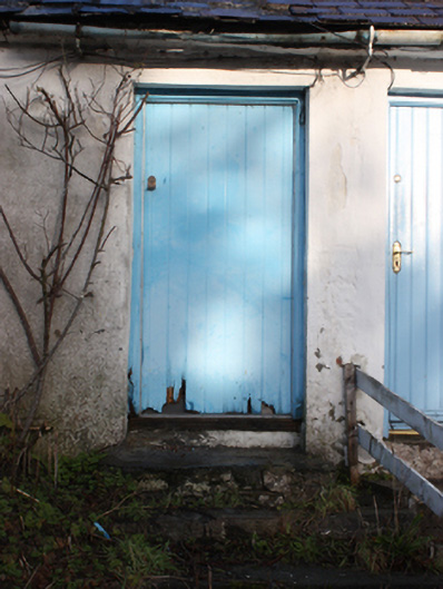
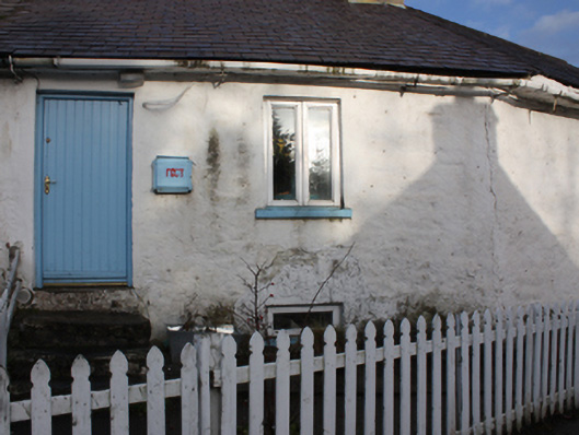
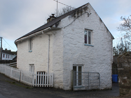
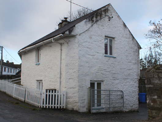
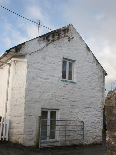
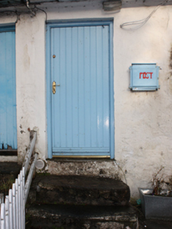
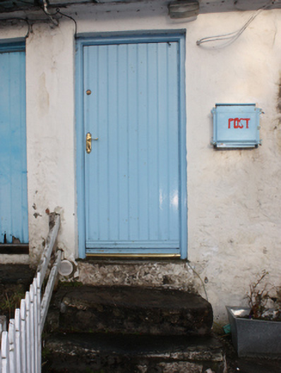
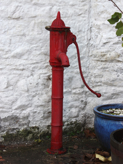
Pair of semi-detached two-storey over raised basement houses, built c. 1820 and reputedly containing fabric of corn mill to site built c. 1620, comprising a single-bay single-storey over basement building to the west (two-storey to rear elevation), and a two-bay two-storey building to the east having canted plan (between bays; following road alignment) and with chamfered corner to the south-east, and having five-bay two-storey block to the rear (north). Building to the west now out of use, building to the east and rear block now in use as a private house. Pitched natural slate roof to front section (south) having clay ridge tiles, two rendered chimneystacks (one to the west gable end and one over canted corner to the house to the east, projecting cut stone eaves course, and some surviving sections of cast-iron rainwater goods. Modern skylight to front pitch of house to the east; roof to section to the west now dilapidated. Hipped natural slate roof to block to the rear having projecting eaves course and surviving sections of cast-iron rainwater goods. Roughcast rendered rubble stone walls, exposed to the west gable end and to the north-west part of rear block having flush roughly squared quoins. Rubble stone buttress to the west end of rear elevation (north) of rear block. Narrow stone or slate sills to window openings to the east gable end of house to the east. Square-headed window openings to house to the west having nine-over-nine pane timber sliding sash window with exposed sash boxes; square-headed window openings to house to the east having replacement casement windows. Square-headed window openings to the west end of block to the west (to both the front and rear elevations) having six-over-three pane timber sliding sash windows with exposed sash boxes. Timber lintel to narrow open window opening\loop hole over millrace arch to the north elevation of block to rear. Square-headed doorways to the front elevation of both houses having battened timber doors (at ground floor and basement level to building to the west end). Surviving flights of stone steps to main entrances. Square-headed doorway to the rear of block to the north having replacement glazed timber door. Square-headed doorways to the east elevation of block to the rear and the rear (north) of house to the east having replacement French doors. Set slightly back from road in own grounds to the north-east of the centre of Ramelton. Timber picket fence to front of house to the east; remains of rubble stone wall to house to the west. Yard to the rear having cast-iron water pump to the rear of building to the east. Single-arched bridge over millrace\stream running under houses having rubble stone voussoirs to arch to the rear (north of rear block), rubble stone spandrels, and rubble stone construction to the arch barrel. Detached three-bay single-storey former miller's house (see 40823120) located across road to the south to the east bank of stream\millrace.
Appraisal
This complex composition retains its original form and character despite some modern alterations. Its integrity is enhanced by the retention of salient fabric such as the surviving sash windows with exposed sash boxes and the natural slate roof. The plan of this building, which follows the road alignment with a canted corner to the east, the unrefined rubble stone construction, and the irregular spacing of the openings, creates an appealing vernacular composition of some picturesque appeal. The modern alterations to the building to the east, although regrettable, fail to detract substantially form its visual appeal. According to local information this building(s) may contain the fabric of a corn mill that was established to serve Ramelton Castle (RMP DG046-005008-), which was built a short distance to the north-west (now demolished). This castle was built by 1619 by Sir William Stewart, who was granted extensive lands in this area at the time of the Plantation and subsequently established the town of Ramelton. However, it is not clear if this building and former mill on Pound Street is the site of this early mill, and the mill does not appear to be depicted on the Ordnance Survey first edition map of c. 1834. If this building does date to the early seventeenth century, it would be one of the oldest buildings Plantation town and an important element of the built heritage of Donegal. The early or earlier layout of this building is difficult to ascertain. The front section to the south may have been originally built as a mill and later converted for use as houses when a later block was constructed to the rear (north). Interestingly, the former millrace runs under the building exiting under a fine arch with stone voussoirs. The location of the mill wheel is not clear although the configuration of the site suggests that it was probably internal. This appealing and complex composition warrants closer inspection to ascertain its origins, and is an integral element of the built heritage of the Ramelton. The single-storey house (see 40823120) to the south was apparently formerly associated with this complex as a former miller’s house, and adds to the context and setting of this site. The cast-iron water pump to the rear, which was probably moved here from another location, completes this composition.