


Survey Data
Reg No
40800404
Rating
Regional
Categories of Special Interest
Architectural, Technical
Original Use
Quay/wharf
In Use As
Quay/wharf
Date
1760 - 1830
Coordinates
222406, 421113
Date Recorded
10/06/2014
Date Updated
--/--/--
Description
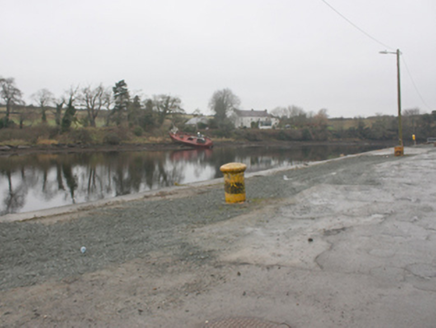
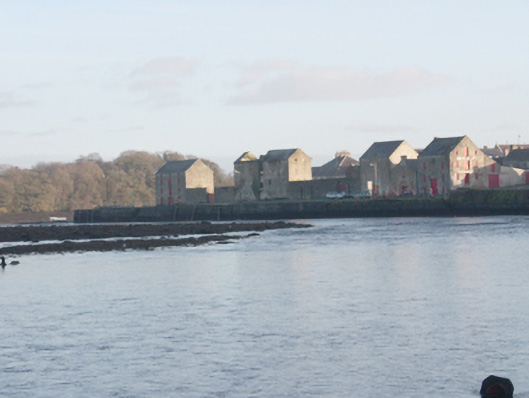
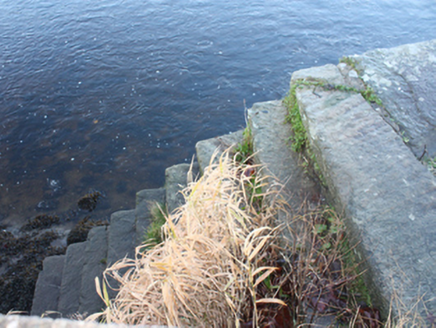
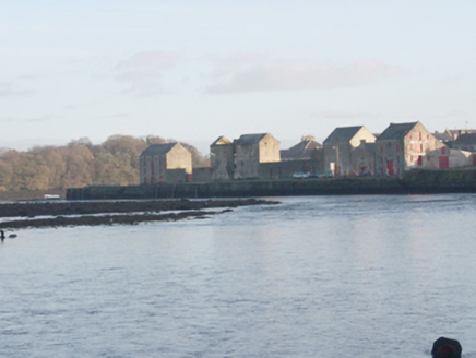
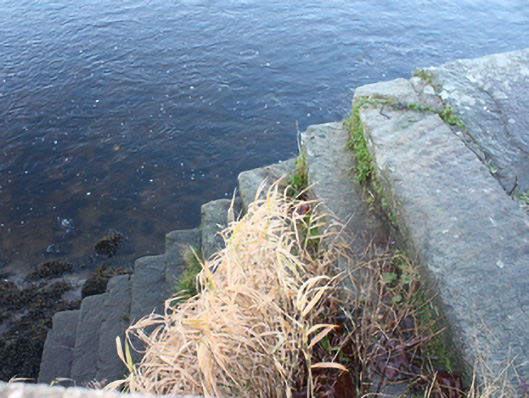
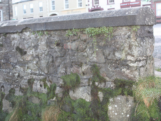
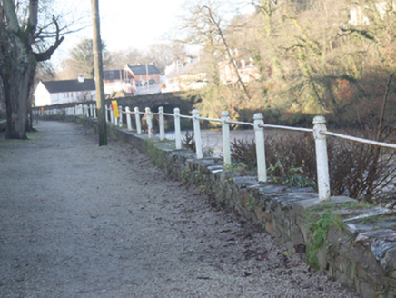
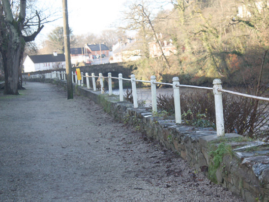
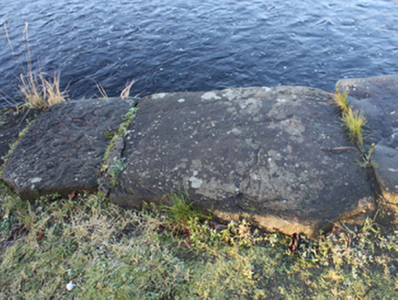
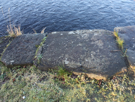
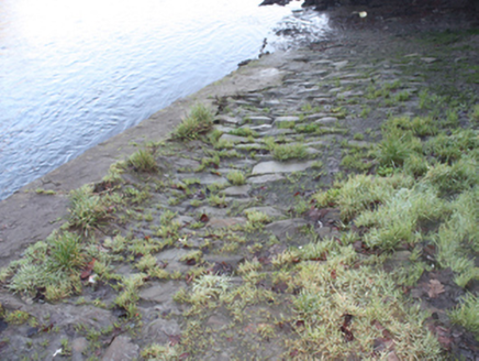
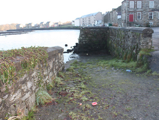
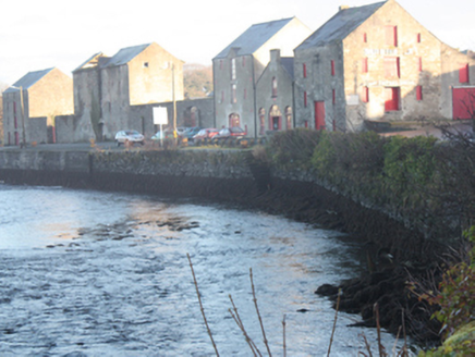
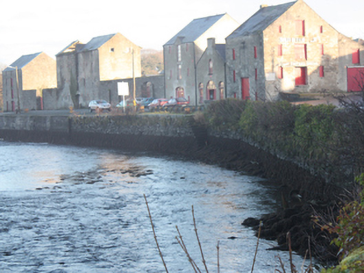
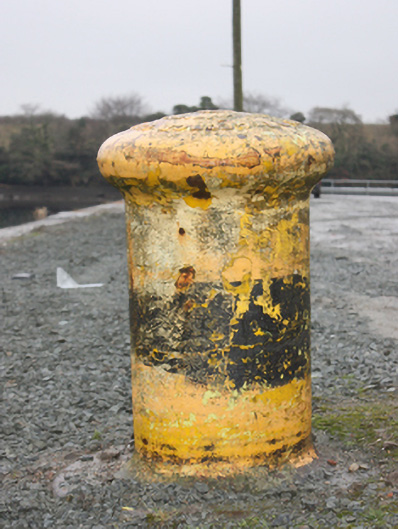
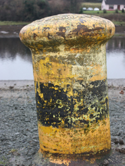
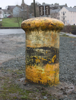
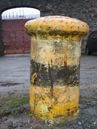
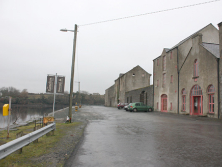
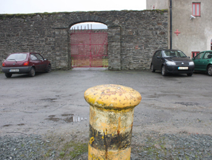
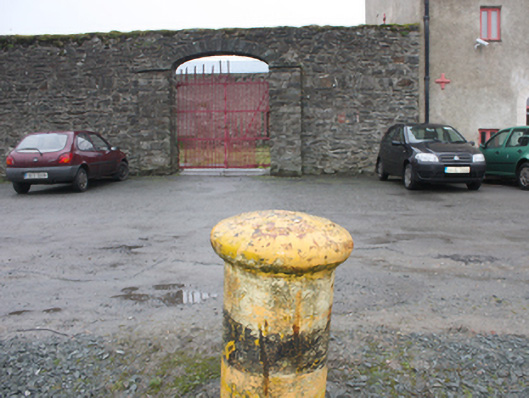
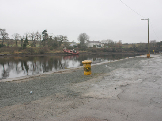
Two sections of quayside walling lining the southern bank of the Leannan River, built c. 1800 and c. 1860, comprising section to the west running from Rathmelton Bridge (see 40800206) to former fish packing warehouse (see 40800203) along the north side of The Mall and section to the north-east along Shore Road and Ramelton Quay, erected c. 1860. Quay walls constructed of rubble stone masonry, battered in places, with rendered coping over; some surviving sections of rubble sandstone coping\kerbing to edging. Low rubble stone plinth wall to edging over section to the west along The Mall having rubble stone coping, cast-iron posts, and wrought-iron railing over (railings and posts c. 1860); modern cement repairs in places. Surviving sections of rubble stone wall to the south aligning Mall; mature trees in places. Low rubble stone plinth wall to edging over section to the west along Shore Road having rendered coping over. No plinth walling to the north-east end of section to the north-east with rubble stone and rendered rubble stone coping\kerbing to waters’ edge; some modern concrete sections to quay. Flights of cut stone steps to the north-east section. Some surviving cut stone bollards (on circular-plan) to the north-east; cast-iron bollards (on circular plan) to the north-east having domed caps with foundry mark 'George Green & Co. Londonderry Engineers & Boiler Makers'. Slipway to the east side of former fish packing warehouse having rendered coping over sandstone kerbing to north edge, cobbled surface running down to water from the west to the east, and with rubble stone retaining walls to the south and the north-west corner having rendered bullnose coping over. Cast-iron weighing scales adjacent to the south of slipway having decorative spandrels. Rubble stone plinth wall with soldier coping over to section to the extreme north-east having modern concrete slipway to the west end with modern guard rails over; concrete quayside adjacent to the east. Located along the south bank of River Leannan to the west, north and north-east of the centre of Ramelton.
Appraisal
Ramelton's long attractive quay is now a local amenity, and serves as an historic reminder of the town’s industrial and maritime heyday during the late-eighteenth and nineteenth centuries. It is well-built using rubble stone (sandstone) masonry with some surviving sections of rubble stone kerbing. The various elements survive in relatively good condition despite some modern repairs. Interest is added by the flights of cut stone steps and the slipway to the north-east section while the elegant cast-iron posts with wrought-iron railings aligning the section to the west along The Mall dates to the period when this part of Ramelton provided a popular riverside promenade for the prosperous merchants and middle-class families of the town. The section to the north-east was added later; the quay is not depicted on the Griffith's Valuation map of c. 1857). Further interest is added by the surviving cut stone and cast-iron bollards to the north-east section; the cast-iron bollards were added c. 1870, and the foundry marks record that they were made at the George Green & Co. foundry, Londonderry. The survival of a cast-iron weighing scales (c. 1890) with decorative spandrels is an interesting feature that provides a further insight into the commercial and mercantile history of Ramelton. This quay was constructed during the eighteenth and nineteenth centuries and possibly contains fabric from an earlier quay or quays that were undoubtedly established when the town was established at the start of the seventeenth century. Ramelton prospered during the eighteenth and nineteenth century as a major port with trade with Britain, Norway, America, and the Caribbean, particularly important (there are accounts of ships from the Caribbean anchored in Lough Swilly and unloading exotic cargoes at Ramelton in exchange for linen, corn, meat and fish). Ramelton had the most important linen works in Donegal and many fortunes were made in the locality in its trade. The Watt family ran the largest linen works in the area by the start of the nineteenth century and were heavily involved in its trade (Samuel Watt moved to Jamaica in the early 1800s and began importing linen from Ramelton, with his brother James as agent). Corn was another major commodity in the area during the eighteenth and nineteenth centuries with a number of large mills still surviving in the area. The surviving warehouses, particularly aligned along the north-east end of the quay, attest to the level of trade and commerce in the Ramelton area. Slater’s Directory of 1846 records that ‘vessels of up to one hundred and fifty tons burthen can come up to the quayside [at Ramelton] at high water, and others, almost of any tonnage, can approach within half a mile of the town’. The construction of the quay to the north-east and many of the warehouses that align it c. 1860 indicates that mercantile trade was still important at Ramelton at this time. The town and port declined in importance towards the end of the nineteenth century, and the establishment of a railway line to nearby Letterkenny in 1909, with no rail link being built to Ramelton, hastened the decline. The quayside forms part of an important collection of structures relating to industry, mercantile commerce etc. at Ramelton, and now provides an attractive local amenity.