


Survey Data
Reg No
40800214
Rating
Regional
Categories of Special Interest
Architectural, Technical
Original Use
Store/warehouse
Historical Use
Factory
In Use As
Outbuilding
Date
1780 - 1840
Coordinates
222392, 421059
Date Recorded
09/06/2014
Date Updated
--/--/--
Description
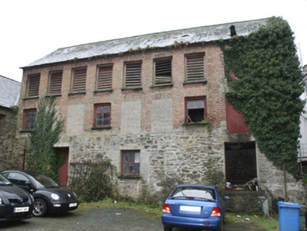
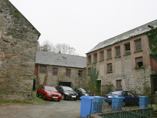
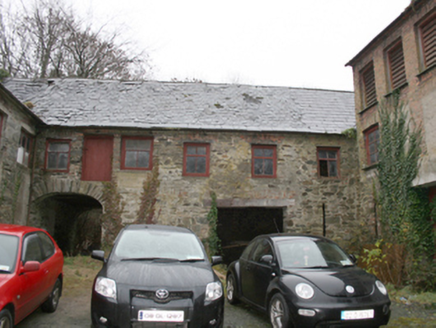
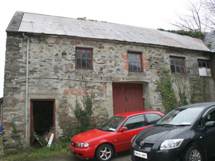
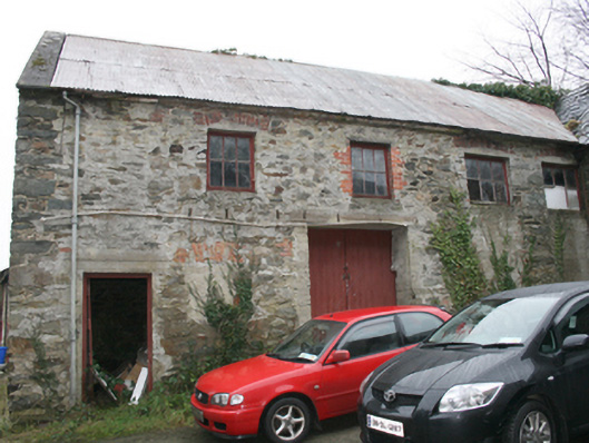
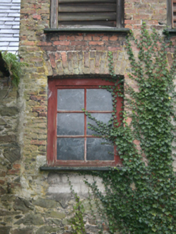
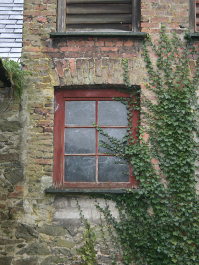
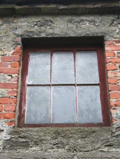
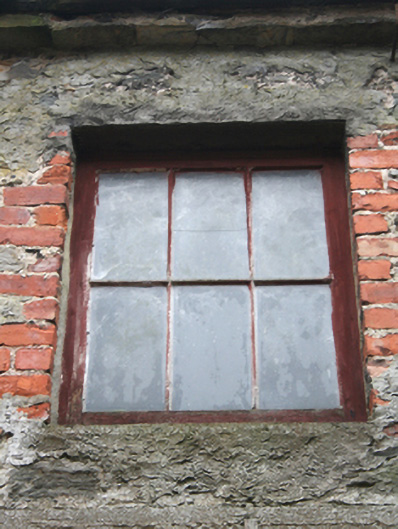
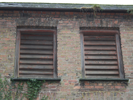
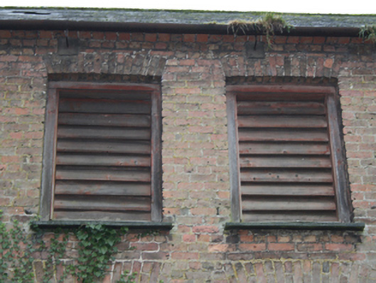
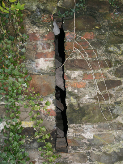
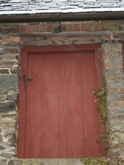
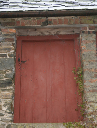
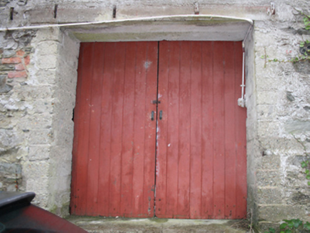
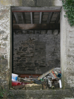
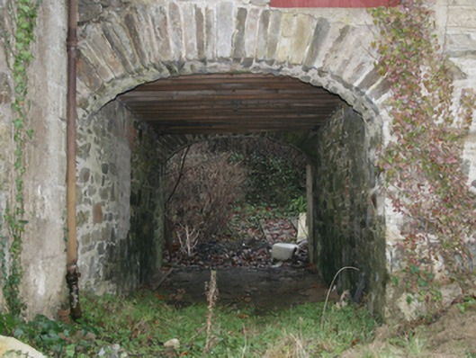
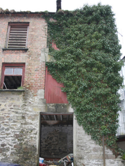
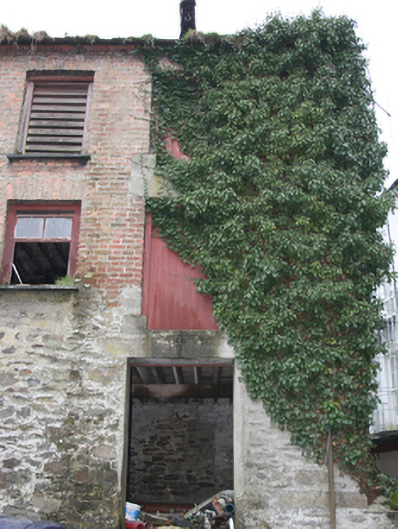
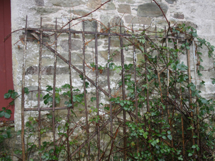
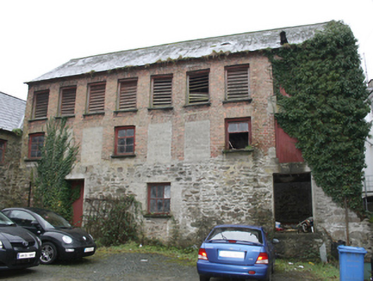
Complex of three multiple-bay two- and three-storey former warehouses on U-shaped plan, built c. 1820, and altered c. 1880, comprising six-bay two-storey range to the south, seven-bay three-storey range to the west, and four-bay two-storey range to the east. Later is use as a factory, c. 1900. Now disused\in use as outbuildings. Pitched natural slate roofs with grey clay ware ridge tiles to south and west ranges, pitched corrugated-metal roof to east range with cement rendered verge to the north gable end. Red brick eaves course to ranges to the south and to the west, cut stone eaves course to the range to the east. Timber beam\loading hoist to front pitch of roof over northern bay to range to the west. Some surviving sections of cast-iron rainwater goods. Partially rendered random rubble stone construction to blocks to the east and to the south with some roughly dressed quoins to the corners; random rubble stone construction to range to the west at ground floor level with red brick (English Garden Bond) construction over at first and second floor level (added c. 1900). Square-headed window openings to range to the east at first floor level having some red brick reveals, red brick relieving arches over, and with three-over-three pane fixed timber windows; ground floor window openings now blocked. Square-headed window openings to range to the south at first floor level having red brick revealing arches over, and with timber casement or fixed-pane windows; single loophole opening to the west end at ground floor level. Square-headed window openings to range to the west at ground floor level having three-over-three pane fixed timber window; square-headed window openings over at first floor level having red brick voussoirs and reveals, and with and with timber casement or fixed-pane windows, square-headed window openings over at second floor level having red brick voussoirs and reveals, and timber louvered fittings; single loophole opening to the south end at ground floor level. Some stone sills surviving to range to the west. Square-headed doorways and loading bays having battened timber doors; some doorways modified with concrete lintels over. Some window and door openings now blocked with modern blockwork. Segmental-headed carriage-arch to the east end of range to the south having rubble stone voussoirs to arch. Square-headed carriage-arch to the west end of range to the south having concrete lintel over; square-headed carriage-arch to the centre of range to the east having battened timber double doors with concrete lintel over. Set around courtyard with some remaining sections of cobbling. Some surviving wrought-iron gates to site. Set back from road to the rear (south) of buildings aligning The Mall, Ramelton. Entrance through shared carriage-arch between two three-storey buildings (see 40800213 and 40823026) from the Mall to the north.
Appraisal
This substantial complex of two- and three storey former warehouses\stores is a significantly element of the extensive industrial and maritime related heritage of the Ramelton area. Its integrity is enhanced by the retention of salient fabric such as the natural slate roof and timber fixed-pane windows. It is constructed in local rubble stone masonry, and its continued survival, albeit in a dilapidated condition, is testament to its robust construction. The three ranges have been altered over the years with many of the openings blocked etc., this is a feature of such industrial complexes that are adapted to meet new industrial needs over time. It was probably originally built during the late-eighteenth or early-nineteenth century as warehouses for the storage of corn and\or linen that were subsequently exported from the thriving port at Ramelton; both linen and corn were important commodities produced in the area at the time. The location of this complex to the rear of The Mall, a fashionable middle class residential area and promenade during the nineteenth century, suggests that it probably predates the laying out of this street and the construction of the many fine dwellings that align it. It is depicted on the 1836 Ordnance Survey six-map of the town. Entrance is through a carriage-arch between two substantial houses on The Mall to the north (see 40800213 and 40823026). The range to the west was substantial altered at a later date with the construction of two red brick storeys; the form of the brick etc. suggest that this took place during the last decades of the nineteenth century, perhaps c. 1880. According to local information these works were carried out to accommodate use as a factory (process unknown, there were a number of boot and shoe manufacturers at Ramelton in 1894 – Slater’s Directory). Although now dilapidated, this complex is an integral element of the extensive mercantile and industrial heritage, and forms part of an important collection of former warehouses in the town along with the impressive collection of mid-nineteenth buildings aligning the Quay to the north-east end of the town.