


Survey Data
Reg No
40401105
Rating
Regional
Categories of Special Interest
Architectural, Technical
Original Use
Bridge
In Use As
Bridge
Date
1860 - 1880
Coordinates
239746, 320335
Date Recorded
17/06/2012
Date Updated
--/--/--
Description
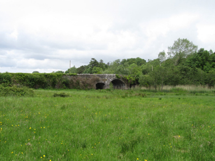
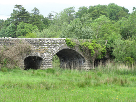
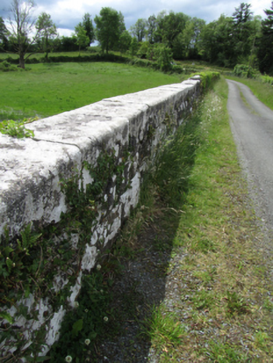
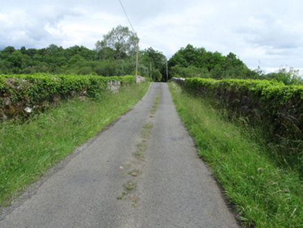
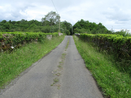
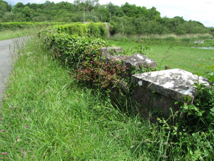
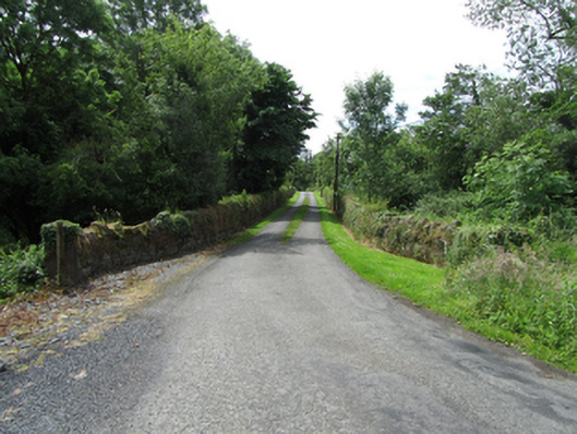
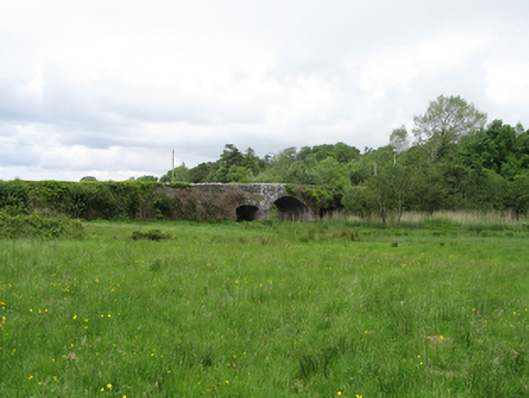
Triple-arch limestone road bridge, built c.1870, central arch flanked by narrower and lower arches supporting a narrow slightly humped deck. Rock-faced elevations, piers, and abutments of stone blocks in varying course heights. Elliptical arched with deep rock-faced voussoirs, arch soffit of coursed cut stone. Smooth round-edged parapet copings, Scotch coping to wing walls. Wings extend along curved approach road from south with one square-profile pier with capping to south-east. Wings to north extend along approach road and widen in front of gates and lodge to Lanesborough Lodge.
Appraisal
A narrow bridge with expressive rusticated stone elevations contrasting to the smooth humped deck curve and coping above. It spans a water channel connection flood plains between Killylea Lough and Derrykerrib Lough. The parapets extend along long approach roads and to the north widen in recognition of the entrance to the setting of lodge and gates to Lanesborough Lodge. It is an example of late nineteenth-century bridge construction and makes an important contribution to the historic character of its landscape setting.